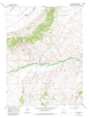
Mckinnon Topo Map Wyoming
To zoom in, hover over the map of Mckinnon
USGS Topo Quad 41109a8 - 1:24,000 scale
| Topo Map Name: | Mckinnon |
| USGS Topo Quad ID: | 41109a8 |
| Print Size: | ca. 21 1/4" wide x 27" high |
| Southeast Coordinates: | 41° N latitude / 109.875° W longitude |
| Map Center Coordinates: | 41.0625° N latitude / 109.9375° W longitude |
| U.S. State: | WY |
| Filename: | o41109a8.jpg |
| Download Map JPG Image: | Mckinnon topo map 1:24,000 scale |
| Map Type: | Topographic |
| Topo Series: | 7.5´ |
| Map Scale: | 1:24,000 |
| Source of Map Images: | United States Geological Survey (USGS) |
| Alternate Map Versions: |
Mc Kinnon WY 1964, updated 1968 Download PDF Buy paper map Mc Kinnon WY 1964, updated 1981 Download PDF Buy paper map McKinnon WY 2012 Download PDF Buy paper map McKinnon WY 2015 Download PDF Buy paper map |
1:24,000 Topo Quads surrounding Mckinnon
> Back to 41109a1 at 1:100,000 scale
> Back to 41108a1 at 1:250,000 scale
> Back to U.S. Topo Maps home
Mckinnon topo map: Gazetteer
Mckinnon: Canals
Interstate Canal elevation 2288m 7506′Mckinnon: Lakes
Shelton Lake elevation 2457m 8061′Mckinnon: Mines
Indian Mine elevation 2099m 6886′Mckinnon: Populated Places
McKinnon elevation 2151m 7057′Rendezvous elevation 2087m 6847′
Mckinnon: Reservoirs
Antler Reservoir elevation 2199m 7214′Branch Reservoir elevation 2186m 7171′
Phil Mass Reservoir elevation 2525m 8284′
Mckinnon: Streams
Birch Creek elevation 2092m 6863′Mckinnon: Valleys
Coon Hollow elevation 2069m 6788′Hisey Hollow elevation 2031m 6663′
Hisey Hollow elevation 2030m 6660′
Welch Hollow elevation 2060m 6758′
Mckinnon digital topo map on disk
Buy this Mckinnon topo map showing relief, roads, GPS coordinates and other geographical features, as a high-resolution digital map file on DVD:


