Wilkins Peak Topo Map Wyoming
To zoom in, hover over the map of Wilkins Peak
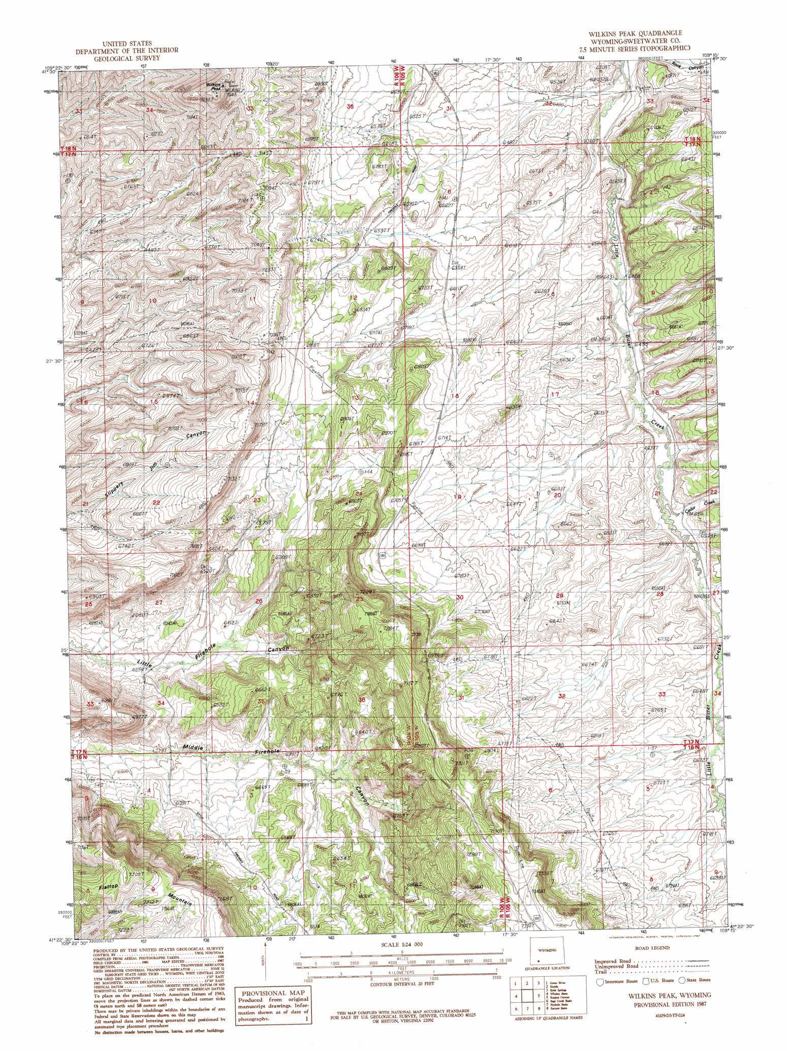
USGS Topo Quad 41109d3 - 1:24,000 scale
| Topo Map Name: | Wilkins Peak |
| USGS Topo Quad ID: | 41109d3 |
| Print Size: | ca. 21 1/4" wide x 27" high |
| Southeast Coordinates: | 41.375° N latitude / 109.25° W longitude |
| Map Center Coordinates: | 41.4375° N latitude / 109.3125° W longitude |
| U.S. State: | WY |
| Filename: | o41109d3.jpg |
| Download Map JPG Image: | Wilkins Peak topo map 1:24,000 scale |
| Map Type: | Topographic |
| Topo Series: | 7.5´ |
| Map Scale: | 1:24,000 |
| Source of Map Images: | United States Geological Survey (USGS) |
| Alternate Map Versions: |
Wilkins Peak WY 1987, updated 1987 Download PDF Buy paper map Wilkins Peak WY 2012 Download PDF Buy paper map Wilkins Peak WY 2015 Download PDF Buy paper map |
1:24,000 Topo Quads surrounding Wilkins Peak
Austin Ranch |
Scott Spring |
Pilot Butte |
Reliance |
North Baxter |
Peru |
Green River |
Kanda |
Rock Springs |
Baxter |
Blacks Fork Bridge |
Whalen Butte |
Wilkins Peak |
Kappes Canyon |
Lion Bluffs |
Halfway Hollow East |
Sage Creek Basin |
Firehole Basin |
Earnest Butte |
South Baxter |
Haystack Buttes North |
Sugarloaf Basin |
Big Ridge |
Maxon Ranch |
Titsworth Gap |
> Back to 41109a1 at 1:100,000 scale
> Back to 41108a1 at 1:250,000 scale
> Back to U.S. Topo Maps home
Wilkins Peak topo map: Gazetteer
Wilkins Peak: Streams
Cedar Creek elevation 1983m 6505′Wilkins Peak: Summits
Flattop Mountain elevation 2212m 7257′Wilkins Peak elevation 2294m 7526′
Wilkins Peak: Valleys
Little Mellor Canyon elevation 1983m 6505′Sand Wash elevation 1988m 6522′
Wilkins Peak digital topo map on disk
Buy this Wilkins Peak topo map showing relief, roads, GPS coordinates and other geographical features, as a high-resolution digital map file on DVD: