Big Island Bridge Topo Map Wyoming
To zoom in, hover over the map of Big Island Bridge
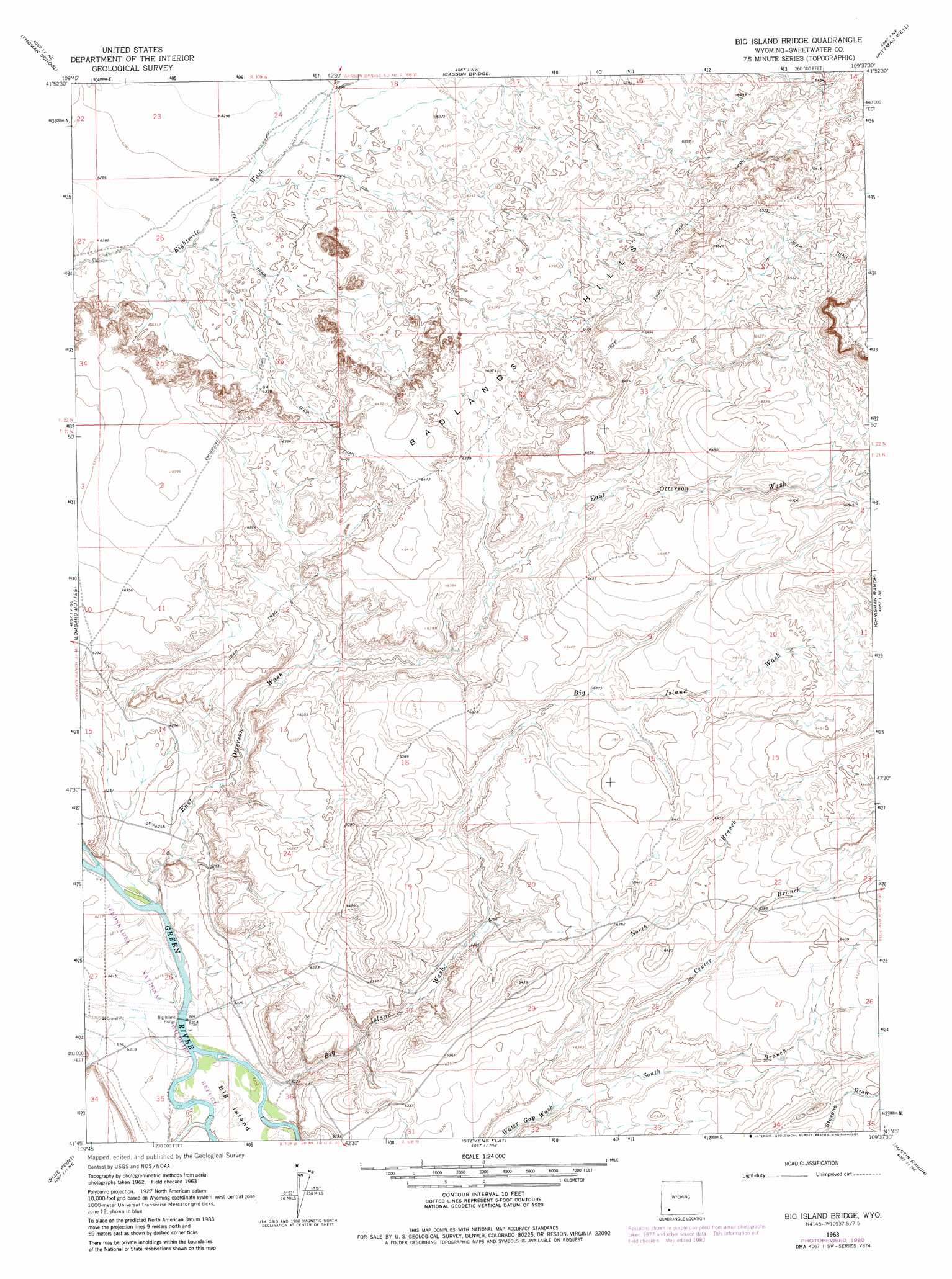
USGS Topo Quad 41109g6 - 1:24,000 scale
| Topo Map Name: | Big Island Bridge |
| USGS Topo Quad ID: | 41109g6 |
| Print Size: | ca. 21 1/4" wide x 27" high |
| Southeast Coordinates: | 41.75° N latitude / 109.625° W longitude |
| Map Center Coordinates: | 41.8125° N latitude / 109.6875° W longitude |
| U.S. State: | WY |
| Filename: | o41109g6.jpg |
| Download Map JPG Image: | Big Island Bridge topo map 1:24,000 scale |
| Map Type: | Topographic |
| Topo Series: | 7.5´ |
| Map Scale: | 1:24,000 |
| Source of Map Images: | United States Geological Survey (USGS) |
| Alternate Map Versions: |
Big Island Bridge WY 1963, updated 1966 Download PDF Buy paper map Big Island Bridge WY 1963, updated 1981 Download PDF Buy paper map Big Island Bridge WY 2012 Download PDF Buy paper map Big Island Bridge WY 2015 Download PDF Buy paper map |
1:24,000 Topo Quads surrounding Big Island Bridge
Blue Forest |
Twelvemile Sink |
Simpson Gulch Sw |
Simpson Gulch Se |
Farson |
Mccullen Bluff |
Thoman School |
Gasson Bridge |
Pittman Well |
Clay Buttes |
Whiskey Buttes |
Lombard Buttes |
Big Island Bridge |
Chrisman Ranch |
Clay Buttes Sw |
Sevenmile Gulch |
Blue Point |
Stevens Flat |
Austin Ranch |
Scott Spring |
Granger |
Little America |
Bryan |
Peru |
Green River |
> Back to 41109e1 at 1:100,000 scale
> Back to 41108a1 at 1:250,000 scale
> Back to U.S. Topo Maps home
Big Island Bridge topo map: Gazetteer
Big Island Bridge: Bridges
Big Island Bridge elevation 1892m 6207′Big Island Bridge: Islands
Big Island elevation 1893m 6210′Big Island Bridge: Mines
Stauffer Chemical Company Big Island Number Twelve Mine elevation 1957m 6420′Big Island Bridge: Ranges
Badlands Hills elevation 1956m 6417′Big Island Bridge: Valleys
Big Island Wash elevation 1894m 6213′Center Branch Water Gap Wash elevation 1916m 6286′
East Otterson Wash elevation 1895m 6217′
North Branch Water Gap Wash elevation 1916m 6286′
South Branch Water Gap Wash elevation 1917m 6289′
West Otterson Wash elevation 1892m 6207′
Big Island Bridge digital topo map on disk
Buy this Big Island Bridge topo map showing relief, roads, GPS coordinates and other geographical features, as a high-resolution digital map file on DVD: