North Table Mountain Topo Map Wyoming
To zoom in, hover over the map of North Table Mountain
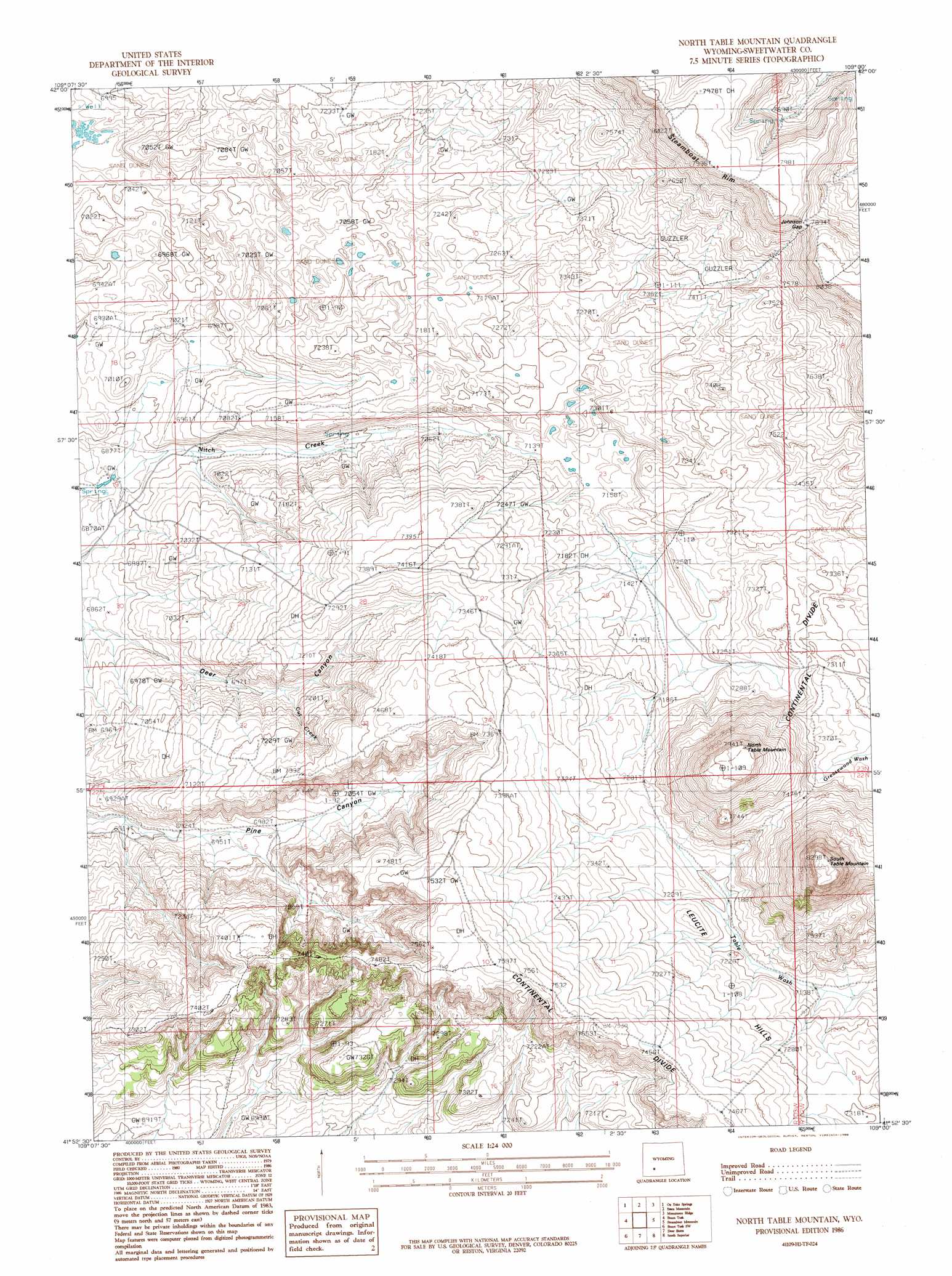
USGS Topo Quad 41109h1 - 1:24,000 scale
| Topo Map Name: | North Table Mountain |
| USGS Topo Quad ID: | 41109h1 |
| Print Size: | ca. 21 1/4" wide x 27" high |
| Southeast Coordinates: | 41.875° N latitude / 109° W longitude |
| Map Center Coordinates: | 41.9375° N latitude / 109.0625° W longitude |
| U.S. State: | WY |
| Filename: | o41109h1.jpg |
| Download Map JPG Image: | North Table Mountain topo map 1:24,000 scale |
| Map Type: | Topographic |
| Topo Series: | 7.5´ |
| Map Scale: | 1:24,000 |
| Source of Map Images: | United States Geological Survey (USGS) |
| Alternate Map Versions: |
North Table Mountain WY 1986, updated 1986 Download PDF Buy paper map North Table Mountain WY 2012 Download PDF Buy paper map North Table Mountain WY 2015 Download PDF Buy paper map |
1:24,000 Topo Quads surrounding North Table Mountain
Eden Reservoir East |
Tule Butte |
North Packsaddle Canyon |
Rock Cabin Spring |
Joe Hay Rim |
Fifteenmile Spring |
Ox Yoke Springs |
Essex Mountain |
Monument Ridge |
Freighter Gap |
White Rocks |
Boars Tusk |
North Table Mountain |
Steamboat Mountain |
Black Rock North |
Clay Buttes Se |
Boars Tusk Sw |
Deer Butte |
South Superior |
Black Rock South |
Pilot Butte |
Reliance |
North Baxter |
Thayer Junction |
Point Of Rocks |
> Back to 41109e1 at 1:100,000 scale
> Back to 41108a1 at 1:250,000 scale
> Back to U.S. Topo Maps home
North Table Mountain topo map: Gazetteer
North Table Mountain: Gaps
Johnson Gap elevation 2409m 7903′North Table Mountain: Streams
Cut Creek elevation 2151m 7057′North Table Mountain: Summits
North Table Mountain elevation 2418m 7933′South Table Mountain elevation 2524m 8280′
North Table Mountain digital topo map on disk
Buy this North Table Mountain topo map showing relief, roads, GPS coordinates and other geographical features, as a high-resolution digital map file on DVD: