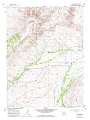
Lonetree Topo Map Wyoming
To zoom in, hover over the map of Lonetree
USGS Topo Quad 41110a2 - 1:24,000 scale
| Topo Map Name: | Lonetree |
| USGS Topo Quad ID: | 41110a2 |
| Print Size: | ca. 21 1/4" wide x 27" high |
| Southeast Coordinates: | 41° N latitude / 110.125° W longitude |
| Map Center Coordinates: | 41.0625° N latitude / 110.1875° W longitude |
| U.S. State: | WY |
| Filename: | o41110a2.jpg |
| Download Map JPG Image: | Lonetree topo map 1:24,000 scale |
| Map Type: | Topographic |
| Topo Series: | 7.5´ |
| Map Scale: | 1:24,000 |
| Source of Map Images: | United States Geological Survey (USGS) |
| Alternate Map Versions: |
Lonetree WY 1964, updated 1968 Download PDF Buy paper map Lonetree WY 1964, updated 1981 Download PDF Buy paper map Lonetree WY 2012 Download PDF Buy paper map Lonetree WY 2015 Download PDF Buy paper map |
| FStopo: | US Forest Service topo Lonetree is available: Download FStopo PDF Download FStopo TIF |
1:24,000 Topo Quads surrounding Lonetree
> Back to 41110a1 at 1:100,000 scale
> Back to 41110a1 at 1:250,000 scale
> Back to U.S. Topo Maps home
Lonetree topo map: Gazetteer
Lonetree: Canals
Cedar Basin Ditch elevation 2357m 7732′Grimsley Ditch elevation 2421m 7942′
J E Ditch elevation 2430m 7972′
Luckey Ditch elevation 2376m 7795′
Stag Hollow Ditch elevation 2419m 7936′
Lonetree: Populated Places
Lonetree elevation 2303m 7555′Lonetree: Reservoirs
Hickey Mountain Reservoir elevation 2335m 7660′Lonetree: Springs
Carter Spring elevation 2406m 7893′Lonetree: Streams
Carter Spring Creek elevation 2335m 7660′Lonetree Creek elevation 2329m 7641′
Louse Creek elevation 2461m 8074′
Middle Fork Beaver Creek elevation 2402m 7880′
Spring Creek elevation 2441m 8008′
Spring Creek elevation 2441m 8008′
West Fork Beaver Creek elevation 2403m 7883′
West Fork Beaver Creek elevation 2402m 7880′
Lonetree: Summits
Hickey Mountain elevation 2686m 8812′The Butte elevation 2473m 8113′
Lonetree digital topo map on disk
Buy this Lonetree topo map showing relief, roads, GPS coordinates and other geographical features, as a high-resolution digital map file on DVD:


