Robertson Topo Map Wyoming
To zoom in, hover over the map of Robertson
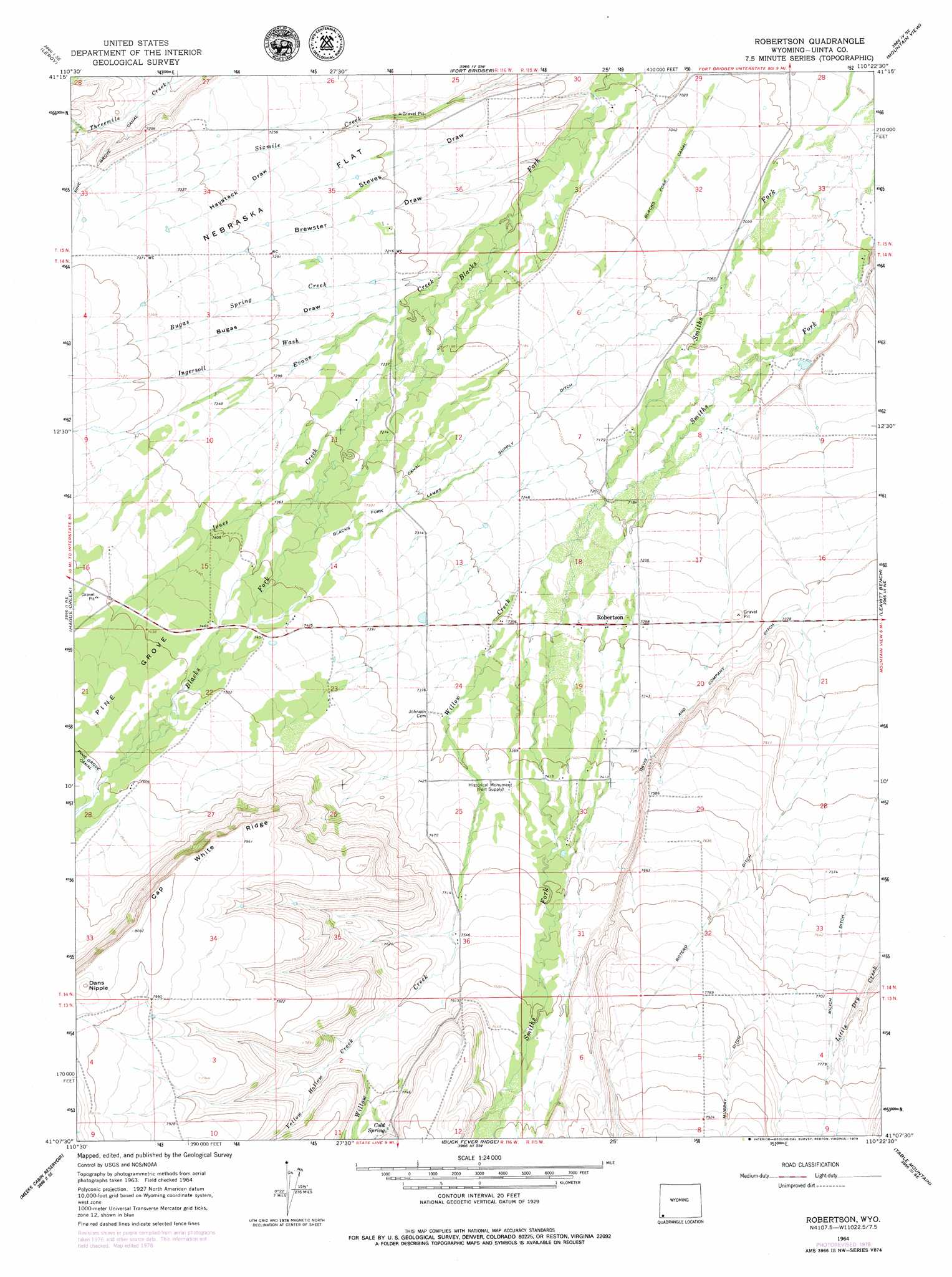
USGS Topo Quad 41110b4 - 1:24,000 scale
| Topo Map Name: | Robertson |
| USGS Topo Quad ID: | 41110b4 |
| Print Size: | ca. 21 1/4" wide x 27" high |
| Southeast Coordinates: | 41.125° N latitude / 110.375° W longitude |
| Map Center Coordinates: | 41.1875° N latitude / 110.4375° W longitude |
| U.S. State: | WY |
| Filename: | o41110b4.jpg |
| Download Map JPG Image: | Robertson topo map 1:24,000 scale |
| Map Type: | Topographic |
| Topo Series: | 7.5´ |
| Map Scale: | 1:24,000 |
| Source of Map Images: | United States Geological Survey (USGS) |
| Alternate Map Versions: |
Robertson WY 1964, updated 1968 Download PDF Buy paper map Robertson WY 1964, updated 1979 Download PDF Buy paper map Robertson WY 2012 Download PDF Buy paper map Robertson WY 2015 Download PDF Buy paper map |
1:24,000 Topo Quads surrounding Robertson
Meadow Draw |
Bridger |
Carter |
Austin Reservoir |
Millersville |
Ragan |
Leroy |
Fort Bridger |
Mountain View |
Turtle Hill |
Piedmont Reservoir |
Hague Creek |
Robertson |
Leavitt Bench |
Reed Reservoir |
Moslander Reservoir |
Meeks Cabin Reservoir |
Buck Fever Ridge |
Table Mountain |
Lonetree |
Elizabeth Mountain |
Lyman Lake |
Bridger Lake |
Gilbert Peak Ne |
Hole In The Rock |
> Back to 41110a1 at 1:100,000 scale
> Back to 41110a1 at 1:250,000 scale
> Back to U.S. Topo Maps home
Robertson topo map: Gazetteer
Robertson: Areas
Pine Grove elevation 2286m 7500′Robertson: Canals
Botero Ditch elevation 2343m 7687′Davis and Company Ditch elevation 2237m 7339′
Lambs Supply Ditch elevation 2194m 7198′
Pine Grove Canal elevation 2220m 7283′
Robertson: Flats
Nebraska Flat elevation 2211m 7253′Robertson: Populated Places
Robertson elevation 2221m 7286′Robertson: Ridges
Cap White Ridge elevation 2428m 7965′Robertson: Springs
Cold Spring elevation 2375m 7791′Robertson: Streams
Bugas Spring Creek elevation 2187m 7175′Evans Creek elevation 2166m 7106′
Jones Creek elevation 2156m 7073′
Willow Creek elevation 2196m 7204′
Yellow Hollow Creek elevation 2330m 7644′
Robertson: Summits
Dans Nipple elevation 2470m 8103′Robertson: Valleys
Brewster Draw elevation 2166m 7106′Bugas Draw elevation 2193m 7194′
Haystack Draw elevation 2197m 7208′
Ingersoll Wash elevation 2212m 7257′
Perry Draw elevation 2144m 7034′
Steves Draw elevation 2143m 7030′
Robertson digital topo map on disk
Buy this Robertson topo map showing relief, roads, GPS coordinates and other geographical features, as a high-resolution digital map file on DVD: