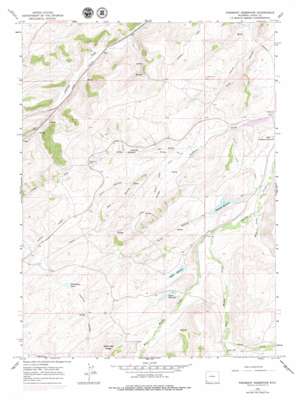
Piedmont Reservoir Topo Map Wyoming
To zoom in, hover over the map of Piedmont Reservoir
USGS Topo Quad 41110b6 - 1:24,000 scale
| Topo Map Name: | Piedmont Reservoir |
| USGS Topo Quad ID: | 41110b6 |
| Print Size: | ca. 21 1/4" wide x 27" high |
| Southeast Coordinates: | 41.125° N latitude / 110.625° W longitude |
| Map Center Coordinates: | 41.1875° N latitude / 110.6875° W longitude |
| U.S. State: | WY |
| Filename: | o41110b6.jpg |
| Download Map JPG Image: | Piedmont Reservoir topo map 1:24,000 scale |
| Map Type: | Topographic |
| Topo Series: | 7.5´ |
| Map Scale: | 1:24,000 |
| Source of Map Images: | United States Geological Survey (USGS) |
| Alternate Map Versions: |
Piedmont Reservoir WY 1965, updated 1968 Download PDF Buy paper map Piedmont Reservoir WY 1965, updated 1979 Download PDF Buy paper map Piedmont Reservoir WY 2012 Download PDF Buy paper map Piedmont Reservoir WY 2015 Download PDF Buy paper map |
1:24,000 Topo Quads surrounding Piedmont Reservoir
> Back to 41110a1 at 1:100,000 scale
> Back to 41110a1 at 1:250,000 scale
> Back to U.S. Topo Maps home
Piedmont Reservoir topo map: Gazetteer
Piedmont Reservoir: Bends
Horseshoe Bend elevation 2255m 7398′Piedmont Reservoir: Canals
Outlet Cross Ditch elevation 2175m 7135′Piedmont Reservoir: Dams
Byrne Dam elevation 2302m 7552′Guild and Dean Dam elevation 2167m 7109′
Guild Dam elevation 2302m 7552′
Little Peidmont Dam elevation 2187m 7175′
Piedmont Dam elevation 2226m 7303′
Piedmont Reservoir: Mines
Carter Mine elevation 2142m 7027′Spring Valley Mine elevation 2134m 7001′
Piedmont Reservoir: Populated Places
Piedmont elevation 2154m 7066′Piedmont Reservoir: Reservoirs
Byrne Reservoir elevation 2302m 7552′Byrne Reservoir elevation 2285m 7496′
Guild and Dean Reservoir elevation 2167m 7109′
Guild Reservoir elevation 2302m 7552′
Guild Reservoir elevation 2271m 7450′
Little Peidmont Reservoir elevation 2187m 7175′
Piedmont Reservoir elevation 2214m 7263′
Thirtythree Pond elevation 2268m 7440′
Piedmont Reservoir: Ridges
Moslander Ridge elevation 2434m 7985′Piedmont Reservoir: Springs
Eight Spring elevation 2260m 7414′Piedmont Reservoir: Streams
Clear Creek elevation 2336m 7664′East Branch Silver Springs Creek elevation 2188m 7178′
East Muddy Creek elevation 2226m 7303′
Fish Creek elevation 2325m 7627′
Moss Creek elevation 2203m 7227′
Silver Springs Creek elevation 2176m 7139′
West Muddy Creek elevation 2226m 7303′
West Muddy Creek elevation 2227m 7306′
Piedmont Reservoir: Valleys
Big Hollow elevation 2170m 7119′Grassy Draw elevation 2173m 7129′
Guild Hollow elevation 2206m 7237′
Twomile Hollow elevation 2250m 7381′
Piedmont Reservoir digital topo map on disk
Buy this Piedmont Reservoir topo map showing relief, roads, GPS coordinates and other geographical features, as a high-resolution digital map file on DVD:


