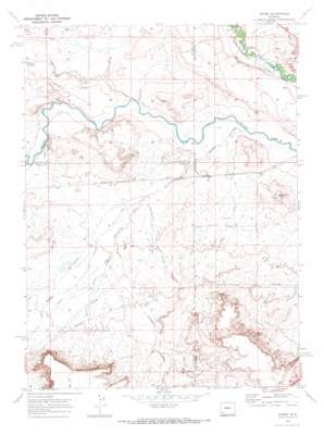
Verne Topo Map Wyoming
To zoom in, hover over the map of Verne
USGS Topo Quad 41110e1 - 1:24,000 scale
| Topo Map Name: | Verne |
| USGS Topo Quad ID: | 41110e1 |
| Print Size: | ca. 21 1/4" wide x 27" high |
| Southeast Coordinates: | 41.5° N latitude / 110° W longitude |
| Map Center Coordinates: | 41.5625° N latitude / 110.0625° W longitude |
| U.S. State: | WY |
| Filename: | o41110e1.jpg |
| Download Map JPG Image: | Verne topo map 1:24,000 scale |
| Map Type: | Topographic |
| Topo Series: | 7.5´ |
| Map Scale: | 1:24,000 |
| Source of Map Images: | United States Geological Survey (USGS) |
| Alternate Map Versions: |
Verne WY 1969, updated 1972 Download PDF Buy paper map Verne WY 2012 Download PDF Buy paper map Verne WY 2015 Download PDF Buy paper map |
1:24,000 Topo Quads surrounding Verne
> Back to 41110e1 at 1:100,000 scale
> Back to 41110a1 at 1:250,000 scale
> Back to U.S. Topo Maps home
Verne topo map: Gazetteer
Verne: Canals
Moore and Bagley Ditch elevation 1927m 6322′Verne: Mines
Diamond Alkali Company Number One Mine elevation 1930m 6332′Verne: Populated Places
Rocky Crossing elevation 1927m 6322′Verne elevation 1942m 6371′
Verne: Streams
Dry Muddy Creek elevation 1916m 6286′Verne: Summits
Moss Agate Knoll elevation 1963m 6440′Verne: Valleys
Bruff Draw elevation 1935m 6348′Caterpillar Draw elevation 1928m 6325′
Porter Hollow elevation 1912m 6272′
Telephone Draw elevation 1918m 6292′
Triangulation Point Draw elevation 1926m 6318′
Verne digital topo map on disk
Buy this Verne topo map showing relief, roads, GPS coordinates and other geographical features, as a high-resolution digital map file on DVD:


