Beckwith Topo Map Wyoming
To zoom in, hover over the map of Beckwith
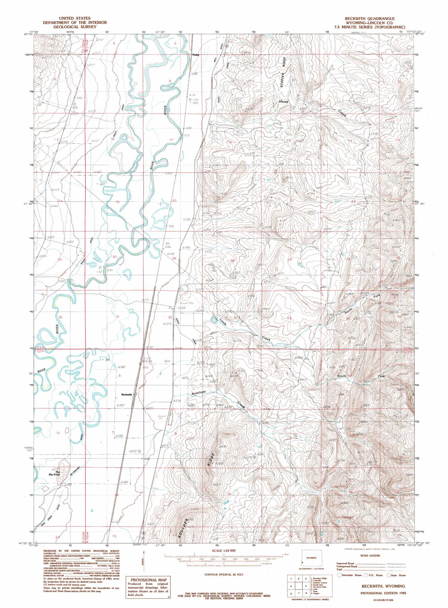
USGS Topo Quad 41110h8 - 1:24,000 scale
| Topo Map Name: | Beckwith |
| USGS Topo Quad ID: | 41110h8 |
| Print Size: | ca. 21 1/4" wide x 27" high |
| Southeast Coordinates: | 41.875° N latitude / 110.875° W longitude |
| Map Center Coordinates: | 41.9375° N latitude / 110.9375° W longitude |
| U.S. State: | WY |
| Filename: | o41110h8.jpg |
| Download Map JPG Image: | Beckwith topo map 1:24,000 scale |
| Map Type: | Topographic |
| Topo Series: | 7.5´ |
| Map Scale: | 1:24,000 |
| Source of Map Images: | United States Geological Survey (USGS) |
| Alternate Map Versions: |
Beckwith WY 1985, updated 1985 Download PDF Buy paper map Beckwith WY 2012 Download PDF Buy paper map Beckwith WY 2015 Download PDF Buy paper map |
1:24,000 Topo Quads surrounding Beckwith
Pegram |
Border |
Marse |
Nugent Park |
Pole Creek |
Pegram Creek |
Boundary Ridge |
Cokeville |
Sublette Canyon |
Wilkinson Creek |
Sheeppen Creek |
South Lake |
Beckwith |
The Rock Slide |
Kemmerer Reservoir |
Sage Creek |
Leefe |
Sage |
Nugget |
Fossil |
Randolph |
Rex Peak |
Windy Point |
Bell Butte Ne |
Warfield Creek |
> Back to 41110e1 at 1:100,000 scale
> Back to 41110a1 at 1:250,000 scale
> Back to U.S. Topo Maps home
Beckwith topo map: Gazetteer
Beckwith: Canals
Covey Canal elevation 1894m 6213′Pixley Ditch elevation 1889m 6197′
Beckwith: Dams
Holland Dam elevation 1989m 6525′Pixley Dam elevation 1885m 6184′
Beckwith: Reservoirs
Holland Reservoir elevation 1989m 6525′Beckwith: Streams
Antelope Creek elevation 1891m 6204′Horse Creek elevation 1896m 6220′
Leeds Creek elevation 1897m 6223′
North Fork Leeds Creek elevation 1940m 6364′
South Fork Leeds Creek elevation 1940m 6364′
Beckwith: Summits
The Big Knob elevation 1912m 6272′Beckwith digital topo map on disk
Buy this Beckwith topo map showing relief, roads, GPS coordinates and other geographical features, as a high-resolution digital map file on DVD: