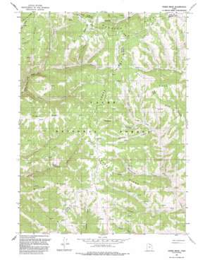
Horse Ridge Topo Map Utah
To zoom in, hover over the map of Horse Ridge
USGS Topo Quad 41111c4 - 1:24,000 scale
| Topo Map Name: | Horse Ridge |
| USGS Topo Quad ID: | 41111c4 |
| Print Size: | ca. 21 1/4" wide x 27" high |
| Southeast Coordinates: | 41.25° N latitude / 111.375° W longitude |
| Map Center Coordinates: | 41.3125° N latitude / 111.4375° W longitude |
| U.S. State: | UT |
| Filename: | o41111c4.jpg |
| Download Map JPG Image: | Horse Ridge topo map 1:24,000 scale |
| Map Type: | Topographic |
| Topo Series: | 7.5´ |
| Map Scale: | 1:24,000 |
| Source of Map Images: | United States Geological Survey (USGS) |
| Alternate Map Versions: |
Horse Ridge UT 1968, updated 1970 Download PDF Buy paper map Horse Ridge UT 1968, updated 1978 Download PDF Buy paper map Horse Ridge UT 1968, updated 1986 Download PDF Buy paper map Horse Ridge UT 1991, updated 1991 Download PDF Buy paper map Horse Ridge UT 1998, updated 2000 Download PDF Buy paper map Horse Ridge UT 2011 Download PDF Buy paper map Horse Ridge UT 2014 Download PDF Buy paper map |
| FStopo: | US Forest Service topo Horse Ridge is available: Download FStopo PDF Download FStopo TIF |
1:24,000 Topo Quads surrounding Horse Ridge
> Back to 41111a1 at 1:100,000 scale
> Back to 41110a1 at 1:250,000 scale
> Back to U.S. Topo Maps home
Horse Ridge topo map: Gazetteer
Horse Ridge: Basins
Weed Basin elevation 2464m 8083′Horse Ridge: Flats
Squaw Flat elevation 2610m 8562′Horse Ridge: Ridges
Bull Ridge elevation 2404m 7887′Condie Ridge elevation 2511m 8238′
Horse Ridge elevation 2439m 8001′
Horse Ridge elevation 2503m 8211′
Knighton Ridge elevation 2492m 8175′
Lake Ridge elevation 2317m 7601′
Lightning Ridge elevation 2562m 8405′
Stark Ridge elevation 2444m 8018′
Wasatch Ridge elevation 2611m 8566′
Horse Ridge: Springs
Wonder Spring elevation 2194m 7198′Horse Ridge: Streams
Monument Creek elevation 2195m 7201′Horse Ridge: Summits
Squaw Butte elevation 2662m 8733′Horse Ridge: Valleys
Frost Canyon elevation 2175m 7135′Hornet Gulch elevation 2004m 6574′
Howard Hollow elevation 2255m 7398′
Pine Canyon elevation 2328m 7637′
Sawmill Canyon elevation 2036m 6679′
Wheatgrass Hollow elevation 2072m 6797′
Horse Ridge digital topo map on disk
Buy this Horse Ridge topo map showing relief, roads, GPS coordinates and other geographical features, as a high-resolution digital map file on DVD:


