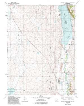
Neponset Reservoir Ne Topo Map Utah
To zoom in, hover over the map of Neponset Reservoir Ne
USGS Topo Quad 41111d1 - 1:24,000 scale
| Topo Map Name: | Neponset Reservoir Ne |
| USGS Topo Quad ID: | 41111d1 |
| Print Size: | ca. 21 1/4" wide x 27" high |
| Southeast Coordinates: | 41.375° N latitude / 111° W longitude |
| Map Center Coordinates: | 41.4375° N latitude / 111.0625° W longitude |
| U.S. States: | UT, WY |
| Filename: | o41111d1.jpg |
| Download Map JPG Image: | Neponset Reservoir Ne topo map 1:24,000 scale |
| Map Type: | Topographic |
| Topo Series: | 7.5´ |
| Map Scale: | 1:24,000 |
| Source of Map Images: | United States Geological Survey (USGS) |
| Alternate Map Versions: |
Neponset Reservoir NE UT 1968, updated 1971 Download PDF Buy paper map Neponset Reservoir NE UT 1968, updated 1979 Download PDF Buy paper map Neponset Reservoir NE UT 1991, updated 1991 Download PDF Buy paper map Neponset Reservoir NE UT 2010 Download PDF Buy paper map Neponset Reservoir NE UT 2014 Download PDF Buy paper map |
1:24,000 Topo Quads surrounding Neponset Reservoir Ne
> Back to 41111a1 at 1:100,000 scale
> Back to 41110a1 at 1:250,000 scale
> Back to U.S. Topo Maps home
Neponset Reservoir Ne topo map: Gazetteer
Neponset Reservoir Ne: Canals
Chapman Canal elevation 2001m 6564′Chapman Canal elevation 1969m 6459′
Christensen Ditch elevation 1971m 6466′
Crompton Ditch elevation 1978m 6489′
Tunnel Ditch elevation 1999m 6558′
Neponset Reservoir Ne: Lakes
Dry Lake elevation 1965m 6446′Neponset Reservoir Ne: Populated Places
Bear River elevation 1991m 6532′Neponset Reservoir Ne: Reservoirs
Neponset Reservoir elevation 1956m 6417′Neponset Reservoir Ne: Ridges
Murphy Ridge elevation 2053m 6735′Neponset Reservoir Ne: Streams
Fowkes Canyon Creek elevation 1985m 6512′Whitney Canyon Creek elevation 1972m 6469′
Neponset Reservoir Ne: Valleys
Acocks Canyon elevation 1969m 6459′Christensen Hollow elevation 1974m 6476′
Murphy Hollow elevation 1969m 6459′
Shell Hollow elevation 2012m 6601′
Stacey Hollow elevation 1956m 6417′
Whitney Canyon elevation 1972m 6469′
Neponset Reservoir Ne digital topo map on disk
Buy this Neponset Reservoir Ne topo map showing relief, roads, GPS coordinates and other geographical features, as a high-resolution digital map file on DVD:


