Neponset Reservoir Nw Topo Map Utah
To zoom in, hover over the map of Neponset Reservoir Nw
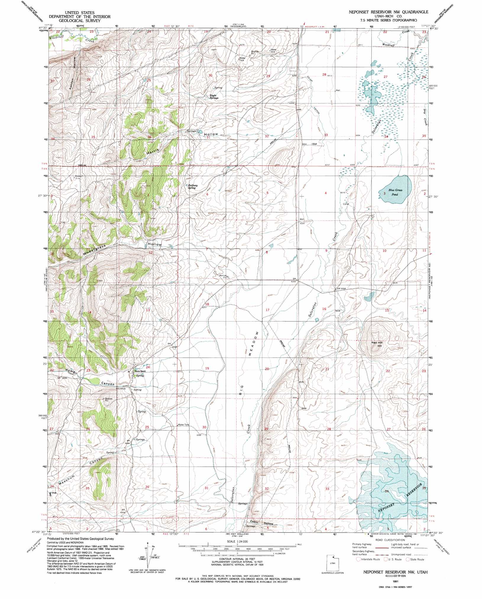
USGS Topo Quad 41111d2 - 1:24,000 scale
| Topo Map Name: | Neponset Reservoir Nw |
| USGS Topo Quad ID: | 41111d2 |
| Print Size: | ca. 21 1/4" wide x 27" high |
| Southeast Coordinates: | 41.375° N latitude / 111.125° W longitude |
| Map Center Coordinates: | 41.4375° N latitude / 111.1875° W longitude |
| U.S. State: | UT |
| Filename: | o41111d2.jpg |
| Download Map JPG Image: | Neponset Reservoir Nw topo map 1:24,000 scale |
| Map Type: | Topographic |
| Topo Series: | 7.5´ |
| Map Scale: | 1:24,000 |
| Source of Map Images: | United States Geological Survey (USGS) |
| Alternate Map Versions: |
Neponset Reservoir NW UT 1968, updated 1971 Download PDF Buy paper map Neponset Reservoir NW UT 1968, updated 1978 Download PDF Buy paper map Neponset Reservoir NW UT 1968, updated 1986 Download PDF Buy paper map Neponset Reservoir NW UT 1991, updated 1991 Download PDF Buy paper map Neponset Reservoir NW UT 2010 Download PDF Buy paper map Neponset Reservoir NW UT 2014 Download PDF Buy paper map |
1:24,000 Topo Quads surrounding Neponset Reservoir Nw
Red Spur Mountain |
Old Canyon |
Randolph |
Rex Peak |
Windy Point |
Curtis Ridge |
Birch Creek Reservoirs |
Woodruff |
Woodruff Narrows |
Sawtooth Mountain |
Dairy Ridge |
Meachum Ridge |
Neponset Reservoir Nw |
Neponset Reservoir Ne |
Three Forks |
Horse Ridge |
Peck Canyon |
Mckay Hollow |
Murphy Ridge |
Evanston |
Lost Creek Dam |
Francis Canyon |
Shearing Corral |
Wahsatch |
Millis |
> Back to 41111a1 at 1:100,000 scale
> Back to 41110a1 at 1:250,000 scale
> Back to U.S. Topo Maps home
Neponset Reservoir Nw topo map: Gazetteer
Neponset Reservoir Nw: Canals
Co-Op Ditch elevation 1927m 6322′Neponset Reservoir Nw: Flats
Big Meadow elevation 1933m 6341′Neponset Reservoir Nw: Lakes
Blue Grass Pond elevation 1923m 6309′Neponset Reservoir Nw: Springs
Eagle Springs elevation 1976m 6482′Halfway Spring elevation 1980m 6496′
Neponset Reservoir Nw: Streams
Dry Creek elevation 1922m 6305′Woodruff Creek elevation 1922m 6305′
Neponset Reservoir Nw: Summits
Red Hill elevation 2038m 6686′Neponset Reservoir Nw: Valleys
Ashton Hollow elevation 2003m 6571′Cabin Hollow elevation 1950m 6397′
Harris Hollow elevation 1938m 6358′
Home Canyon elevation 1974m 6476′
Meachum Canyon elevation 1970m 6463′
Wheatgrass Hollow elevation 1961m 6433′
Neponset Reservoir Nw digital topo map on disk
Buy this Neponset Reservoir Nw topo map showing relief, roads, GPS coordinates and other geographical features, as a high-resolution digital map file on DVD: