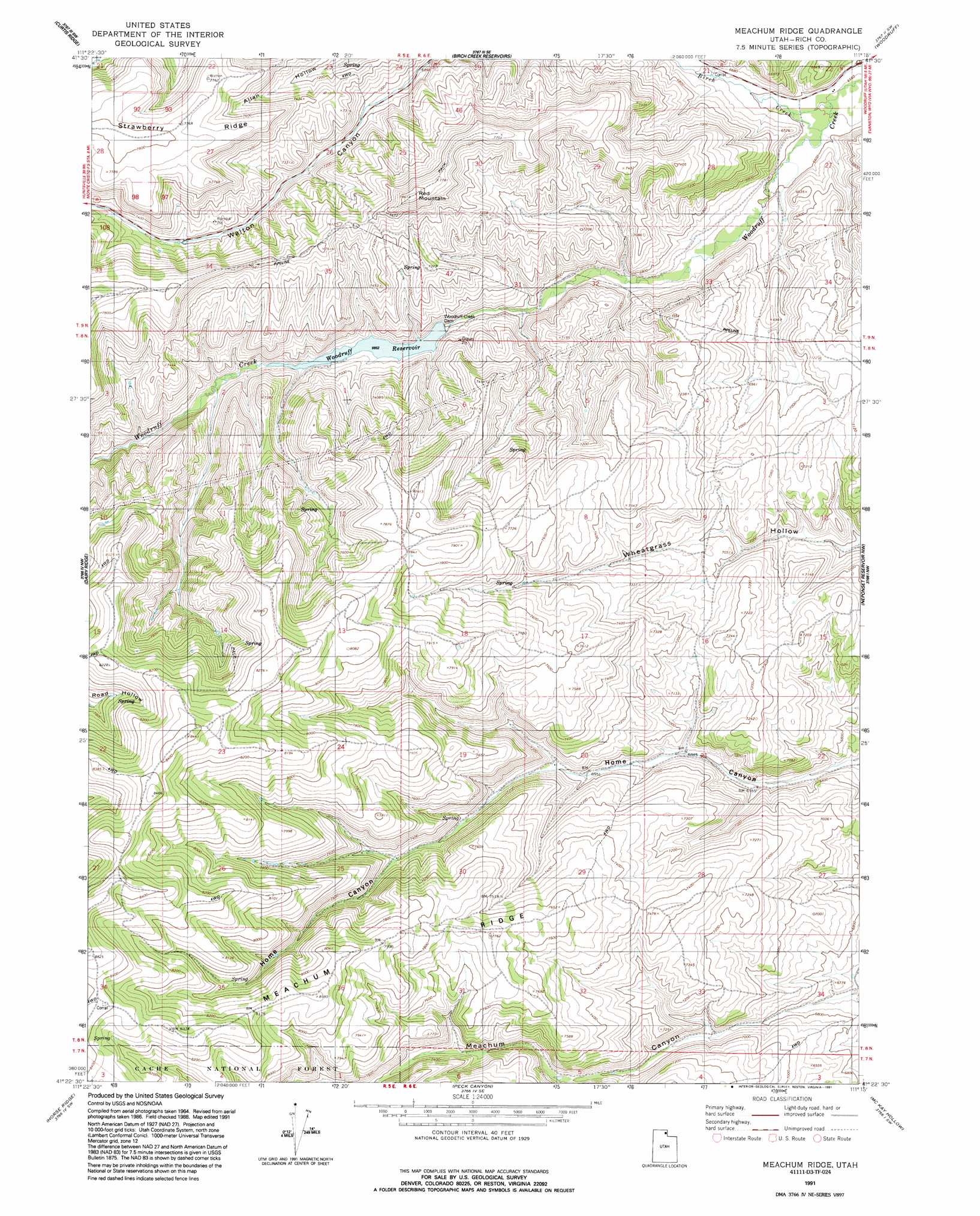
Meachum Ridge Topo Map Utah
To zoom in, hover over the map of Meachum Ridge
USGS Topo Quad 41111d3 - 1:24,000 scale
| Topo Map Name: | Meachum Ridge |
| USGS Topo Quad ID: | 41111d3 |
| Print Size: | ca. 21 1/4" wide x 27" high |
| Southeast Coordinates: | 41.375° N latitude / 111.25° W longitude |
| Map Center Coordinates: | 41.4375° N latitude / 111.3125° W longitude |
| U.S. State: | UT |
| Filename: | o41111d3.jpg |
| Download Map JPG Image: | Meachum Ridge topo map 1:24,000 scale |
| Map Type: | Topographic |
| Topo Series: | 7.5´ |
| Map Scale: | 1:24,000 |
| Source of Map Images: | United States Geological Survey (USGS) |
| Alternate Map Versions: |
Meachum Ridge UT 1968, updated 1971 Download PDF Buy paper map Meachum Ridge UT 1968, updated 1980 Download PDF Buy paper map Meachum Ridge UT 1968, updated 1986 Download PDF Buy paper map Meachum Ridge UT 1991, updated 1991 Download PDF Buy paper map Meachum Ridge UT 1998, updated 2001 Download PDF Buy paper map Meachum Ridge UT 2011 Download PDF Buy paper map Meachum Ridge UT 2014 Download PDF Buy paper map |
| FStopo: | US Forest Service topo Meachum Ridge is available: Download FStopo PDF Download FStopo TIF |
1:24,000 Topo Quads surrounding Meachum Ridge
Boulder Mountain |
Red Spur Mountain |
Old Canyon |
Randolph |
Rex Peak |
Hardware Ranch |
Curtis Ridge |
Birch Creek Reservoirs |
Woodruff |
Woodruff Narrows |
Monte Cristo Peak |
Dairy Ridge |
Meachum Ridge |
Neponset Reservoir Nw |
Neponset Reservoir Ne |
Causey Dam |
Horse Ridge |
Peck Canyon |
Mckay Hollow |
Murphy Ridge |
Bybee Knoll |
Lost Creek Dam |
Francis Canyon |
Shearing Corral |
Wahsatch |
> Back to 41111a1 at 1:100,000 scale
> Back to 41110a1 at 1:250,000 scale
> Back to U.S. Topo Maps home
Meachum Ridge topo map: Gazetteer
Meachum Ridge: Dams
Woodruff Creek Dam elevation 2083m 6833′Meachum Ridge: Reservoirs
Woodruff Reservoir elevation 2090m 6856′Meachum Ridge: Ridges
Meachum Ridge elevation 2417m 7929′Strawberry Ridge elevation 2381m 7811′
Meachum Ridge: Streams
Birch Creek elevation 2000m 6561′Meachum Ridge: Summits
Red Mountain elevation 2395m 7857′Meachum Ridge digital topo map on disk
Buy this Meachum Ridge topo map showing relief, roads, GPS coordinates and other geographical features, as a high-resolution digital map file on DVD: