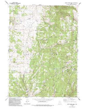
Monte Cristo Peak Topo Map Utah
To zoom in, hover over the map of Monte Cristo Peak
USGS Topo Quad 41111d5 - 1:24,000 scale
| Topo Map Name: | Monte Cristo Peak |
| USGS Topo Quad ID: | 41111d5 |
| Print Size: | ca. 21 1/4" wide x 27" high |
| Southeast Coordinates: | 41.375° N latitude / 111.5° W longitude |
| Map Center Coordinates: | 41.4375° N latitude / 111.5625° W longitude |
| U.S. State: | UT |
| Filename: | o41111d5.jpg |
| Download Map JPG Image: | Monte Cristo Peak topo map 1:24,000 scale |
| Map Type: | Topographic |
| Topo Series: | 7.5´ |
| Map Scale: | 1:24,000 |
| Source of Map Images: | United States Geological Survey (USGS) |
| Alternate Map Versions: |
Monte Cristo PK UT 1964, updated 1965 Download PDF Buy paper map Monte Cristo PK UT 1964, updated 1975 Download PDF Buy paper map Monte Cristo Peak UT 1991, updated 1991 Download PDF Buy paper map Monte Cristo Peak UT 1991, updated 1991 Download PDF Buy paper map Monte Cristo Peak UT 1998, updated 2001 Download PDF Buy paper map Monte Cristo Peak UT 2011 Download PDF Buy paper map Monte Cristo Peak UT 2014 Download PDF Buy paper map |
| FStopo: | US Forest Service topo Monte Cristo Peak is available: Download FStopo PDF Download FStopo TIF |
1:24,000 Topo Quads surrounding Monte Cristo Peak
> Back to 41111a1 at 1:100,000 scale
> Back to 41110a1 at 1:250,000 scale
> Back to U.S. Topo Maps home
Monte Cristo Peak topo map: Gazetteer
Monte Cristo Peak: Flats
Bluebell Flat elevation 2428m 7965′Monte Cristo Peak: Lakes
Dry Bread Pond elevation 2512m 8241′Lower Dry Bread Pond elevation 2310m 7578′
Monte Cristo Peak: Springs
Bluebell Spring elevation 2400m 7874′Bullwacker Spring elevation 2437m 7995′
Harriet Spring elevation 2644m 8674′
Indian Spring elevation 2660m 8727′
Lewis Spring elevation 2333m 7654′
Limestone Spring elevation 2023m 6637′
Norma Spring elevation 2560m 8398′
Monte Cristo Peak: Streams
Buckskin Fork elevation 2179m 7148′Coulee Creek elevation 2000m 6561′
Elk Creek elevation 2004m 6574′
Faucett Creek elevation 2097m 6879′
Skunk Creek elevation 2205m 7234′
Monte Cristo Peak: Summits
Little Monte elevation 2730m 8956′Monte Cristo Peak elevation 2787m 9143′
Mount McKinnon elevation 2770m 9087′
Monte Cristo Peak: Valleys
Blake Hollow elevation 2160m 7086′Cabin Hollow elevation 2273m 7457′
Dans Hollow elevation 2327m 7634′
Mitchell Hollow elevation 2311m 7582′
Trigger Gulch elevation 2340m 7677′
Monte Cristo Peak digital topo map on disk
Buy this Monte Cristo Peak topo map showing relief, roads, GPS coordinates and other geographical features, as a high-resolution digital map file on DVD:


