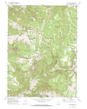
Logan Peak Topo Map Utah
To zoom in, hover over the map of Logan Peak
USGS Topo Quad 41111f6 - 1:24,000 scale
| Topo Map Name: | Logan Peak |
| USGS Topo Quad ID: | 41111f6 |
| Print Size: | ca. 21 1/4" wide x 27" high |
| Southeast Coordinates: | 41.625° N latitude / 111.625° W longitude |
| Map Center Coordinates: | 41.6875° N latitude / 111.6875° W longitude |
| U.S. State: | UT |
| Filename: | o41111f6.jpg |
| Download Map JPG Image: | Logan Peak topo map 1:24,000 scale |
| Map Type: | Topographic |
| Topo Series: | 7.5´ |
| Map Scale: | 1:24,000 |
| Source of Map Images: | United States Geological Survey (USGS) |
| Alternate Map Versions: |
Logan Peak UT 1969, updated 1973 Download PDF Buy paper map Logan Peak UT 1998, updated 2001 Download PDF Buy paper map Logan Peak UT 2011 Download PDF Buy paper map Logan Peak UT 2014 Download PDF Buy paper map |
| FStopo: | US Forest Service topo Logan Peak is available: Download FStopo PDF Download FStopo TIF |
1:24,000 Topo Quads surrounding Logan Peak
> Back to 41111e1 at 1:100,000 scale
> Back to 41110a1 at 1:250,000 scale
> Back to U.S. Topo Maps home
Logan Peak topo map: Gazetteer
Logan Peak: Bends
The Elbow elevation 2208m 7244′Logan Peak: Flats
Gus Lind Flat elevation 1523m 4996′Welches Flat elevation 2385m 7824′
Logan Peak: Lakes
Providence Lake elevation 2638m 8654′Logan Peak: Parks
Hyrum City Park elevation 1642m 5387′Logan Peak: Pillars
Lake Bonneville Monument elevation 1609m 5278′Logan Peak: Ranges
Bear River Range elevation 1952m 6404′Logan Peak: Springs
Banjo Spring elevation 2125m 6971′Box Spring elevation 2194m 7198′
Ferry Spring elevation 2424m 7952′
Pig Hole Spring elevation 1986m 6515′
Seep Spring elevation 2007m 6584′
White Bedground Spring elevation 2346m 7696′
White Rock Spring elevation 2303m 7555′
Logan Peak: Summits
Logan Peak elevation 2959m 9708′Mahogany Range elevation 2298m 7539′
Millville Peak elevation 2832m 9291′
Providence Peak elevation 2922m 9586′
Logan Peak: Valleys
Basin Hollow elevation 2159m 7083′Big Daley elevation 2147m 7043′
Big Hollow elevation 1556m 5104′
Boar Hole elevation 1786m 5859′
Box Elder Hollow elevation 2060m 6758′
Cart Hollow elevation 1837m 6026′
Cave Hollow elevation 2207m 7240′
Charles Hollow elevation 1654m 5426′
Clark Hollow elevation 1535m 5036′
First Waterfall Hollow elevation 1943m 6374′
Herd Hollow elevation 1706m 5597′
Hog Hole elevation 1691m 5547′
Leatham Hollow elevation 1572m 5157′
Left Hand Fork Blacksmith Fork Canyon elevation 1557m 5108′
Little Daley elevation 2088m 6850′
Pig Hole elevation 1735m 5692′
Richards Hollow elevation 1677m 5501′
Rocky Hollow elevation 2036m 6679′
Second Waterfall Hollow elevation 2047m 6715′
South Hollow elevation 2277m 7470′
Sow Hole elevation 1692m 5551′
Welches Hollow elevation 1927m 6322′
Logan Peak digital topo map on disk
Buy this Logan Peak topo map showing relief, roads, GPS coordinates and other geographical features, as a high-resolution digital map file on DVD:


