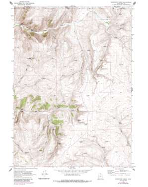
Sheeppen Creek Topo Map Utah
To zoom in, hover over the map of Sheeppen Creek
USGS Topo Quad 41111h2 - 1:24,000 scale
| Topo Map Name: | Sheeppen Creek |
| USGS Topo Quad ID: | 41111h2 |
| Print Size: | ca. 21 1/4" wide x 27" high |
| Southeast Coordinates: | 41.875° N latitude / 111.125° W longitude |
| Map Center Coordinates: | 41.9375° N latitude / 111.1875° W longitude |
| U.S. State: | UT |
| Filename: | o41111h2.jpg |
| Download Map JPG Image: | Sheeppen Creek topo map 1:24,000 scale |
| Map Type: | Topographic |
| Topo Series: | 7.5´ |
| Map Scale: | 1:24,000 |
| Source of Map Images: | United States Geological Survey (USGS) |
| Alternate Map Versions: |
Sheeppen Creek UT 1969, updated 1972 Download PDF Buy paper map Sheeppen Creek UT 1969, updated 1973 Download PDF Buy paper map Sheeppen Creek UT 1969, updated 1986 Download PDF Buy paper map Sheeppen Creek UT 2010 Download PDF Buy paper map Sheeppen Creek UT 2014 Download PDF Buy paper map |
1:24,000 Topo Quads surrounding Sheeppen Creek
> Back to 41111e1 at 1:100,000 scale
> Back to 41110a1 at 1:250,000 scale
> Back to U.S. Topo Maps home
Sheeppen Creek topo map: Gazetteer
Sheeppen Creek: Reservoirs
Lower North Eden Reservoir elevation 1854m 6082′South Eden Reservoir elevation 1935m 6348′
Upper North Eden Reservoir elevation 1872m 6141′
Sheeppen Creek: Springs
Cottonwood Spring elevation 2151m 7057′Rabbit Spring elevation 2053m 6735′
Sheeppen Spring elevation 2015m 6610′
Shirley Spring elevation 2106m 6909′
Sheeppen Creek: Streams
Black Mountain Creek elevation 1996m 6548′Cottonwood Creek elevation 1901m 6236′
Currant Creek elevation 1881m 6171′
Sheeppen Creek elevation 1945m 6381′
Sheeppen Creek: Summits
Black Mountain elevation 2349m 7706′Sheeppen Creek: Valleys
Christy Canyon elevation 1989m 6525′East Branch South Fork South Eden Canyon elevation 1950m 6397′
Left Hand South Fork North Eden Canyon elevation 1942m 6371′
Middle Branch South Fork South Eden Canyon elevation 1959m 6427′
Right Hand South Fork North Eden Canyon elevation 1942m 6371′
South Fork North Eden Canyon elevation 1895m 6217′
South Fork South Eden Canyon elevation 1942m 6371′
West Branch South Fork South Eden Canyon elevation 1950m 6397′
Sheeppen Creek digital topo map on disk
Buy this Sheeppen Creek topo map showing relief, roads, GPS coordinates and other geographical features, as a high-resolution digital map file on DVD:


