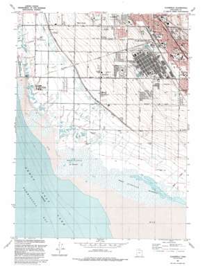
Clearfield Topo Map Utah
To zoom in, hover over the map of Clearfield
USGS Topo Quad 41112a1 - 1:24,000 scale
| Topo Map Name: | Clearfield |
| USGS Topo Quad ID: | 41112a1 |
| Print Size: | ca. 21 1/4" wide x 27" high |
| Southeast Coordinates: | 41° N latitude / 112° W longitude |
| Map Center Coordinates: | 41.0625° N latitude / 112.0625° W longitude |
| U.S. State: | UT |
| Filename: | o41112a1.jpg |
| Download Map JPG Image: | Clearfield topo map 1:24,000 scale |
| Map Type: | Topographic |
| Topo Series: | 7.5´ |
| Map Scale: | 1:24,000 |
| Source of Map Images: | United States Geological Survey (USGS) |
| Alternate Map Versions: |
Clearfield UT 1955, updated 1956 Download PDF Buy paper map Clearfield UT 1972, updated 1974 Download PDF Buy paper map Clearfield UT 1991, updated 1991 Download PDF Buy paper map Clearfield UT 1991, updated 1991 Download PDF Buy paper map Clearfield UT 1999, updated 2001 Download PDF Buy paper map Clearfield UT 2011 Download PDF Buy paper map Clearfield UT 2014 Download PDF Buy paper map |
1:24,000 Topo Quads surrounding Clearfield
> Back to 41112a1 at 1:100,000 scale
> Back to 41112a1 at 1:250,000 scale
> Back to U.S. Topo Maps home
Clearfield topo map: Gazetteer
Clearfield: Airports
Davis County Mosquito Abatement Airstrip elevation 1284m 4212′Clearfield: Canals
Hooper Canal elevation 1292m 4238′Clearfield: Crossings
Interchange 336 elevation 1382m 4534′Interchange 338 elevation 1395m 4576′
Clearfield: Parks
Bicentennial Park elevation 1378m 4520′Clearfield Central Park elevation 1374m 4507′
Constitution Park elevation 1309m 4294′
Fisher Park elevation 1371m 4498′
Island View Park elevation 1335m 4379′
Kiwanis Park elevation 1382m 4534′
Steed Park elevation 1352m 4435′
Stoker Park elevation 1318m 4324′
West Point Park elevation 1310m 4297′
Clearfield: Populated Places
Airlane Park elevation 1398m 4586′Al Vita Park elevation 1388m 4553′
Allison Acres elevation 1312m 4304′
Anchorage elevation 1337m 4386′
Barlow Heights elevation 1362m 4468′
Barnes elevation 1312m 4304′
Bel-Aire Condominium elevation 1369m 4491′
Bluff Road elevation 1298m 4258′
Bridgewood Manor Condominium elevation 1371m 4498′
Brimhall Estates elevation 1329m 4360′
Campbell Heights elevation 1367m 4484′
Central Park Addition elevation 1371m 4498′
Cherry Hill elevation 1382m 4534′
Clearfield elevation 1361m 4465′
Clearfield Estates elevation 1337m 4386′
Clearfield Heights elevation 1375m 4511′
Clearfield Terrace elevation 1404m 4606′
Clearfield Villa elevation 1380m 4527′
Country Crossing elevation 1309m 4294′
Country Village elevation 1353m 4438′
Edgehill Estates elevation 1326m 4350′
Equestrian Ranchettes elevation 1316m 4317′
Frew Estates elevation 1333m 4373′
Glade Nielsen elevation 1348m 4422′
Golden Park elevation 1387m 4550′
Grandview Acres elevation 1375m 4511′
Grants Lane elevation 1310m 4297′
Green Hill Acres elevation 1366m 4481′
Green Pastures elevation 1283m 4209′
Henry Oleson elevation 1312m 4304′
Jamarl Acres elevation 1382m 4534′
Julie Estates elevation 1338m 4389′
Katies Place elevation 1330m 4363′
Kristalyn Gardens elevation 1305m 4281′
Lakeview elevation 1382m 4534′
Lakeview Condominium elevation 1341m 4399′
Layton Park elevation 1373m 4504′
Lori Estates elevation 1347m 4419′
Lou-vre Estates elevation 1394m 4573′
Marilyn Acres elevation 1319m 4327′
Meadow Park elevation 1325m 4347′
Melanie Acres elevation 1322m 4337′
Newport Haven elevation 1282m 4206′
Oakcrest Estates elevation 1332m 4370′
Park West Estates elevation 1347m 4419′
Pratts elevation 1366m 4481′
Ranchettes West elevation 1291m 4235′
Rhoades Lane elevation 1320m 4330′
Shimada Acres elevation 1303m 4274′
Sky West Estates elevation 1312m 4304′
Smedley Acres elevation 1301m 4268′
Smith Estates elevation 1366m 4481′
Smith Village elevation 1385m 4543′
Southwood elevation 1328m 4356′
Steed elevation 1359m 4458′
Stuart elevation 1331m 4366′
Sundial Park elevation 1300m 4265′
Suntrails elevation 1336m 4383′
Syracuse elevation 1306m 4284′
Terrace View elevation 1393m 4570′
Thornleys elevation 1370m 4494′
Thurgood Estates elevation 1331m 4366′
Vae View elevation 1354m 4442′
Valhalla Estates elevation 1374m 4507′
Valley View elevation 1385m 4543′
Valley West Ranches elevation 1320m 4330′
Villa Vista elevation 1319m 4327′
West Gate Addition elevation 1387m 4550′
West Point elevation 1315m 4314′
West Sunset View Estates elevation 1299m 4261′
Westland elevation 1332m 4370′
Westmond Condominium elevation 1332m 4370′
Westwood Estates elevation 1340m 4396′
Yorkshire Place elevation 1359m 4458′
Clearfield: Streams
Kays Creek elevation 1282m 4206′Clearfield: Swamps
West Kaysville Marshes elevation 1283m 4209′West Layton Marshes elevation 1283m 4209′
Clearfield digital topo map on disk
Buy this Clearfield topo map showing relief, roads, GPS coordinates and other geographical features, as a high-resolution digital map file on DVD:


