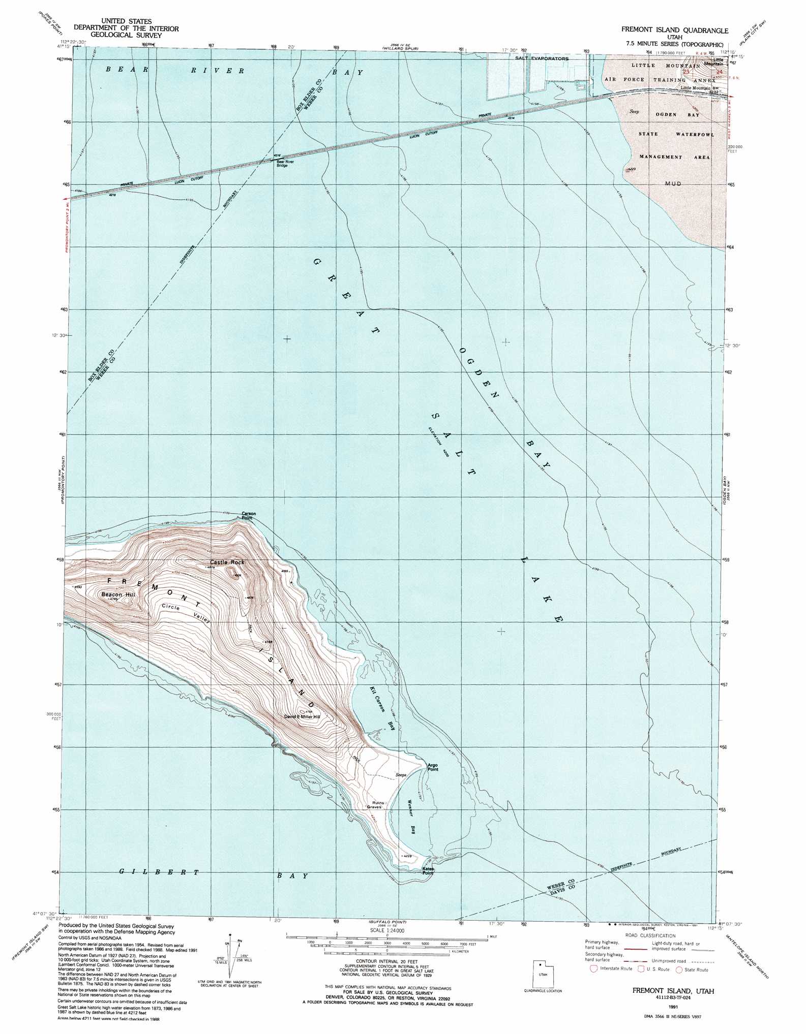
Fremont Island Topo Map Utah
To zoom in, hover over the map of Fremont Island
USGS Topo Quad 41112b3 - 1:24,000 scale
| Topo Map Name: | Fremont Island |
| USGS Topo Quad ID: | 41112b3 |
| Print Size: | ca. 21 1/4" wide x 27" high |
| Southeast Coordinates: | 41.125° N latitude / 112.25° W longitude |
| Map Center Coordinates: | 41.1875° N latitude / 112.3125° W longitude |
| U.S. State: | UT |
| Filename: | o41112b3.jpg |
| Download Map JPG Image: | Fremont Island topo map 1:24,000 scale |
| Map Type: | Topographic |
| Topo Series: | 7.5´ |
| Map Scale: | 1:24,000 |
| Source of Map Images: | United States Geological Survey (USGS) |
| Alternate Map Versions: |
Fremont Island UT 1955, updated 1956 Download PDF Buy paper map Fremont Island UT 1972, updated 1974 Download PDF Buy paper map Fremont Island UT 1991, updated 1991 Download PDF Buy paper map Fremont Island UT 2011 Download PDF Buy paper map Fremont Island UT 2014 Download PDF Buy paper map |
1:24,000 Topo Quads surrounding Fremont Island
Messix Peak |
East Promontory |
Mouth Of Bear River |
Whistler Canal |
Willard |
Indian Cove |
Pokes Point |
Willard Spur |
Plain City Sw |
Plain City |
Carrington Island Ne |
Promontory Point |
Fremont Island |
Ogden Bay |
Roy |
Carrington Island |
Fremont Island Sw |
Buffalo Point |
Antelope Island North |
Clearfield |
Badger Island |
Plug Peak Nw |
Plug Peak Ne |
Antelope Island |
Saltair Ne |
> Back to 41112a1 at 1:100,000 scale
> Back to 41112a1 at 1:250,000 scale
> Back to U.S. Topo Maps home
Fremont Island topo map: Gazetteer
Fremont Island: Bars
Fremont Island Bar elevation 1281m 4202′Fremont Island: Bays
Fremont Bight elevation 1281m 4202′Kit Carson Bay elevation 1281m 4202′
Ogden Bay elevation 1281m 4202′
Wenner Bay elevation 1281m 4202′
Fremont Island: Beaches
Jones Beach elevation 1288m 4225′Fremont Island: Bridges
Bear River Bridge elevation 1281m 4202′Fremont Island: Capes
Argo Point elevation 1286m 4219′Carson Point elevation 1304m 4278′
Kates Point elevation 1288m 4225′
Fremont Island: Islands
Fremont Island elevation 1408m 4619′Fremont Island: Populated Places
Little Mountain elevation 1285m 4215′Fremont Island: Streams
North Fork Weber River elevation 1281m 4202′Fremont Island: Summits
Beacon Hill elevation 1460m 4790′Castle Rock elevation 1523m 4996′
David E Miller Hill elevation 1434m 4704′
Fremont Island: Valleys
Circle Valley elevation 1336m 4383′Fremont Island digital topo map on disk
Buy this Fremont Island topo map showing relief, roads, GPS coordinates and other geographical features, as a high-resolution digital map file on DVD: