Monument Point Topo Map Utah
To zoom in, hover over the map of Monument Point
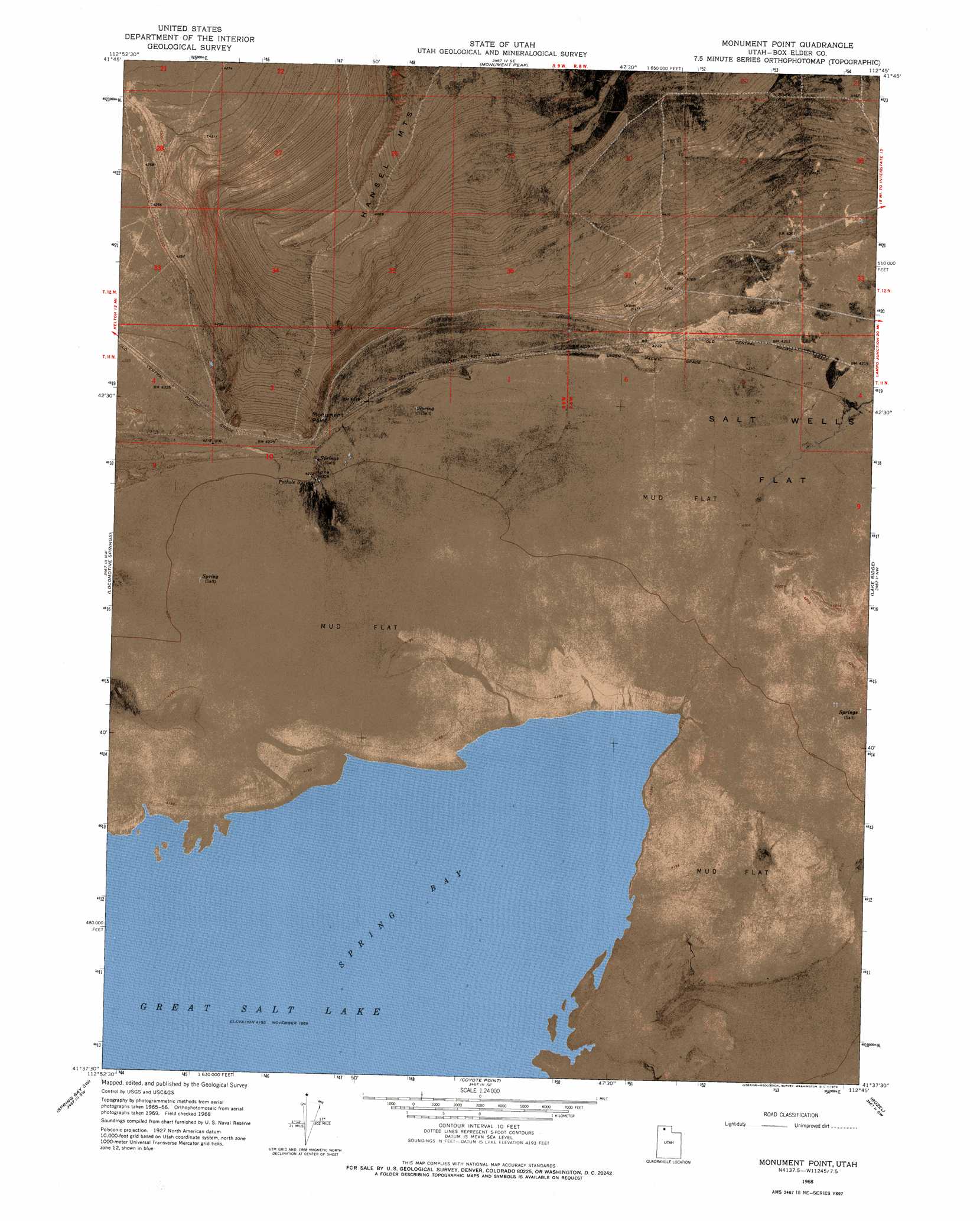
USGS Topo Quad 41112f7 - 1:24,000 scale
| Topo Map Name: | Monument Point |
| USGS Topo Quad ID: | 41112f7 |
| Print Size: | ca. 21 1/4" wide x 27" high |
| Southeast Coordinates: | 41.625° N latitude / 112.75° W longitude |
| Map Center Coordinates: | 41.6875° N latitude / 112.8125° W longitude |
| U.S. State: | UT |
| Filename: | p41112f7.jpg |
| Download Map JPG Image: | Monument Point topo map 1:24,000 scale |
| Map Type: | Orthophoto |
| Topo Series: | 7.5´ |
| Map Scale: | 1:24,000 |
| Source of Map Images: | United States Geological Survey (USGS) |
| Alternate Map Versions: |
Monument Point UT 1968, updated 1969 Download PDF Buy paper map Monument Point UT 1968, updated 1972 Download PDF Buy paper map Monument Point UT 2011 Download PDF Buy paper map Monument Point UT 2014 Download PDF Buy paper map |
1:24,000 Topo Quads surrounding Monument Point
Curlew Junction |
Monument Peak Nw |
Monument Peak Ne |
Snowville |
Rattlesnake Pass |
Kelton Pass Se |
Monument Peak Sw |
Monument Peak |
Salt Wells |
Bulls Pass |
Crocodile Mountain Ne |
Locomotive Springs |
Monument Point |
Lake Ridge |
Sunset Pass |
Crocodile Mountain Se |
Spring Bay Sw |
Coyote Point |
Rozel |
Golden Spike Monument |
Dolphin Island West |
Dolphin Island East |
Gunnison Island Ne |
Rozel Point |
Messix Peak |
> Back to 41112e1 at 1:100,000 scale
> Back to 41112a1 at 1:250,000 scale
> Back to U.S. Topo Maps home
Monument Point topo map: Gazetteer
Monument Point: Bays
Spring Bay elevation 1280m 4199′Monument Point: Cliffs
Monument Point elevation 1323m 4340′Monument Point: Pillars
Lone Rock elevation 1282m 4206′Monument Point: Ranges
Hansel Mountains elevation 1289m 4229′Monument Point: Springs
Pothole Springs elevation 1282m 4206′Monument Point: Valleys
Curlew Valley elevation 1288m 4225′Monument Point digital topo map on disk
Buy this Monument Point topo map showing relief, roads, GPS coordinates and other geographical features, as a high-resolution digital map file on DVD: