Snowville Topo Map Utah
To zoom in, hover over the map of Snowville
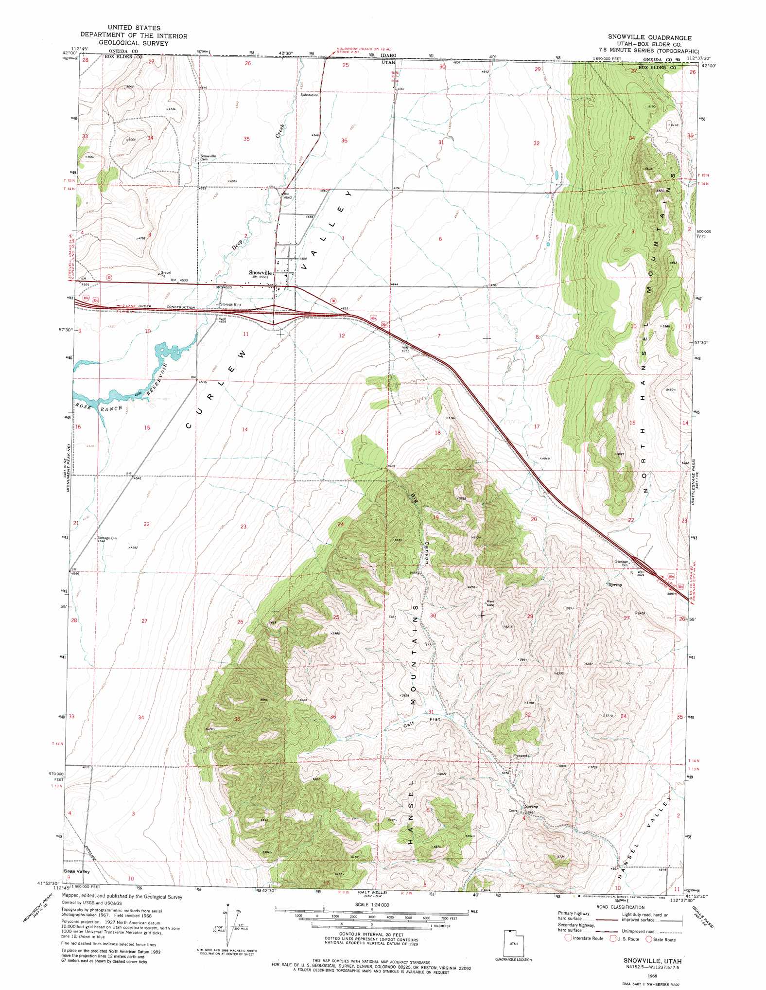
USGS Topo Quad 41112h6 - 1:24,000 scale
| Topo Map Name: | Snowville |
| USGS Topo Quad ID: | 41112h6 |
| Print Size: | ca. 21 1/4" wide x 27" high |
| Southeast Coordinates: | 41.875° N latitude / 112.625° W longitude |
| Map Center Coordinates: | 41.9375° N latitude / 112.6875° W longitude |
| U.S. State: | UT |
| Filename: | o41112h6.jpg |
| Download Map JPG Image: | Snowville topo map 1:24,000 scale |
| Map Type: | Topographic |
| Topo Series: | 7.5´ |
| Map Scale: | 1:24,000 |
| Source of Map Images: | United States Geological Survey (USGS) |
| Alternate Map Versions: |
Snowville UT 1968, updated 1972 Download PDF Buy paper map Snowville UT 1968, updated 1980 Download PDF Buy paper map Snowville UT 2011 Download PDF Buy paper map Snowville UT 2014 Download PDF Buy paper map |
1:24,000 Topo Quads surrounding Snowville
Juniper |
Badger Hole Spring |
Holbrook |
Sheep Creek Spring |
Ireland Springs |
Black Pine |
The Cove |
Stone |
Co-Op Spring |
Grover Canyon |
Monument Peak Nw |
Monument Peak Ne |
Snowville |
Rattlesnake Pass |
Ridgedale Pass |
Monument Peak Sw |
Monument Peak |
Salt Wells |
Bulls Pass |
Howell |
Locomotive Springs |
Monument Point |
Lake Ridge |
Sunset Pass |
Lampo Junction |
> Back to 41112e1 at 1:100,000 scale
> Back to 41112a1 at 1:250,000 scale
> Back to U.S. Topo Maps home
Snowville topo map: Gazetteer
Snowville: Flats
Calf Flat elevation 1666m 5465′Snowville: Populated Places
Snowville elevation 1386m 4547′Snowville: Valleys
Big Canyon elevation 1510m 4954′Snowville digital topo map on disk
Buy this Snowville topo map showing relief, roads, GPS coordinates and other geographical features, as a high-resolution digital map file on DVD: