Lucin 4 Se Topo Map Utah
To zoom in, hover over the map of Lucin 4 Se
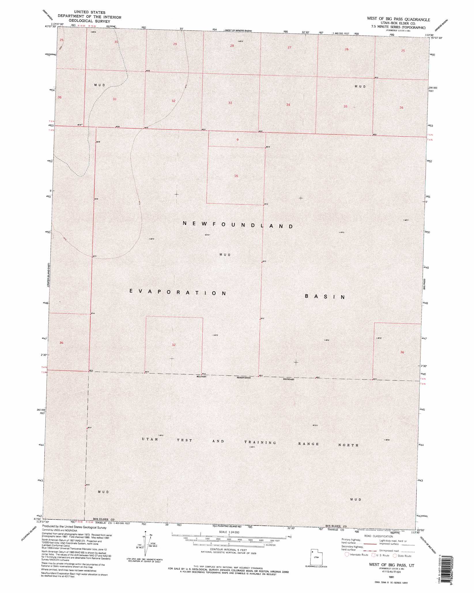
USGS Topo Quad 41113a5 - 1:24,000 scale
| Topo Map Name: | Lucin 4 Se |
| USGS Topo Quad ID: | 41113a5 |
| Print Size: | ca. 21 1/4" wide x 27" high |
| Southeast Coordinates: | 41° N latitude / 113.5° W longitude |
| Map Center Coordinates: | 41.0625° N latitude / 113.5625° W longitude |
| U.S. State: | UT |
| Filename: | o41113a5.jpg |
| Download Map JPG Image: | Lucin 4 Se topo map 1:24,000 scale |
| Map Type: | Topographic |
| Topo Series: | 7.5´ |
| Map Scale: | 1:24,000 |
| Source of Map Images: | United States Geological Survey (USGS) |
| Alternate Map Versions: |
Lucin 4 SE UT 1983, updated 1983 Download PDF Buy paper map Lucin 4 SE UT 1991, updated 1991 Download PDF Buy paper map West of Big Pass UT 1991, updated 1995 Download PDF Buy paper map West of Big Pass UT 2011 Download PDF Buy paper map West of Big Pass UT 2014 Download PDF Buy paper map |
1:24,000 Topo Quads surrounding Lucin 4 Se
Pigeon Mountain |
Jackson |
Bovine Se |
Lemay |
Groome |
Lemay Island |
Lucin 4 Nw |
Lucin 4 Ne |
Miners Basin |
Desert Peak |
Crater Island |
Lucin 4 Sw |
Lucin 4 Se |
Big Pass |
Keller Well |
Graham Peak |
Floating Island |
Floating Island Ne |
Knolls 2 Nw |
Knolls 2 Ne |
Bonneville Racetrack |
Floating Island Sw |
Floating Island Se |
Knolls 2 Sw |
Knolls 2 Se |
> Back to 41113a1 at 1:100,000 scale
> Back to 41112a1 at 1:250,000 scale
> Back to U.S. Topo Maps home
Lucin 4 Se topo map: Gazetteer
Lucin 4 Se: Basins
Newfoundland Evaporation Basin elevation 1286m 4219′Lucin 4 Se digital topo map on disk
Buy this Lucin 4 Se topo map showing relief, roads, GPS coordinates and other geographical features, as a high-resolution digital map file on DVD: