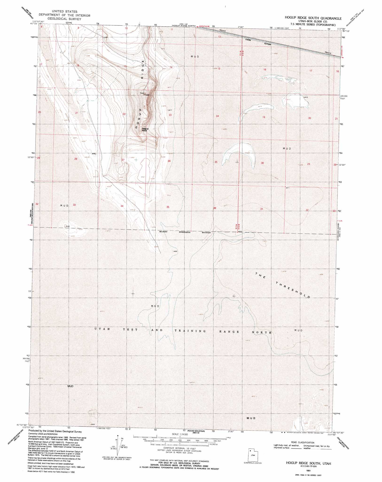
Hogup Ridge South Topo Map Utah
To zoom in, hover over the map of Hogup Ridge South
USGS Topo Quad 41113b1 - 1:24,000 scale
| Topo Map Name: | Hogup Ridge South |
| USGS Topo Quad ID: | 41113b1 |
| Print Size: | ca. 21 1/4" wide x 27" high |
| Southeast Coordinates: | 41.125° N latitude / 113° W longitude |
| Map Center Coordinates: | 41.1875° N latitude / 113.0625° W longitude |
| U.S. State: | UT |
| Filename: | o41113b1.jpg |
| Download Map JPG Image: | Hogup Ridge South topo map 1:24,000 scale |
| Map Type: | Topographic |
| Topo Series: | 7.5´ |
| Map Scale: | 1:24,000 |
| Source of Map Images: | United States Geological Survey (USGS) |
| Alternate Map Versions: |
Hogup Ridge South UT 1969, updated 1972 Download PDF Buy paper map Hogup Ridge South UT 1991, updated 1991 Download PDF Buy paper map Hogup Ridge South UT 2011 Download PDF Buy paper map Hogup Ridge South UT 2014 Download PDF Buy paper map |
1:24,000 Topo Quads surrounding Hogup Ridge South
Sheep Mountain |
Tangent Peak |
Dolphin Island West |
Dolphin Island East |
Gunnison Island Ne |
Groome |
Meadow Spring |
Hogup Ridge North |
Gunnison Island Sw |
Gunnison Island |
Desert Peak |
Round Mountain Nw |
Hogup Ridge South |
Strongs Knob |
Lakeside |
Keller Well |
Round Mountain Sw |
Round Mountain |
Sally Mountain |
Deardens Knoll |
Knolls 2 Ne |
Finger Ridge |
Grassy Mountains |
Puddle Valley Knolls |
Craner Peak |
> Back to 41113a1 at 1:100,000 scale
> Back to 41112a1 at 1:250,000 scale
> Back to U.S. Topo Maps home
Hogup Ridge South topo map: Gazetteer
Hogup Ridge South: Flats
The Threshold elevation 1284m 4212′Hogup Ridge South: Ridges
Hogup Point elevation 1389m 4557′Hogup Ridge South digital topo map on disk
Buy this Hogup Ridge South topo map showing relief, roads, GPS coordinates and other geographical features, as a high-resolution digital map file on DVD: