Red Dome Topo Map Utah
To zoom in, hover over the map of Red Dome
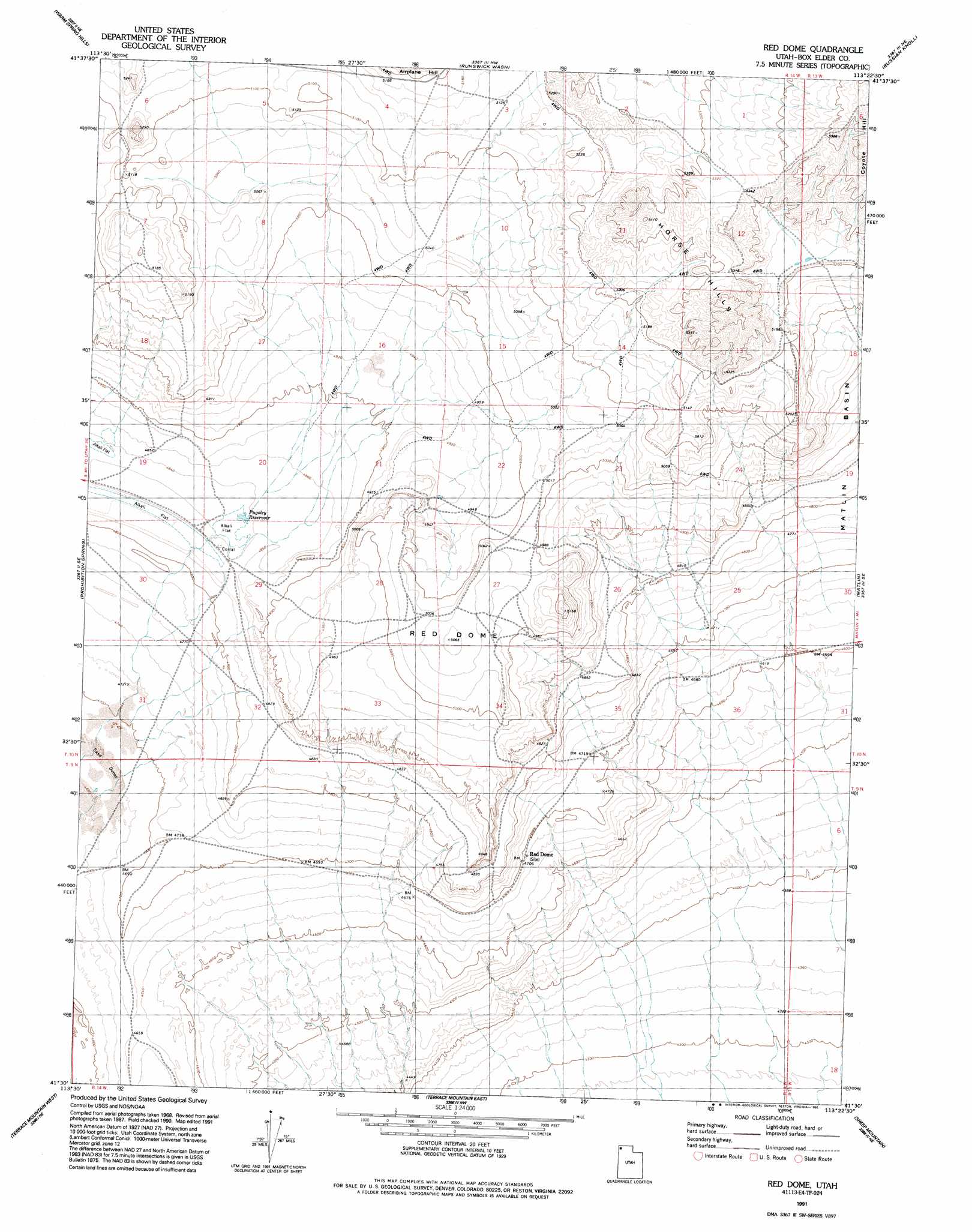
USGS Topo Quad 41113e4 - 1:24,000 scale
| Topo Map Name: | Red Dome |
| USGS Topo Quad ID: | 41113e4 |
| Print Size: | ca. 21 1/4" wide x 27" high |
| Southeast Coordinates: | 41.5° N latitude / 113.375° W longitude |
| Map Center Coordinates: | 41.5625° N latitude / 113.4375° W longitude |
| U.S. State: | UT |
| Filename: | o41113e4.jpg |
| Download Map JPG Image: | Red Dome topo map 1:24,000 scale |
| Map Type: | Topographic |
| Topo Series: | 7.5´ |
| Map Scale: | 1:24,000 |
| Source of Map Images: | United States Geological Survey (USGS) |
| Alternate Map Versions: |
Red Dome UT 1971, updated 1974 Download PDF Buy paper map Red Dome UT 1991, updated 1992 Download PDF Buy paper map Red Dome UT 2011 Download PDF Buy paper map Red Dome UT 2014 Download PDF Buy paper map |
1:24,000 Topo Quads surrounding Red Dome
Lynn Reservoir |
Dennis Hill |
Rosette |
Park Valley |
Black Butte |
Potters Creek |
Warm Spring Hills |
Runswick Wash |
Russian Knoll |
Peplin Flats |
Emigrant Pass |
Prohibition Spring |
Red Dome |
Matlin |
Hogup Bar |
Bovine |
Terrace Mountain West |
Terrace Mountain East |
Sheep Mountain |
Tangent Peak |
Jackson |
Bovine Se |
Lemay |
Groome |
Meadow Spring |
> Back to 41113e1 at 1:100,000 scale
> Back to 41112a1 at 1:250,000 scale
> Back to U.S. Topo Maps home
Red Dome topo map: Gazetteer
Red Dome: Reservoirs
Pugsley Reservoir elevation 1476m 4842′Red Dome: Summits
Horse Hills elevation 1628m 5341′Red Dome elevation 1545m 5068′
Red Dome digital topo map on disk
Buy this Red Dome topo map showing relief, roads, GPS coordinates and other geographical features, as a high-resolution digital map file on DVD: