Black Butte Topo Map Utah
To zoom in, hover over the map of Black Butte
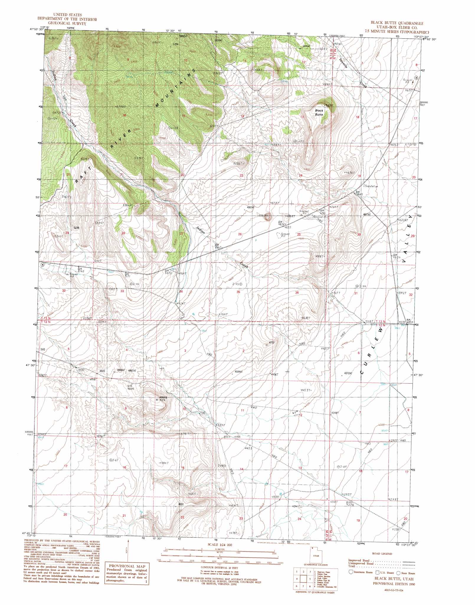
USGS Topo Quad 41113g2 - 1:24,000 scale
| Topo Map Name: | Black Butte |
| USGS Topo Quad ID: | 41113g2 |
| Print Size: | ca. 21 1/4" wide x 27" high |
| Southeast Coordinates: | 41.75° N latitude / 113.125° W longitude |
| Map Center Coordinates: | 41.8125° N latitude / 113.1875° W longitude |
| U.S. State: | UT |
| Filename: | o41113g2.jpg |
| Download Map JPG Image: | Black Butte topo map 1:24,000 scale |
| Map Type: | Topographic |
| Topo Series: | 7.5´ |
| Map Scale: | 1:24,000 |
| Source of Map Images: | United States Geological Survey (USGS) |
| Alternate Map Versions: |
Black Butte UT 1990, updated 1990 Download PDF Buy paper map Black Butte UT 2011 Download PDF Buy paper map Black Butte UT 2014 Download PDF Buy paper map |
1:24,000 Topo Quads surrounding Black Butte
Chokecherry Canyon |
Naf |
Strevell |
Black Pine Peak |
Black Pine |
Standrod |
Rosevere Point |
Kelton Pass |
Curlew Junction |
Monument Peak Nw |
Rosette |
Park Valley |
Black Butte |
Kelton Pass Se |
Monument Peak Sw |
Runswick Wash |
Russian Knoll |
Peplin Flats |
Crocodile Mountain Ne |
Locomotive Springs |
Red Dome |
Matlin |
Hogup Bar |
Crocodile Mountain Se |
Spring Bay Sw |
> Back to 41113e1 at 1:100,000 scale
> Back to 41112a1 at 1:250,000 scale
> Back to U.S. Topo Maps home
Black Butte topo map: Gazetteer
Black Butte: Streams
Indian Creek elevation 1320m 4330′South Fork Indian Creek elevation 1698m 5570′
Black Butte: Summits
Black Butte elevation 1583m 5193′Black Butte digital topo map on disk
Buy this Black Butte topo map showing relief, roads, GPS coordinates and other geographical features, as a high-resolution digital map file on DVD: