Rosevere Point Topo Map Utah
To zoom in, hover over the map of Rosevere Point
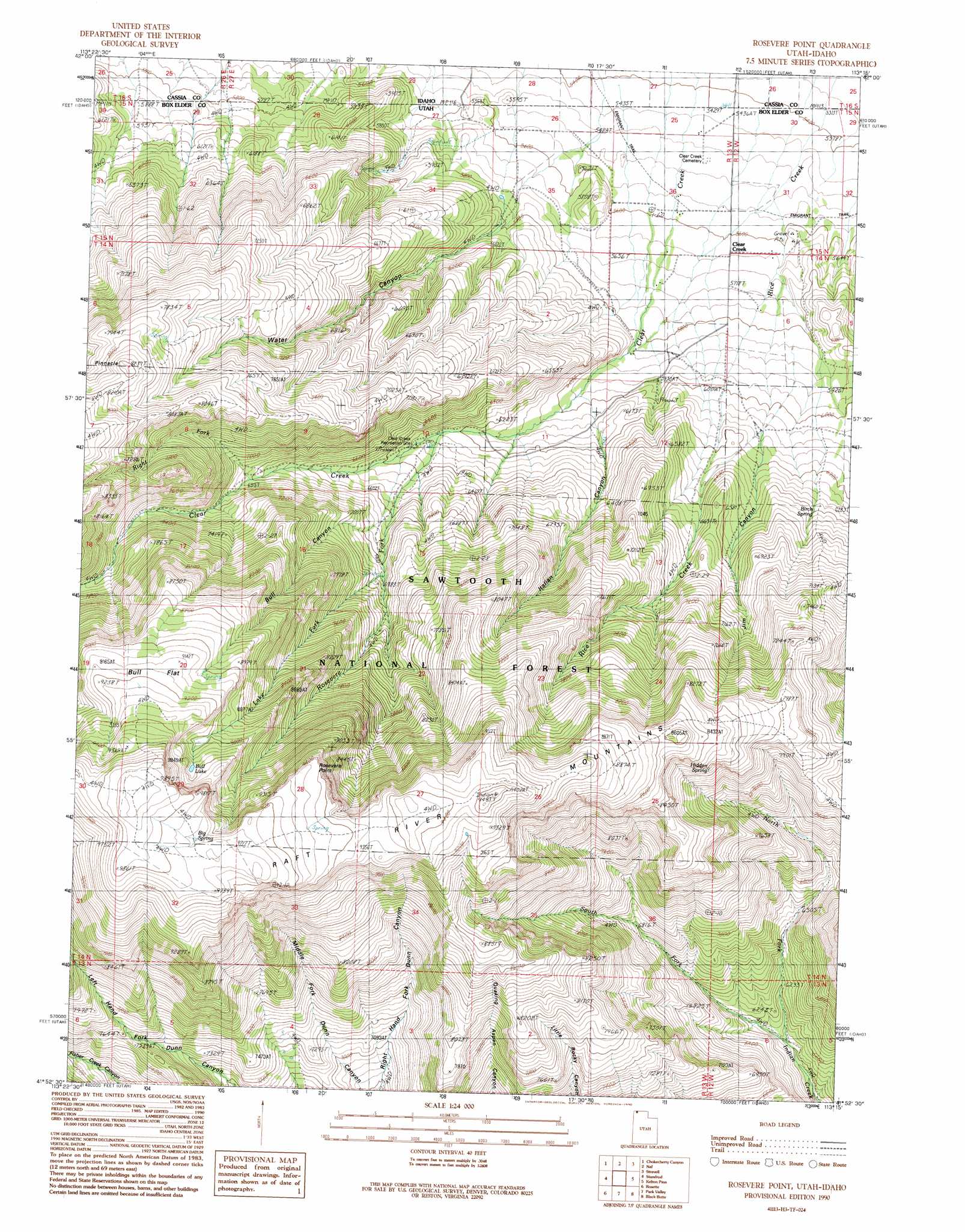
USGS Topo Quad 41113h3 - 1:24,000 scale
| Topo Map Name: | Rosevere Point |
| USGS Topo Quad ID: | 41113h3 |
| Print Size: | ca. 21 1/4" wide x 27" high |
| Southeast Coordinates: | 41.875° N latitude / 113.25° W longitude |
| Map Center Coordinates: | 41.9375° N latitude / 113.3125° W longitude |
| U.S. States: | UT, ID |
| Filename: | o41113h3.jpg |
| Download Map JPG Image: | Rosevere Point topo map 1:24,000 scale |
| Map Type: | Topographic |
| Topo Series: | 7.5´ |
| Map Scale: | 1:24,000 |
| Source of Map Images: | United States Geological Survey (USGS) |
| Alternate Map Versions: |
Rosevere Point UT 1990, updated 1990 Download PDF Buy paper map Rosevere Point UT 2001, updated 2006 Download PDF Buy paper map Rosevere Point UT 2011 Download PDF Buy paper map Rosevere Point UT 2014 Download PDF Buy paper map |
| FStopo: | US Forest Service topo Rosevere Point is available: Download FStopo PDF Download FStopo TIF |
1:24,000 Topo Quads surrounding Rosevere Point
Elba |
Kane Canyon |
Bridge |
Sandrock Canyon |
Sweetzer Canyon |
Jim Sage Canyon |
Chokecherry Canyon |
Naf |
Strevell |
Black Pine Peak |
Yost |
Standrod |
Rosevere Point |
Kelton Pass |
Curlew Junction |
Dennis Hill |
Rosette |
Park Valley |
Black Butte |
Kelton Pass Se |
Warm Spring Hills |
Runswick Wash |
Russian Knoll |
Peplin Flats |
Crocodile Mountain Ne |
> Back to 41113e1 at 1:100,000 scale
> Back to 41112a1 at 1:250,000 scale
> Back to U.S. Topo Maps home
Rosevere Point topo map: Gazetteer
Rosevere Point: Arroyos
Right Fork Clear Creek elevation 2078m 6817′Rosevere Point: Cliffs
Rosevere Point elevation 2762m 9061′Rosevere Point: Flats
Bull Flat elevation 2811m 9222′Rosevere Point: Pillars
Pinnacle elevation 2464m 8083′Rosevere Point: Reservoirs
Bull Lake elevation 2808m 9212′Rosevere Point: Springs
Big Spring elevation 2942m 9652′Birch Spring elevation 2037m 6683′
Birch Spring elevation 1991m 6532′
Hidden Spring elevation 2353m 7719′
Hidden Spring elevation 2470m 8103′
Rosevere Point: Streams
Lake Fork elevation 2165m 7103′North Fork Indian Creek elevation 1846m 6056′
Right Fork Clear Creek elevation 2085m 6840′
Rosevere Fork elevation 1902m 6240′
Rosevere Point: Valleys
Bull Canyon elevation 2023m 6637′Italian Canyon elevation 1842m 6043′
Jim Canyon elevation 1770m 5807′
Water Canyon elevation 1701m 5580′
Rosevere Point digital topo map on disk
Buy this Rosevere Point topo map showing relief, roads, GPS coordinates and other geographical features, as a high-resolution digital map file on DVD: