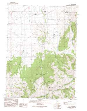
Yost Topo Map Utah
To zoom in, hover over the map of Yost
USGS Topo Quad 41113h5 - 1:24,000 scale
| Topo Map Name: | Yost |
| USGS Topo Quad ID: | 41113h5 |
| Print Size: | ca. 21 1/4" wide x 27" high |
| Southeast Coordinates: | 41.875° N latitude / 113.5° W longitude |
| Map Center Coordinates: | 41.9375° N latitude / 113.5625° W longitude |
| U.S. States: | UT, ID |
| Filename: | o41113h5.jpg |
| Download Map JPG Image: | Yost topo map 1:24,000 scale |
| Map Type: | Topographic |
| Topo Series: | 7.5´ |
| Map Scale: | 1:24,000 |
| Source of Map Images: | United States Geological Survey (USGS) |
| Alternate Map Versions: |
Yost UT 1990, updated 1990 Download PDF Buy paper map Yost UT 2001, updated 2006 Download PDF Buy paper map Yost UT 2011 Download PDF Buy paper map Yost UT 2014 Download PDF Buy paper map |
| FStopo: | US Forest Service topo Yost is available: Download FStopo PDF Download FStopo TIF |
1:24,000 Topo Quads surrounding Yost
> Back to 41113e1 at 1:100,000 scale
> Back to 41112a1 at 1:250,000 scale
> Back to U.S. Topo Maps home
Yost topo map: Gazetteer
Yost: Basins
Upper Raft River Valley elevation 1712m 5616′Yost: Populated Places
Yost elevation 1821m 5974′Yost: Springs
Blyth Spring elevation 2158m 7080′Cabin Spring elevation 1905m 6250′
Callahan Spring elevation 1876m 6154′
Carter Spring elevation 2479m 8133′
Cold Spring elevation 2325m 7627′
Mahogany Spring elevation 2336m 7664′
Yost: Streams
Charleston Creek elevation 1797m 5895′Left Hand Fork Johnson Creek elevation 2008m 6587′
Right Hand Fork Johnson Creek elevation 2008m 6587′
South Fork Johnson Creek elevation 1936m 6351′
Yost: Summits
Mahogany Peaks elevation 2540m 8333′Yost: Valleys
Browns Canyon elevation 2146m 7040′Dry Hollow elevation 1779m 5836′
Limekiln Hollow elevation 1779m 5836′
Yost digital topo map on disk
Buy this Yost topo map showing relief, roads, GPS coordinates and other geographical features, as a high-resolution digital map file on DVD:


