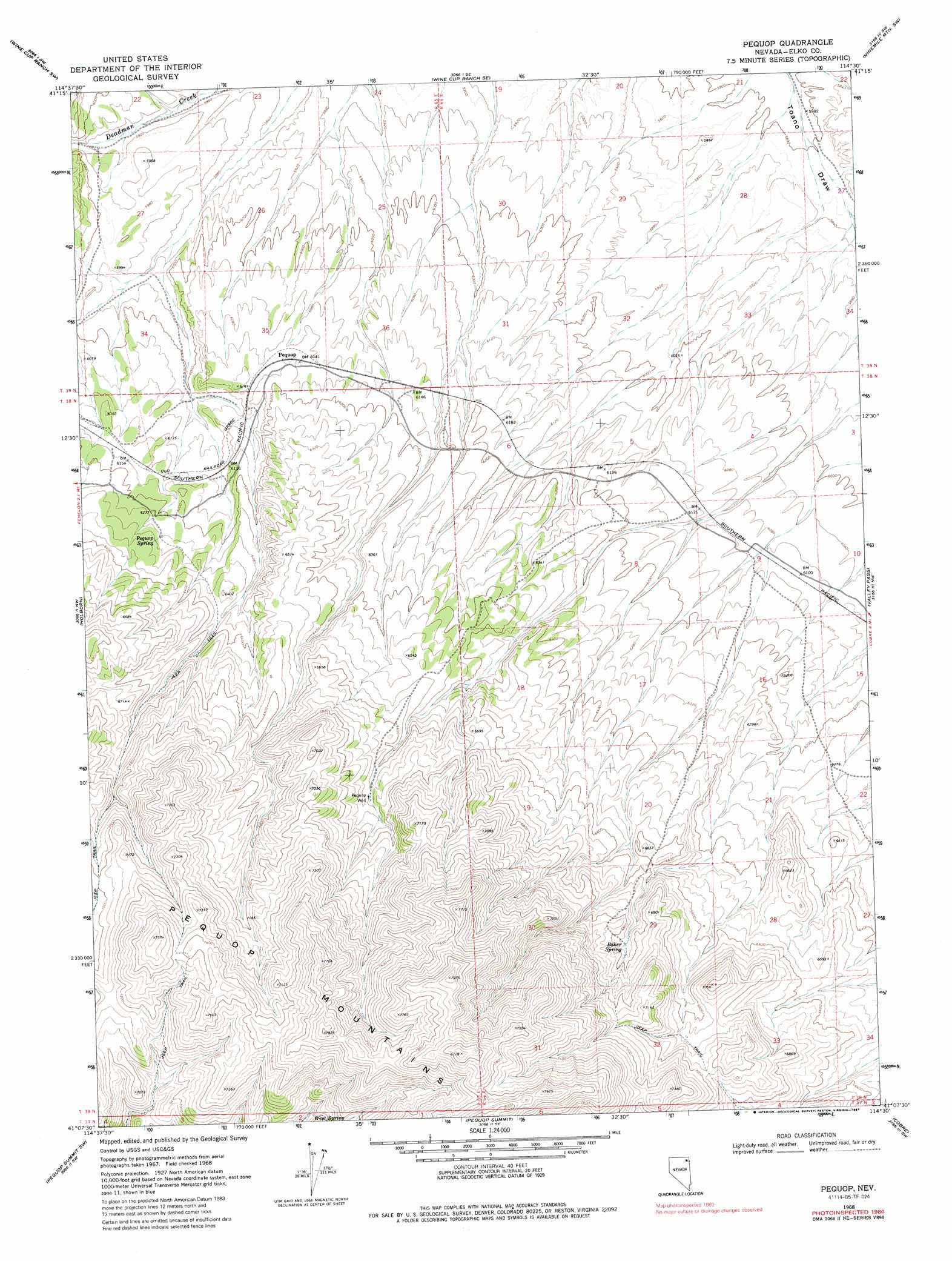
Pequop Topo Map Nevada
To zoom in, hover over the map of Pequop
USGS Topo Quad 41114b5 - 1:24,000 scale
| Topo Map Name: | Pequop |
| USGS Topo Quad ID: | 41114b5 |
| Print Size: | ca. 21 1/4" wide x 27" high |
| Southeast Coordinates: | 41.125° N latitude / 114.5° W longitude |
| Map Center Coordinates: | 41.1875° N latitude / 114.5625° W longitude |
| U.S. State: | NV |
| Filename: | o41114b5.jpg |
| Download Map JPG Image: | Pequop topo map 1:24,000 scale |
| Map Type: | Topographic |
| Topo Series: | 7.5´ |
| Map Scale: | 1:24,000 |
| Source of Map Images: | United States Geological Survey (USGS) |
| Alternate Map Versions: |
Pequop NV 1968, updated 1971 Download PDF Buy paper map Pequop NV 1968, updated 1987 Download PDF Buy paper map Pequop NV 2012 Download PDF Buy paper map Pequop NV 2014 Download PDF Buy paper map |
1:24,000 Topo Quads surrounding Pequop
Wilkins |
Wine Cup Ranch |
Wine Cup Ranch Ne |
Ninemile Mountain |
Ninemile Mountain Ne |
Melandco |
Wine Cup Ranch Sw |
Wine Cup Ranch Se |
Ninemile Mountain Sw |
Montello Canyon |
Wells Peak |
Holborn |
Pequop |
Valley Pass |
Loray |
Moor Summit |
Pequop Summit Sw |
Pequop Summit |
Cobre |
Cobre Se |
Snow Water Lake Ne |
Independence Valley Nw |
Independence Valley Ne |
Hardy Creek |
Silver Zone Pass |
> Back to 41114a1 at 1:100,000 scale
> Back to 41114a1 at 1:250,000 scale
> Back to U.S. Topo Maps home
Pequop topo map: Gazetteer
Pequop: Populated Places
Pequop elevation 1872m 6141′Pequop: Springs
Baker Spring elevation 2057m 6748′Himmel Springs elevation 1953m 6407′
Pequop Spring elevation 1913m 6276′
Sheep Spring elevation 2023m 6637′
West Spring elevation 2112m 6929′
Pequop: Wells
Pequop Well elevation 2034m 6673′Railroad Well elevation 1816m 5958′
Pequop digital topo map on disk
Buy this Pequop topo map showing relief, roads, GPS coordinates and other geographical features, as a high-resolution digital map file on DVD: