Holborn Topo Map Nevada
To zoom in, hover over the map of Holborn
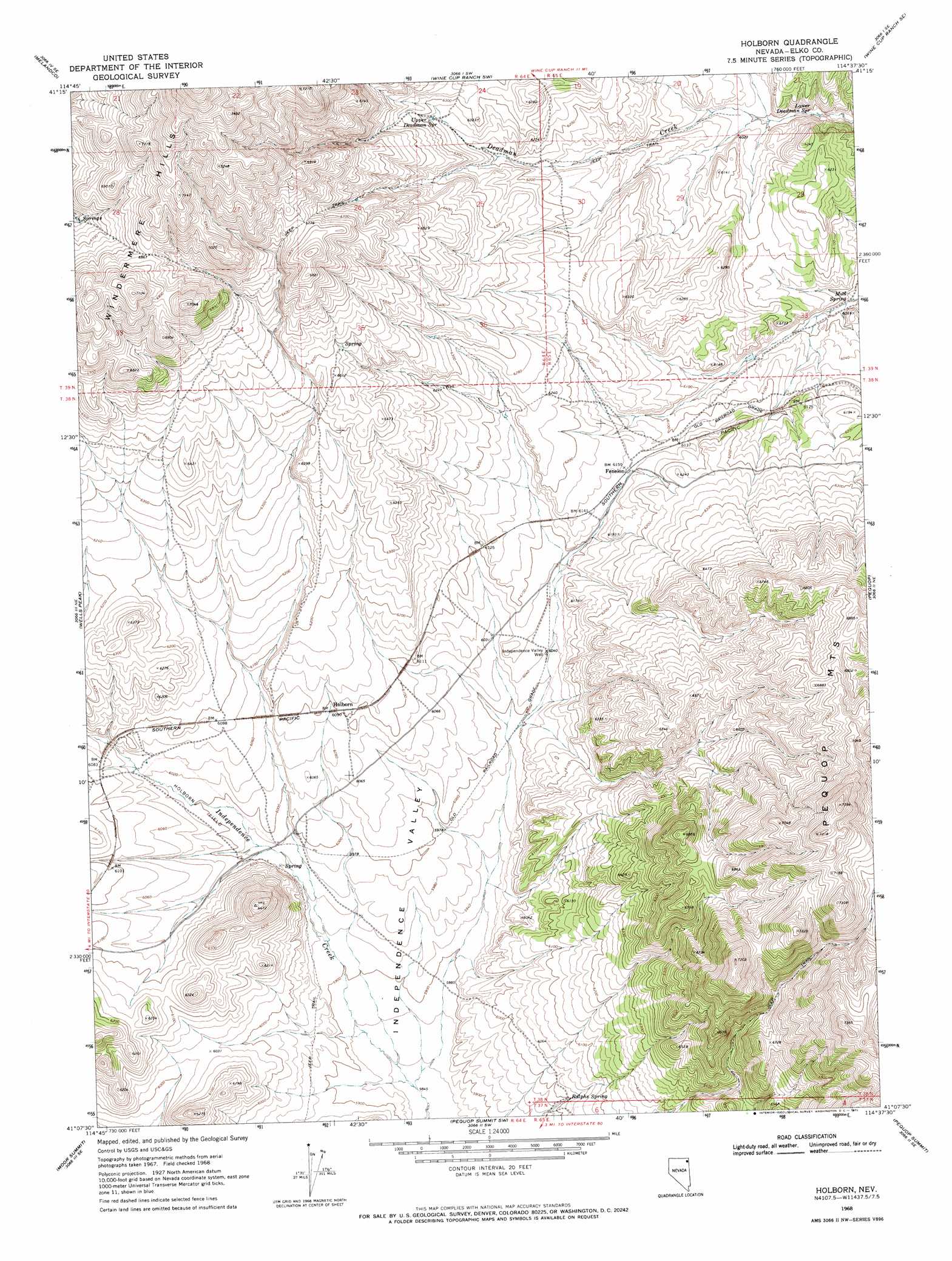
USGS Topo Quad 41114b6 - 1:24,000 scale
| Topo Map Name: | Holborn |
| USGS Topo Quad ID: | 41114b6 |
| Print Size: | ca. 21 1/4" wide x 27" high |
| Southeast Coordinates: | 41.125° N latitude / 114.625° W longitude |
| Map Center Coordinates: | 41.1875° N latitude / 114.6875° W longitude |
| U.S. State: | NV |
| Filename: | o41114b6.jpg |
| Download Map JPG Image: | Holborn topo map 1:24,000 scale |
| Map Type: | Topographic |
| Topo Series: | 7.5´ |
| Map Scale: | 1:24,000 |
| Source of Map Images: | United States Geological Survey (USGS) |
| Alternate Map Versions: |
Holborn NV 1968, updated 1971 Download PDF Buy paper map Holborn NV 2012 Download PDF Buy paper map Holborn NV 2014 Download PDF Buy paper map |
1:24,000 Topo Quads surrounding Holborn
Loomis Mountain |
Wilkins |
Wine Cup Ranch |
Wine Cup Ranch Ne |
Ninemile Mountain |
Summer Camp |
Melandco |
Wine Cup Ranch Sw |
Wine Cup Ranch Se |
Ninemile Mountain Sw |
Oxley Peak |
Wells Peak |
Holborn |
Pequop |
Valley Pass |
Wells |
Moor Summit |
Pequop Summit Sw |
Pequop Summit |
Cobre |
Tobar |
Snow Water Lake Ne |
Independence Valley Nw |
Independence Valley Ne |
Hardy Creek |
> Back to 41114a1 at 1:100,000 scale
> Back to 41114a1 at 1:250,000 scale
> Back to U.S. Topo Maps home
Holborn topo map: Gazetteer
Holborn: Flats
Holborn Field elevation 1831m 6007′Holborn: Populated Places
Fenelon elevation 1878m 6161′Holborn elevation 1862m 6108′
Holborn: Springs
Lower Deadman Spring elevation 1823m 5980′Mud Spring elevation 1818m 5964′
Ralphs Spring elevation 1830m 6003′
Upper Deadman Spring elevation 1910m 6266′
Wollmon Spring elevation 1872m 6141′
Holborn: Summits
Windermere Hills elevation 2167m 7109′Holborn: Valleys
Sheep Draw elevation 1829m 6000′Holborn: Wells
Wine Cup Well elevation 1882m 6174′Holborn digital topo map on disk
Buy this Holborn topo map showing relief, roads, GPS coordinates and other geographical features, as a high-resolution digital map file on DVD: