Wells Peak Topo Map Nevada
To zoom in, hover over the map of Wells Peak
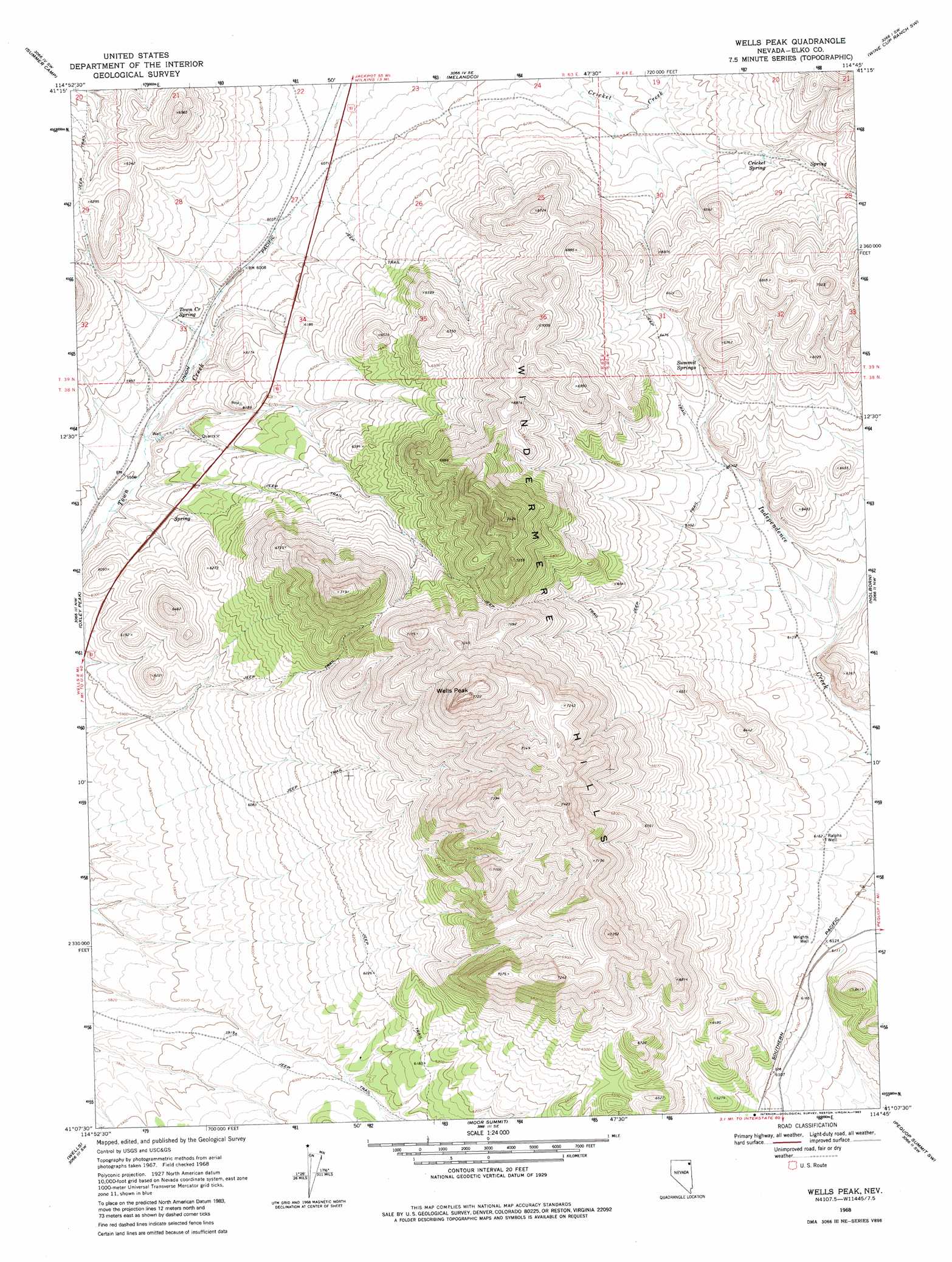
USGS Topo Quad 41114b7 - 1:24,000 scale
| Topo Map Name: | Wells Peak |
| USGS Topo Quad ID: | 41114b7 |
| Print Size: | ca. 21 1/4" wide x 27" high |
| Southeast Coordinates: | 41.125° N latitude / 114.75° W longitude |
| Map Center Coordinates: | 41.1875° N latitude / 114.8125° W longitude |
| U.S. State: | NV |
| Filename: | o41114b7.jpg |
| Download Map JPG Image: | Wells Peak topo map 1:24,000 scale |
| Map Type: | Topographic |
| Topo Series: | 7.5´ |
| Map Scale: | 1:24,000 |
| Source of Map Images: | United States Geological Survey (USGS) |
| Alternate Map Versions: |
Wells Peak NV 1968, updated 1971 Download PDF Buy paper map Wells Peak NV 1968, updated 1983 Download PDF Buy paper map Wells Peak NV 2012 Download PDF Buy paper map Wells Peak NV 2014 Download PDF Buy paper map |
1:24,000 Topo Quads surrounding Wells Peak
Black Butte Ne |
Loomis Mountain |
Wilkins |
Wine Cup Ranch |
Wine Cup Ranch Ne |
Black Butte |
Summer Camp |
Melandco |
Wine Cup Ranch Sw |
Wine Cup Ranch Se |
Metropolis |
Oxley Peak |
Wells Peak |
Holborn |
Pequop |
Welcome |
Wells |
Moor Summit |
Pequop Summit Sw |
Pequop Summit |
Humboldt Peak |
Tobar |
Snow Water Lake Ne |
Independence Valley Nw |
Independence Valley Ne |
> Back to 41114a1 at 1:100,000 scale
> Back to 41114a1 at 1:250,000 scale
> Back to U.S. Topo Maps home
Wells Peak topo map: Gazetteer
Wells Peak: Springs
Cricket Spring elevation 1935m 6348′Quilici Spring elevation 1964m 6443′
Summit Springs elevation 1980m 6496′
Town Creek Spring elevation 1836m 6023′
Wilson Spring elevation 1895m 6217′
Wells Peak: Summits
Wells Peak elevation 2337m 7667′Wells Peak: Wells
Ralphs Well elevation 1879m 6164′Wrights Well elevation 1871m 6138′
Wells Peak digital topo map on disk
Buy this Wells Peak topo map showing relief, roads, GPS coordinates and other geographical features, as a high-resolution digital map file on DVD: