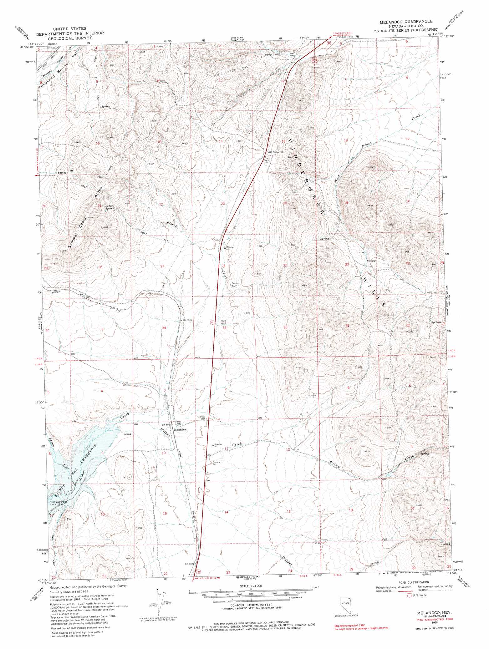
Melandco Topo Map Nevada
To zoom in, hover over the map of Melandco
USGS Topo Quad 41114c7 - 1:24,000 scale
| Topo Map Name: | Melandco |
| USGS Topo Quad ID: | 41114c7 |
| Print Size: | ca. 21 1/4" wide x 27" high |
| Southeast Coordinates: | 41.25° N latitude / 114.75° W longitude |
| Map Center Coordinates: | 41.3125° N latitude / 114.8125° W longitude |
| U.S. State: | NV |
| Filename: | o41114c7.jpg |
| Download Map JPG Image: | Melandco topo map 1:24,000 scale |
| Map Type: | Topographic |
| Topo Series: | 7.5´ |
| Map Scale: | 1:24,000 |
| Source of Map Images: | United States Geological Survey (USGS) |
| Alternate Map Versions: |
Melandco NV 1968, updated 1971 Download PDF Buy paper map Melandco NV 1968, updated 1985 Download PDF Buy paper map Melandco NV 2012 Download PDF Buy paper map Melandco NV 2014 Download PDF Buy paper map |
1:24,000 Topo Quads surrounding Melandco
Stormy Peak |
Boies Reservoir |
Harris Canyon |
Knoll Mountain |
Knoll Mountain Se |
Black Butte Ne |
Loomis Mountain |
Wilkins |
Wine Cup Ranch |
Wine Cup Ranch Ne |
Black Butte |
Summer Camp |
Melandco |
Wine Cup Ranch Sw |
Wine Cup Ranch Se |
Metropolis |
Oxley Peak |
Wells Peak |
Holborn |
Pequop |
Welcome |
Wells |
Moor Summit |
Pequop Summit Sw |
Pequop Summit |
> Back to 41114a1 at 1:100,000 scale
> Back to 41114a1 at 1:250,000 scale
> Back to U.S. Topo Maps home
Melandco topo map: Gazetteer
Melandco: Dams
Barren Dam elevation 1831m 6007′Melandco: Gaps
H D Summit elevation 1918m 6292′Melandco: Populated Places
Melandco elevation 1820m 5971′Melandco: Ridges
Summer Camp Ridge elevation 2105m 6906′Melandco: Springs
Bishop Spring elevation 1851m 6072′Ledge Spring elevation 2030m 6660′
Melandco: Streams
Cricket Creek elevation 1823m 5980′Johnson Creek elevation 1799m 5902′
Willow Creek elevation 1810m 5938′
Melandco: Wells
Bishop Flat Well elevation 1867m 6125′Melandco digital topo map on disk
Buy this Melandco topo map showing relief, roads, GPS coordinates and other geographical features, as a high-resolution digital map file on DVD: