Twelvemile Ranch Topo Map Nevada
To zoom in, hover over the map of Twelvemile Ranch
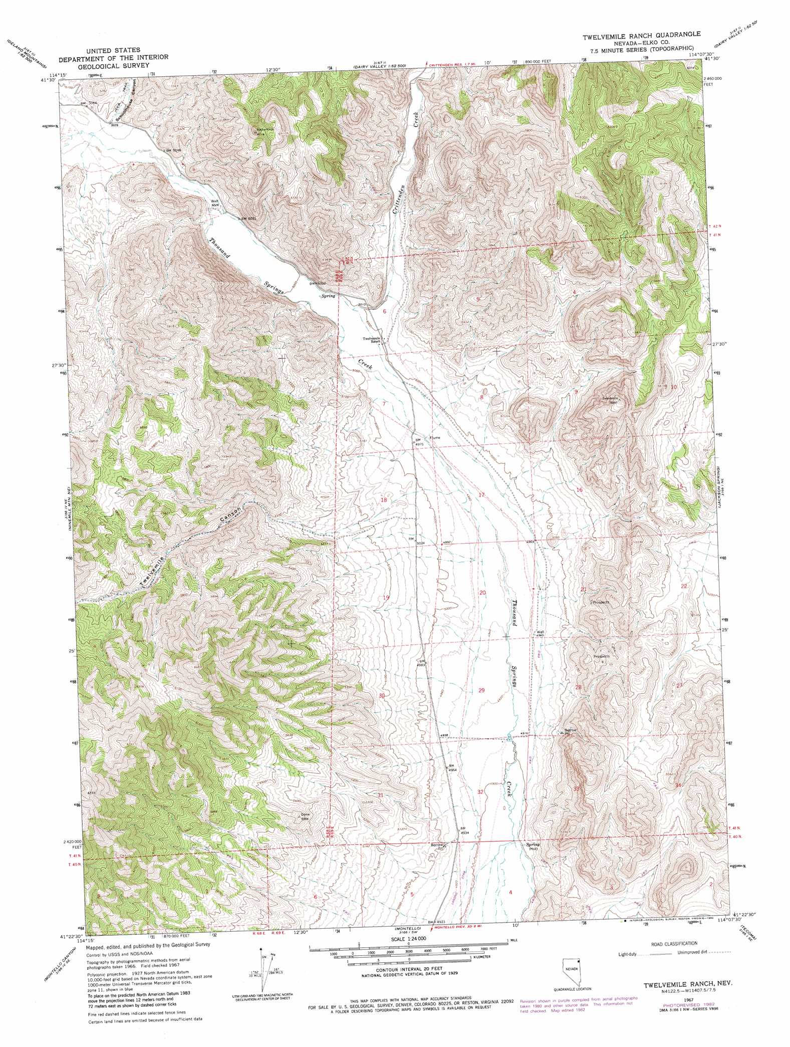
USGS Topo Quad 41114d2 - 1:24,000 scale
| Topo Map Name: | Twelvemile Ranch |
| USGS Topo Quad ID: | 41114d2 |
| Print Size: | ca. 21 1/4" wide x 27" high |
| Southeast Coordinates: | 41.375° N latitude / 114.125° W longitude |
| Map Center Coordinates: | 41.4375° N latitude / 114.1875° W longitude |
| U.S. State: | NV |
| Filename: | o41114d2.jpg |
| Download Map JPG Image: | Twelvemile Ranch topo map 1:24,000 scale |
| Map Type: | Topographic |
| Topo Series: | 7.5´ |
| Map Scale: | 1:24,000 |
| Source of Map Images: | United States Geological Survey (USGS) |
| Alternate Map Versions: |
Twelvemile Ranch NV 1967, updated 1971 Download PDF Buy paper map Twelvemile Ranch NV 1967, updated 1982 Download PDF Buy paper map Twelvemile Ranch NV 2012 Download PDF Buy paper map Twelvemile Ranch NV 2015 Download PDF Buy paper map |
1:24,000 Topo Quads surrounding Twelvemile Ranch
Emigrant Springs |
Dry Canyon |
The Baldies |
Death Creek Reservoir |
Grouse Creek |
Chicken Springs |
Delano Peak |
Crittenden Springs |
Dairy Valley |
Toms Cabin Spring |
Ninemile Mountain |
Ninemile Mountain Ne |
Twelvemile Ranch |
Jackson Spring |
Lucin Nw |
Ninemile Mountain Sw |
Montello Canyon |
Montello |
Tecoma |
Lucin |
Valley Pass |
Loray |
Pilot Peak Nw |
Patterson Pass |
Crater Island Nw |
> Back to 41114a1 at 1:100,000 scale
> Back to 41114a1 at 1:250,000 scale
> Back to U.S. Topo Maps home
Twelvemile Ranch topo map: Gazetteer
Twelvemile Ranch: Airports
Juniper Landing Strip elevation 1498m 4914′Twelvemile Ranch: Springs
Red Hot Spring elevation 1497m 4911′Twelvemile Ranch: Streams
Crittenden Creek elevation 1522m 4993′Twelvemile Ranch: Valleys
Schoolhouse Canyon elevation 1547m 5075′Twelvemile Canyon elevation 1520m 4986′
Twelvemile Ranch digital topo map on disk
Buy this Twelvemile Ranch topo map showing relief, roads, GPS coordinates and other geographical features, as a high-resolution digital map file on DVD: