Henry Topo Map Nevada
To zoom in, hover over the map of Henry
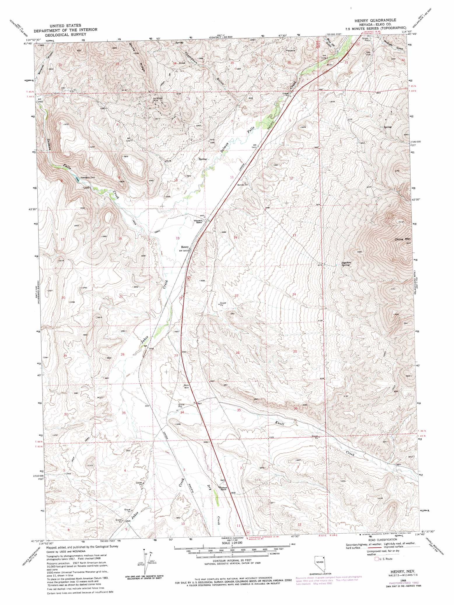
USGS Topo Quad 41114f7 - 1:24,000 scale
| Topo Map Name: | Henry |
| USGS Topo Quad ID: | 41114f7 |
| Print Size: | ca. 21 1/4" wide x 27" high |
| Southeast Coordinates: | 41.625° N latitude / 114.75° W longitude |
| Map Center Coordinates: | 41.6875° N latitude / 114.8125° W longitude |
| U.S. State: | NV |
| Filename: | o41114f7.jpg |
| Download Map JPG Image: | Henry topo map 1:24,000 scale |
| Map Type: | Topographic |
| Topo Series: | 7.5´ |
| Map Scale: | 1:24,000 |
| Source of Map Images: | United States Geological Survey (USGS) |
| Alternate Map Versions: |
Henry NV 1968, updated 1972 Download PDF Buy paper map Henry NV 1968, updated 1983 Download PDF Buy paper map Henry NV 2012 Download PDF Buy paper map Henry NV 2014 Download PDF Buy paper map |
1:24,000 Topo Quads surrounding Henry
Elk Mountain |
Bear Mountain |
Browns Bench Ranch |
Jackpot |
East Of Jackpot |
Buckhorn Ridge |
Twin Meadows Ranch |
Contact |
Middle Stack Mountain |
Tijuana John Peak |
Gilmer Ranch |
Hubbard Basin |
Henry |
Blanchard Mountain |
Texas Spring |
Stormy Peak |
Boies Reservoir |
Harris Canyon |
Knoll Mountain |
Knoll Mountain Se |
Black Butte Ne |
Loomis Mountain |
Wilkins |
Wine Cup Ranch |
Wine Cup Ranch Ne |
> Back to 41114e1 at 1:100,000 scale
> Back to 41114a1 at 1:250,000 scale
> Back to U.S. Topo Maps home
Henry topo map: Gazetteer
Henry: Dams
Headgate Dam elevation 1670m 5479′Henry: Mines
Ivy Wilson Mine elevation 1932m 6338′Henry: Populated Places
Henry elevation 1664m 5459′Riverside (historical) elevation 1654m 5426′
Henry: Ridges
White Ridge elevation 2048m 6719′Henry: Springs
Sagehen Spring elevation 1903m 6243′Henry: Streams
Blue Jay Creek elevation 1635m 5364′Dry Creek elevation 1697m 5567′
Jakes Creek elevation 1655m 5429′
Knoll Creek elevation 1684m 5524′
Townsend Creek elevation 1672m 5485′
Henry: Summits
China Mountain elevation 2541m 8336′Henry: Valleys
Blue Jay Gulch elevation 1638m 5374′Cottonwood Canon elevation 1822m 5977′
McDuffy Gulch elevation 1654m 5426′
Thompson Gulch elevation 1665m 5462′
Henry digital topo map on disk
Buy this Henry topo map showing relief, roads, GPS coordinates and other geographical features, as a high-resolution digital map file on DVD: