Judd Mountain Topo Map Nevada
To zoom in, hover over the map of Judd Mountain
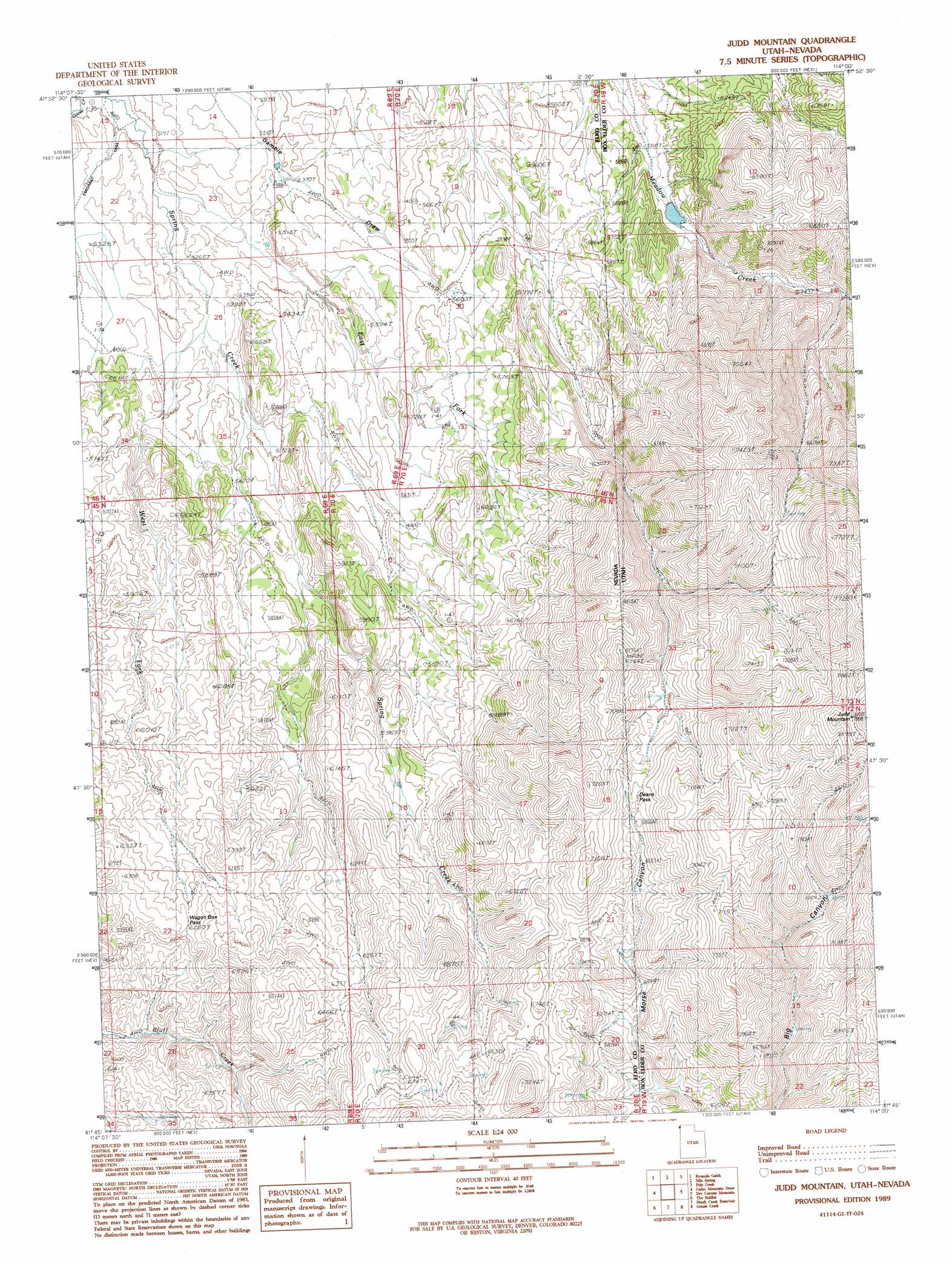
USGS Topo Quad 41114g1 - 1:24,000 scale
| Topo Map Name: | Judd Mountain |
| USGS Topo Quad ID: | 41114g1 |
| Print Size: | ca. 21 1/4" wide x 27" high |
| Southeast Coordinates: | 41.75° N latitude / 114° W longitude |
| Map Center Coordinates: | 41.8125° N latitude / 114.0625° W longitude |
| U.S. States: | NV, UT |
| Filename: | o41114g1.jpg |
| Download Map JPG Image: | Judd Mountain topo map 1:24,000 scale |
| Map Type: | Topographic |
| Topo Series: | 7.5´ |
| Map Scale: | 1:24,000 |
| Source of Map Images: | United States Geological Survey (USGS) |
| Alternate Map Versions: |
Judd Mountain UT 1989, updated 1989 Download PDF Buy paper map Judd Mountain UT 2011 Download PDF Buy paper map Judd Mountain UT 2014 Download PDF Buy paper map Judd Mountain UT 2017 Download PDF Buy paper map |
1:24,000 Topo Quads surrounding Judd Mountain
Timber Butte |
Mahogany Butte |
Ibex Peak |
Blue Hill |
Lyman Pass |
Stratton Spring |
Fivemile Gulch |
Nile Spring |
Pole Creek |
Cotton Thomas Basin |
Mustang Draw |
Cedar Mountain Draw |
Judd Mountain |
Dry Canyon Mountain |
Kimbell Creek |
Dry Canyon |
The Baldies |
Death Creek Reservoir |
Grouse Creek |
Ingham Canyon |
Delano Peak |
Crittenden Springs |
Dairy Valley |
Toms Cabin Spring |
Rocky Pass Peak |
> Back to 41114e1 at 1:100,000 scale
> Back to 41114a1 at 1:250,000 scale
> Back to U.S. Topo Maps home
Judd Mountain topo map: Gazetteer
Judd Mountain: Gaps
Deans Pass elevation 2062m 6765′Wagon Box Pass elevation 1913m 6276′
Judd Mountain: Post Offices
Annaville Post Office (historical) elevation 1687m 5534′Judd Mountain: Reservoirs
Burnt Reservoir elevation 1719m 5639′Deans Pass Reservoir elevation 1690m 5544′
South Fork Reservoir elevation 1705m 5593′
Judd Mountain: Springs
Cold Spring elevation 1949m 6394′Rock Spring elevation 1951m 6400′
Triple Group Springs elevation 2081m 6827′
Judd Mountain: Streams
East Fork Spring Creek elevation 1593m 5226′West Fork Spring Creek elevation 1623m 5324′
Judd Mountain: Summits
Judd Mountain elevation 2394m 7854′Judd Mountain: Valleys
Gamble Draw elevation 1584m 5196′Judd Mountain digital topo map on disk
Buy this Judd Mountain topo map showing relief, roads, GPS coordinates and other geographical features, as a high-resolution digital map file on DVD: