Mustang Draw Topo Map Nevada
To zoom in, hover over the map of Mustang Draw
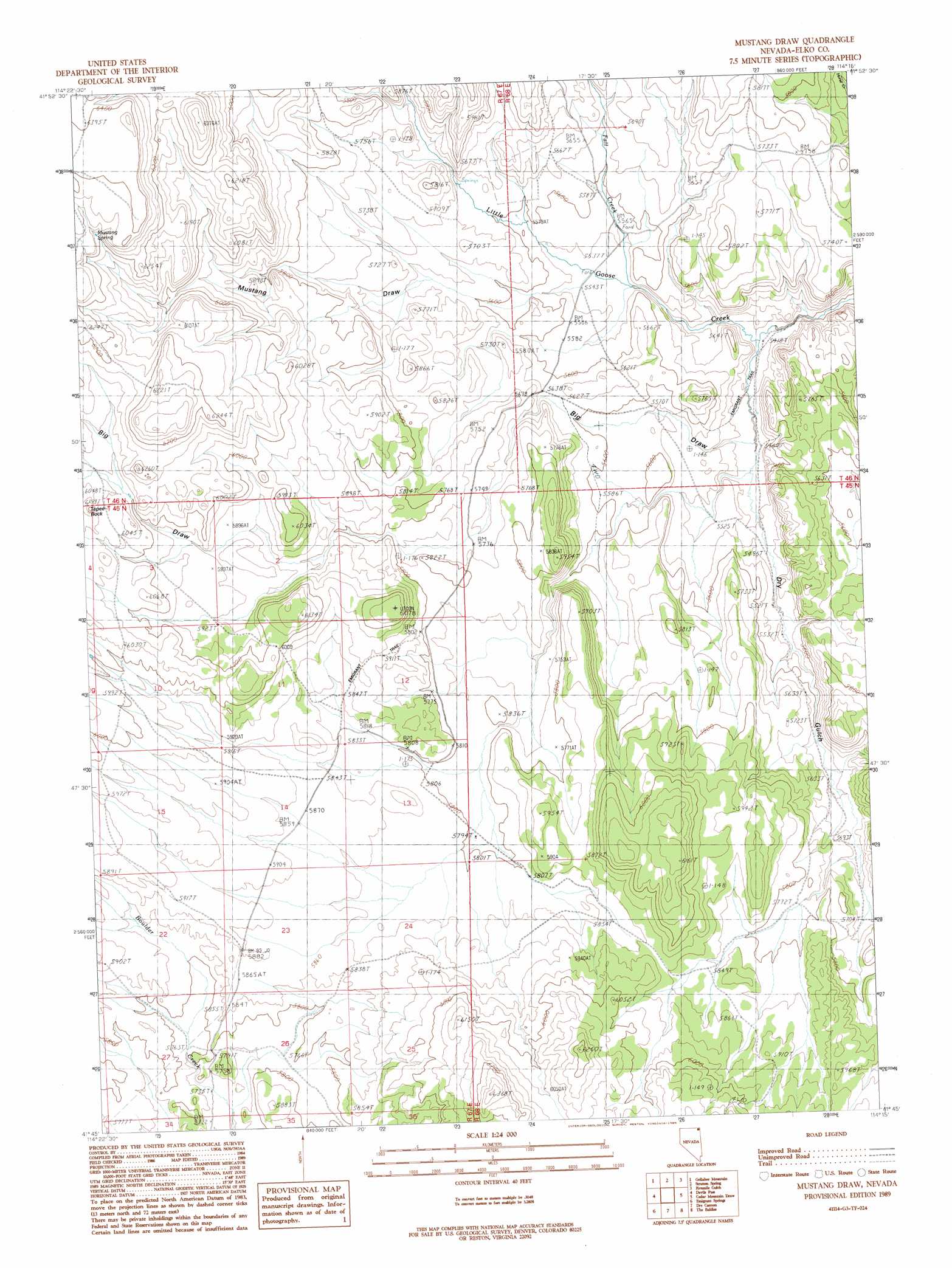
USGS Topo Quad 41114g3 - 1:24,000 scale
| Topo Map Name: | Mustang Draw |
| USGS Topo Quad ID: | 41114g3 |
| Print Size: | ca. 21 1/4" wide x 27" high |
| Southeast Coordinates: | 41.75° N latitude / 114.25° W longitude |
| Map Center Coordinates: | 41.8125° N latitude / 114.3125° W longitude |
| U.S. State: | NV |
| Filename: | o41114g3.jpg |
| Download Map JPG Image: | Mustang Draw topo map 1:24,000 scale |
| Map Type: | Topographic |
| Topo Series: | 7.5´ |
| Map Scale: | 1:24,000 |
| Source of Map Images: | United States Geological Survey (USGS) |
| Alternate Map Versions: |
Mustang Draw NV 1989, updated 1989 Download PDF Buy paper map Mustang Draw NV 2012 Download PDF Buy paper map Mustang Draw NV 2014 Download PDF Buy paper map |
1:24,000 Topo Quads surrounding Mustang Draw
Magic Hot Springs |
Big Creek Ranch |
Timber Butte |
Mahogany Butte |
Ibex Peak |
East Of Jackpot |
Gollaher Mountain |
Stratton Spring |
Fivemile Gulch |
Nile Spring |
Tijuana John Peak |
Devils Pass |
Mustang Draw |
Cedar Mountain Draw |
Judd Mountain |
Texas Spring |
Emigrant Springs |
Dry Canyon |
The Baldies |
Death Creek Reservoir |
Knoll Mountain Se |
Chicken Springs |
Delano Peak |
Crittenden Springs |
Dairy Valley |
> Back to 41114e1 at 1:100,000 scale
> Back to 41114a1 at 1:250,000 scale
> Back to U.S. Topo Maps home
Mustang Draw topo map: Gazetteer
Mustang Draw: Springs
Mustang Spring elevation 1918m 6292′Mustang Draw: Streams
Fall Creek elevation 1683m 5521′Mustang Draw: Summits
Tepee Rock elevation 1729m 5672′Mustang Draw: Valleys
Big Draw elevation 1660m 5446′Dry Gulch elevation 1651m 5416′
Mustang Draw elevation 1692m 5551′
Mustang Draw: Wells
Bedke Well elevation 1781m 5843′Mustang Draw digital topo map on disk
Buy this Mustang Draw topo map showing relief, roads, GPS coordinates and other geographical features, as a high-resolution digital map file on DVD: