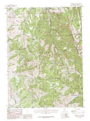
Jarbidge South Topo Map Nevada
To zoom in, hover over the map of Jarbidge South
USGS Topo Quad 41115g4 - 1:24,000 scale
| Topo Map Name: | Jarbidge South |
| USGS Topo Quad ID: | 41115g4 |
| Print Size: | ca. 21 1/4" wide x 27" high |
| Southeast Coordinates: | 41.75° N latitude / 115.375° W longitude |
| Map Center Coordinates: | 41.8125° N latitude / 115.4375° W longitude |
| U.S. State: | NV |
| Filename: | o41115g4.jpg |
| Download Map JPG Image: | Jarbidge South topo map 1:24,000 scale |
| Map Type: | Topographic |
| Topo Series: | 7.5´ |
| Map Scale: | 1:24,000 |
| Source of Map Images: | United States Geological Survey (USGS) |
| Alternate Map Versions: |
Jarbidge South NV 1986, updated 1987 Download PDF Buy paper map Jarbidge South NV 1986, updated 1987 Download PDF Buy paper map Jarbidge South NV 2012 Download PDF Buy paper map Jarbidge South NV 2015 Download PDF Buy paper map |
| FStopo: | US Forest Service topo Jarbidge South is available: Download FStopo PDF Download FStopo TIF |
1:24,000 Topo Quads surrounding Jarbidge South
> Back to 41115e1 at 1:100,000 scale
> Back to 41114a1 at 1:250,000 scale
> Back to U.S. Topo Maps home
Jarbidge South topo map: Gazetteer
Jarbidge South: Basins
Copper Basin elevation 2258m 7408′Jarbidge South: Cliffs
Danger Point elevation 2578m 8458′Jarbidge South: Craters
Jack Creek Crater elevation 2876m 9435′Little Jack Creek Crater elevation 2971m 9747′
Jarbidge South: Flats
Bear Creek Meadows elevation 2605m 8546′Jarbidge South: Gaps
Coon Creek Summit elevation 2577m 8454′Jarbidge South: Lakes
Cora Lake elevation 2936m 9632′Jarbidge South: Mines
Alpha Mine elevation 1931m 6335′Altitude Mine elevation 2995m 9826′
Arizona Mine elevation 2134m 7001′
Arkansas Mine elevation 2994m 9822′
Batholith Mines elevation 2442m 8011′
Ben Hur Mine elevation 2911m 9550′
Black Cat Mine elevation 2072m 6797′
Bluster Mine elevation 2435m 7988′
Bourne Discovery Mine elevation 2171m 7122′
Buster Mine elevation 2101m 6893′
Coon Creek Mine elevation 2407m 7896′
Elcora Mine elevation 1918m 6292′
Flaxie Mine elevation 2427m 7962′
Gold Spring Mine elevation 2260m 7414′
Golden Stairs Number Two Mine elevation 3086m 10124′
Good Luck Mine elevation 2101m 6893′
Heckla Mine elevation 2108m 6916′
Jarbidge Mine elevation 2411m 7910′
Jarbidge Wonders Mine elevation 2206m 7237′
Josephine Mine elevation 2402m 7880′
Labelle Mine elevation 2475m 8120′
Legitimate Mine elevation 2420m 7939′
Long Hike Mine elevation 2253m 7391′
Mission Cross Mine elevation 2429m 7969′
Myrtle Mine elevation 2241m 7352′
North Star Mine elevation 1979m 6492′
O K Mine elevation 2283m 7490′
Pavlok Mine elevation 1972m 6469′
Pick and Shovel Mine elevation 2553m 8375′
Puritan Mine elevation 2910m 9547′
Quartzite Mine elevation 2094m 6870′
Rabbit Foot Mine elevation 2964m 9724′
Rainbow American Mines elevation 1929m 6328′
Redbird Mine elevation 2086m 6843′
Reliance Number One Mine elevation 2214m 7263′
Rex Mine elevation 2397m 7864′
Rose Bud Mine elevation 3029m 9937′
Saint Joe Mine elevation 2102m 6896′
Starlight Mine elevation 2417m 7929′
Stray Dog Mine elevation 2372m 7782′
Success Mine elevation 2415m 7923′
Sugar Mine elevation 2999m 9839′
Sugar Number One Mine elevation 3014m 9888′
Taft Mine elevation 2145m 7037′
Third Peak Number One Mine elevation 2960m 9711′
Third Peak Number Two Mine elevation 3031m 9944′
Victorias Mine elevation 2865m 9399′
White Rock Mine elevation 3193m 10475′
Windy Mine elevation 3007m 9865′
Jarbidge South: Populated Places
Jarbidge elevation 1932m 6338′Pavlak (historical) elevation 1966m 6450′
Jarbidge South: Post Offices
Jarbidge Post Office elevation 1932m 6338′Pavlak Post Office (historical) elevation 1966m 6450′
Jarbidge South: Ranges
Jarbidge Mountains elevation 2825m 9268′Jarbidge South: Streams
Bear Creek elevation 1938m 6358′Bonanza Creek elevation 1968m 6456′
Dead Horse Creek elevation 2106m 6909′
Fox Creek elevation 2058m 6751′
Little Jack Creek elevation 2672m 8766′
Meadow Fork elevation 2123m 6965′
Sawmill Creek elevation 2293m 7522′
West Fork Pine Creek elevation 2013m 6604′
Jarbidge South: Summits
Bald Peak elevation 3208m 10524′Bear Creek Butte elevation 2736m 8976′
Bear Creek Summit elevation 2575m 8448′
Coon Creek Peak elevation 2884m 9461′
Deer Mountain elevation 2735m 8973′
Fox Creek Peak elevation 2908m 9540′
Jarbidge Peak elevation 3207m 10521′
Jumbo Peak elevation 3189m 10462′
Matterhorn elevation 3250m 10662′
North Hill elevation 2846m 9337′
Square Top elevation 3189m 10462′
Jarbidge South: Trails
Gold Creek Trail elevation 2341m 7680′Jarbidge South: Valleys
Bonanza Gulch elevation 1969m 6459′Bourne Gulch elevation 1903m 6243′
Dry Gulch elevation 2199m 7214′
Gorge Gulch elevation 2064m 6771′
Snowslide Gulch elevation 2119m 6952′
Jarbidge South digital topo map on disk
Buy this Jarbidge South topo map showing relief, roads, GPS coordinates and other geographical features, as a high-resolution digital map file on DVD:


