Blue Basin Topo Map Nevada
To zoom in, hover over the map of Blue Basin
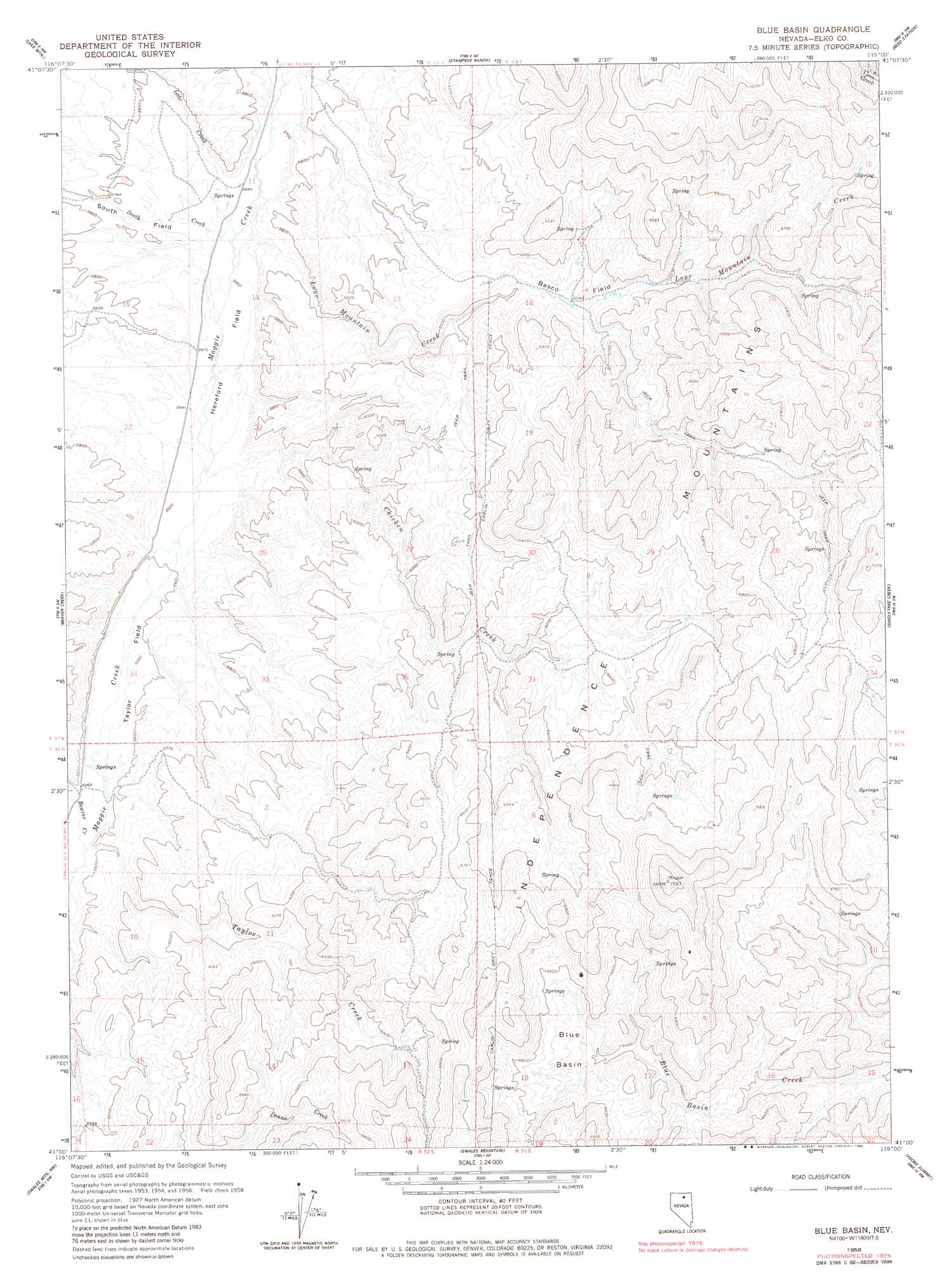
USGS Topo Quad 41116a1 - 1:24,000 scale
| Topo Map Name: | Blue Basin |
| USGS Topo Quad ID: | 41116a1 |
| Print Size: | ca. 21 1/4" wide x 27" high |
| Southeast Coordinates: | 41° N latitude / 116° W longitude |
| Map Center Coordinates: | 41.0625° N latitude / 116.0625° W longitude |
| U.S. State: | NV |
| Filename: | o41116a1.jpg |
| Download Map JPG Image: | Blue Basin topo map 1:24,000 scale |
| Map Type: | Topographic |
| Topo Series: | 7.5´ |
| Map Scale: | 1:24,000 |
| Source of Map Images: | United States Geological Survey (USGS) |
| Alternate Map Versions: |
Blue Basin NV 1958, updated 1960 Download PDF Buy paper map Blue Basin NV 1958, updated 1980 Download PDF Buy paper map Blue Basin NV 2012 Download PDF Buy paper map Blue Basin NV 2015 Download PDF Buy paper map |
1:24,000 Topo Quads surrounding Blue Basin
Mount Blitzen |
Tuscarora |
Water Pipe Canyon |
Mahala Creek West |
Mahala Creek East |
Sugarloaf Butte |
Lake Mountain |
Stampede Ranch |
Reed Station |
Wieland Flat |
Beaver Peak |
Beaver Creek |
Blue Basin |
Singletree Creek |
Dinner Station |
Rodeo Creek Ne |
Swales Mountain Nw |
Swales Mountain |
Adobe Summit |
Kittridge Springs |
Welches Canyon |
Schroeder Mountain |
Huntsman Ranch |
Hunter |
Elko West |
> Back to 41116a1 at 1:100,000 scale
> Back to 41116a1 at 1:250,000 scale
> Back to U.S. Topo Maps home
Blue Basin topo map: Gazetteer
Blue Basin: Basins
Blue Basin elevation 1977m 6486′Blue Basin: Flats
Basco Field elevation 1850m 6069′Hereford Field elevation 1722m 5649′
South Field elevation 1756m 5761′
Taylor Field elevation 1703m 5587′
Blue Basin: Mines
Rip Van Winkle Mine elevation 2154m 7066′Blue Basin: Streams
Beaver Creek elevation 1694m 5557′Chicken Creek elevation 1713m 5620′
Lake Creek elevation 1727m 5666′
Lone Mountain Creek elevation 1727m 5666′
South Creek elevation 1727m 5666′
Taylor Creek elevation 1695m 5561′
Blue Basin digital topo map on disk
Buy this Blue Basin topo map showing relief, roads, GPS coordinates and other geographical features, as a high-resolution digital map file on DVD: