Mount Blitzen Topo Map Nevada
To zoom in, hover over the map of Mount Blitzen
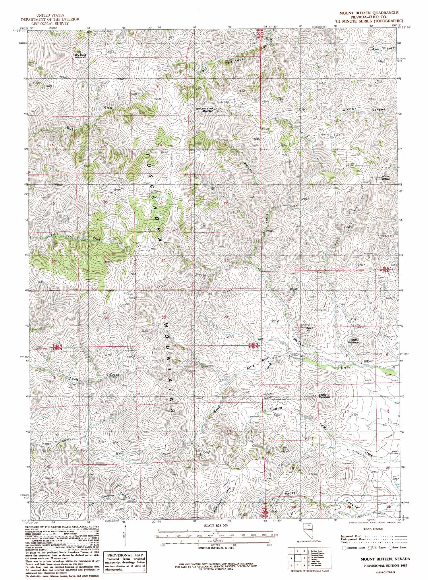
USGS Topo Quad 41116c3 - 1:24,000 scale
| Topo Map Name: | Mount Blitzen |
| USGS Topo Quad ID: | 41116c3 |
| Print Size: | ca. 21 1/4" wide x 27" high |
| Southeast Coordinates: | 41.25° N latitude / 116.25° W longitude |
| Map Center Coordinates: | 41.3125° N latitude / 116.3125° W longitude |
| U.S. State: | NV |
| Filename: | o41116c3.jpg |
| Download Map JPG Image: | Mount Blitzen topo map 1:24,000 scale |
| Map Type: | Topographic |
| Topo Series: | 7.5´ |
| Map Scale: | 1:24,000 |
| Source of Map Images: | United States Geological Survey (USGS) |
| Alternate Map Versions: |
Mount Blitzen NV 1987, updated 1987 Download PDF Buy paper map Mount Blitzen NV 2012 Download PDF Buy paper map Mount Blitzen NV 2014 Download PDF Buy paper map |
1:24,000 Topo Quads surrounding Mount Blitzen
Middle Draw Reservoir |
I-L Ranch |
Cornucopia Ridge |
Deep Creek |
Chicken Creek Summit |
Soldier Cap |
Red Cow Creek |
Big Cottonwood Canyon |
Cottonwood Peak |
Jacks Peak |
Little Rock Creek |
Toe Jam Mountain |
Mount Blitzen |
Tuscarora |
Water Pipe Canyon |
Willow Creek Reservoir |
China Camp |
Sugarloaf Butte |
Lake Mountain |
Stampede Ranch |
Willow Cr Reservoir Se |
Santa Renia Fields |
Beaver Peak |
Beaver Creek |
Blue Basin |
> Back to 41116a1 at 1:100,000 scale
> Back to 41116a1 at 1:250,000 scale
> Back to U.S. Topo Maps home
Mount Blitzen topo map: Gazetteer
Mount Blitzen: Basins
Berry Basin elevation 1917m 6289′Mount Blitzen: Streams
Berry Creek elevation 1858m 6095′Mount Blitzen: Summits
Battle Mountain elevation 1984m 6509′Beard Hill elevation 2004m 6574′
Castile Mountain elevation 2072m 6797′
Dry Creek Mountain elevation 2543m 8343′
McCann Creek Mountain elevation 2614m 8576′
Mount Blitzen elevation 2468m 8097′
Mount Neva elevation 2612m 8569′
Mount Blitzen: Valleys
Packer Canyon elevation 1806m 5925′Mount Blitzen digital topo map on disk
Buy this Mount Blitzen topo map showing relief, roads, GPS coordinates and other geographical features, as a high-resolution digital map file on DVD: