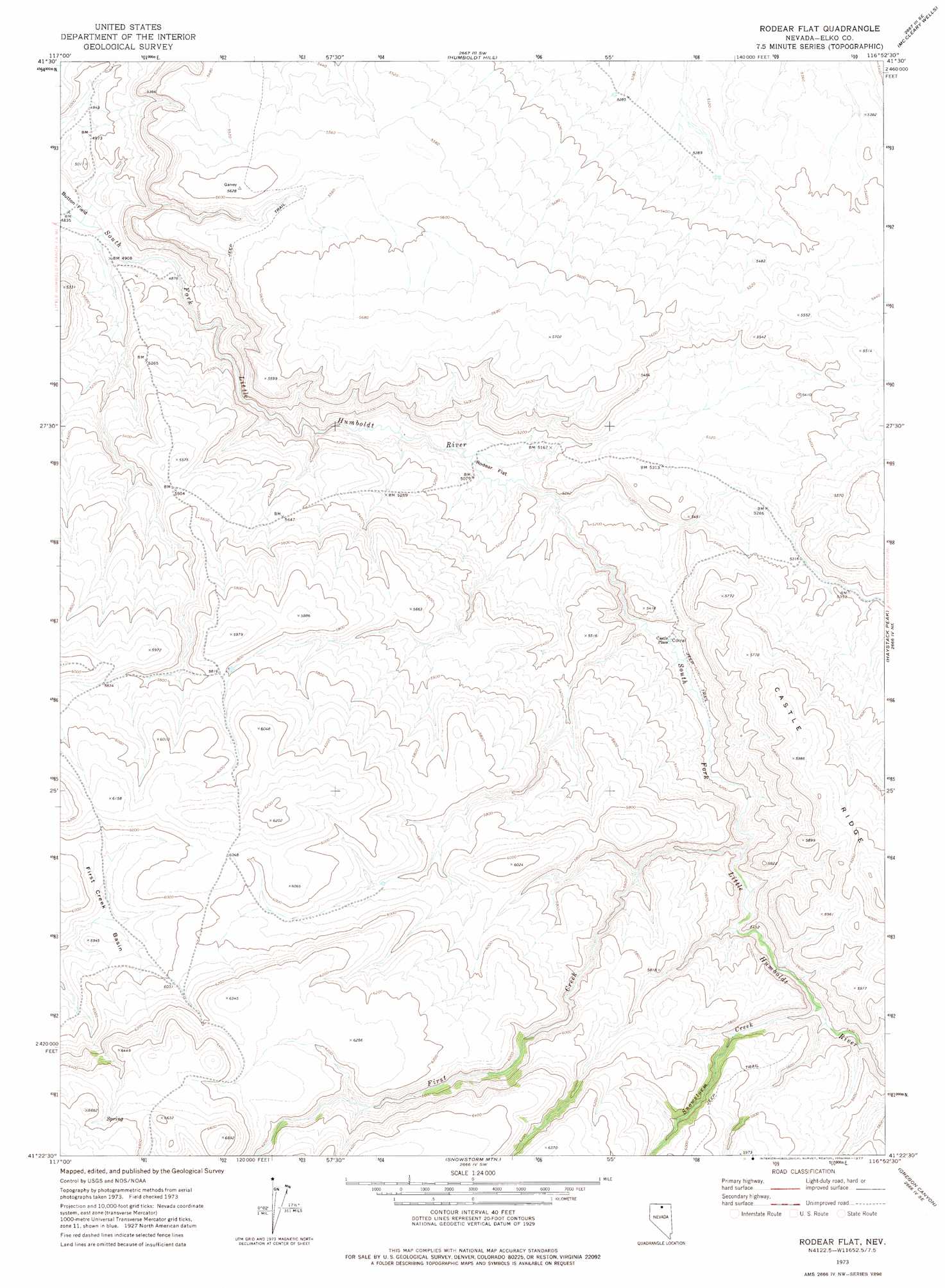
Rodear Flat Topo Map Nevada
To zoom in, hover over the map of Rodear Flat
USGS Topo Quad 41116d8 - 1:24,000 scale
| Topo Map Name: | Rodear Flat |
| USGS Topo Quad ID: | 41116d8 |
| Print Size: | ca. 21 1/4" wide x 27" high |
| Southeast Coordinates: | 41.375° N latitude / 116.875° W longitude |
| Map Center Coordinates: | 41.4375° N latitude / 116.9375° W longitude |
| U.S. State: | NV |
| Filename: | o41116d8.jpg |
| Download Map JPG Image: | Rodear Flat topo map 1:24,000 scale |
| Map Type: | Topographic |
| Topo Series: | 7.5´ |
| Map Scale: | 1:24,000 |
| Source of Map Images: | United States Geological Survey (USGS) |
| Alternate Map Versions: |
Rodear Flat NV 1973, updated 1977 Download PDF Buy paper map Rodear Flat NV 2012 Download PDF Buy paper map Rodear Flat NV 2015 Download PDF Buy paper map |
1:24,000 Topo Quads surrounding Rodear Flat
Greeley Flat |
Button Lake |
Button Lake Well |
Corral Lake |
Silver Lake |
Whiskey Springs |
Greeley Flat Se |
Humboldt Hill |
Mccleary Wells |
Winters Ranch Reservoir |
Chimney Reservoir |
Layton Spring |
Rodear Flat |
Haystack Peak |
Burner Hills |
Dry Hills North |
Kenny Creek |
Snowstorm Mountain |
Oregon Canyon |
Scraper Springs |
Dry Hills South |
The Knolls |
Jake Creek Mountain |
Midas |
Squaw Valley Ranch |
> Back to 41116a1 at 1:100,000 scale
> Back to 41116a1 at 1:250,000 scale
> Back to U.S. Topo Maps home
Rodear Flat topo map: Gazetteer
Rodear Flat: Basins
First Creek Basin elevation 1789m 5869′Rodear Flat: Flats
Rodear Flat elevation 1543m 5062′Rodear Flat: Streams
First Creek elevation 1610m 5282′Snowstorm Creek elevation 1632m 5354′
Rodear Flat digital topo map on disk
Buy this Rodear Flat topo map showing relief, roads, GPS coordinates and other geographical features, as a high-resolution digital map file on DVD: