Deep Creek Topo Map Nevada
To zoom in, hover over the map of Deep Creek
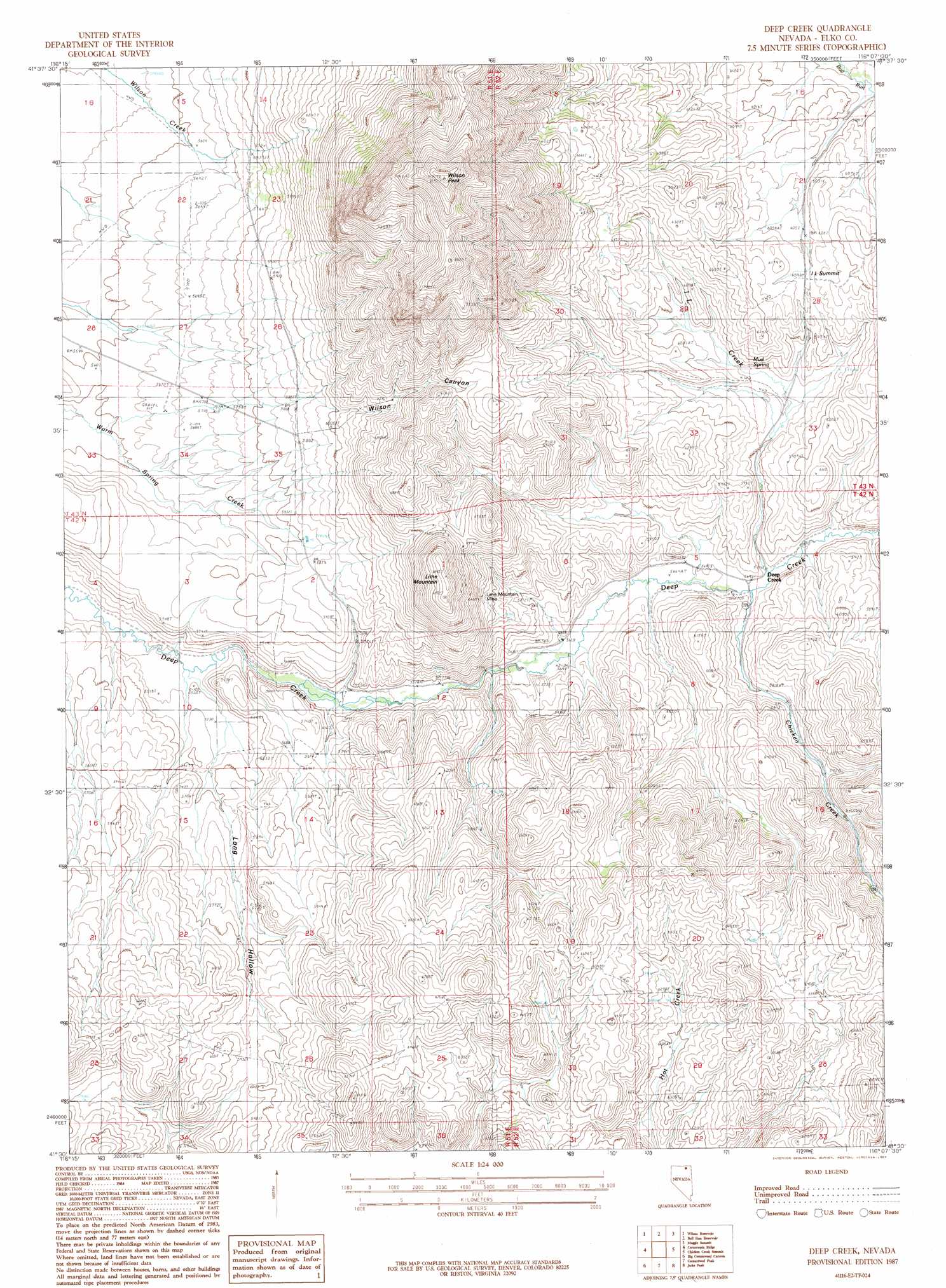
USGS Topo Quad 41116e2 - 1:24,000 scale
| Topo Map Name: | Deep Creek |
| USGS Topo Quad ID: | 41116e2 |
| Print Size: | ca. 21 1/4" wide x 27" high |
| Southeast Coordinates: | 41.5° N latitude / 116.125° W longitude |
| Map Center Coordinates: | 41.5625° N latitude / 116.1875° W longitude |
| U.S. State: | NV |
| Filename: | o41116e2.jpg |
| Download Map JPG Image: | Deep Creek topo map 1:24,000 scale |
| Map Type: | Topographic |
| Topo Series: | 7.5´ |
| Map Scale: | 1:24,000 |
| Source of Map Images: | United States Geological Survey (USGS) |
| Alternate Map Versions: |
Deep Creek NV 1987, updated 1987 Download PDF Buy paper map Deep Creek NV 2012 Download PDF Buy paper map Deep Creek NV 2014 Download PDF Buy paper map |
1:24,000 Topo Quads surrounding Deep Creek
Peterson Table East |
Sheep Creek Reservoir |
Dry Creek Reservoir |
Ungina Wongo |
Mountain City |
Fourmile Butte |
Wilson Reservoir |
Bull Run Reservoir |
Maggie Summit |
Badger Creek |
I-L Ranch |
Cornucopia Ridge |
Deep Creek |
Chicken Creek Summit |
Mcafee Peak |
Red Cow Creek |
Big Cottonwood Canyon |
Cottonwood Peak |
Jacks Peak |
California Mountain |
Toe Jam Mountain |
Mount Blitzen |
Tuscarora |
Water Pipe Canyon |
Mahala Creek West |
> Back to 41116e1 at 1:100,000 scale
> Back to 41116a1 at 1:250,000 scale
> Back to U.S. Topo Maps home
Deep Creek topo map: Gazetteer
Deep Creek: Mines
Lime Mountain Mine elevation 1954m 6410′Deep Creek: Populated Places
Deep Creek elevation 1749m 5738′Deep Creek: Springs
Mud Spring elevation 1818m 5964′Sage Spring elevation 1749m 5738′
Deep Creek: Streams
Chicken Creek elevation 1746m 5728′I L Creek elevation 1740m 5708′
Deep Creek: Summits
I L Summit elevation 1901m 6236′Lime Mountain elevation 2114m 6935′
Wilson Peak elevation 2565m 8415′
Deep Creek: Valleys
Long Hollow elevation 1675m 5495′Wilson Canyon elevation 1706m 5597′
Deep Creek digital topo map on disk
Buy this Deep Creek topo map showing relief, roads, GPS coordinates and other geographical features, as a high-resolution digital map file on DVD: