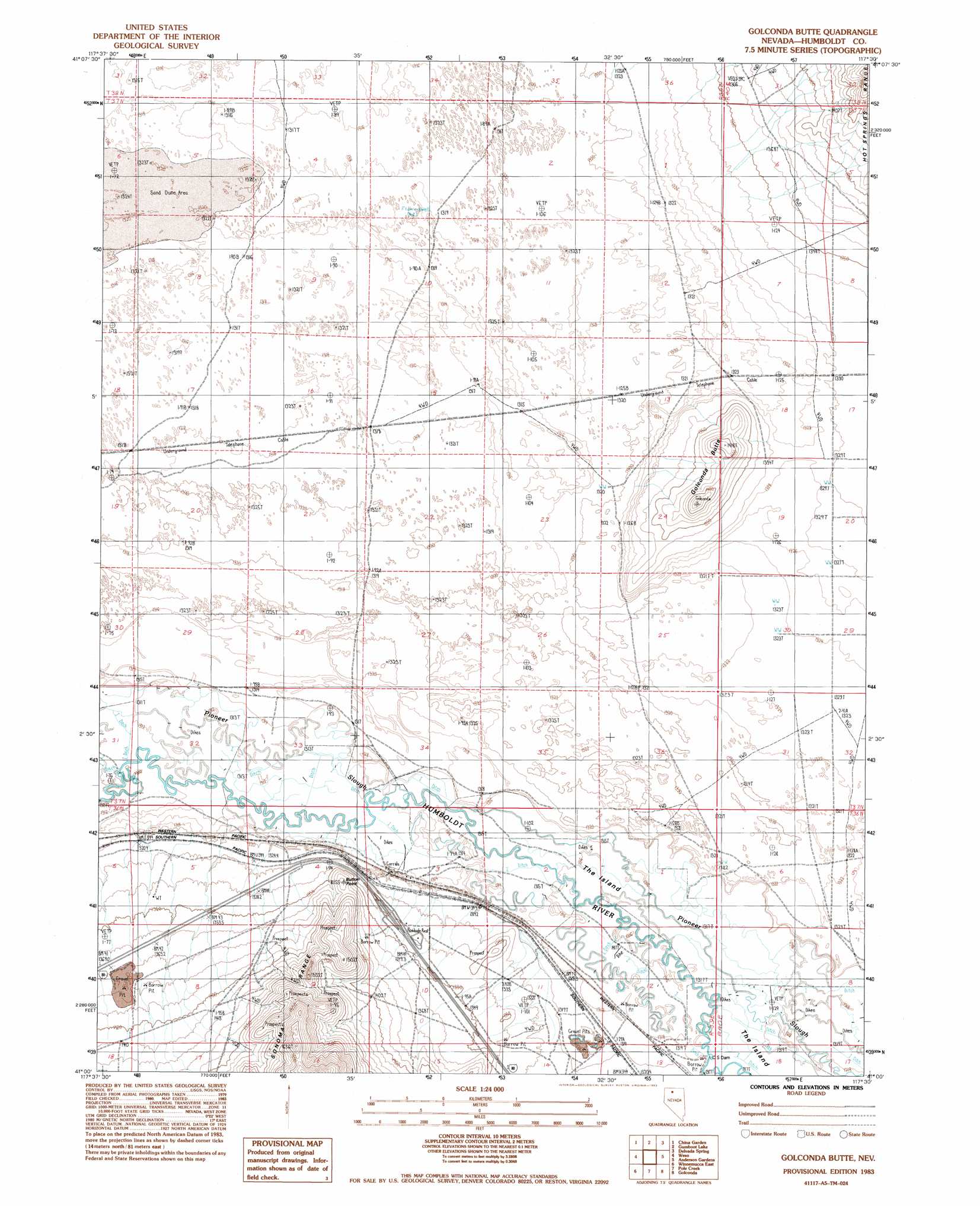
Golconda Butte Topo Map Nevada
To zoom in, hover over the map of Golconda Butte
USGS Topo Quad 41117a5 - 1:24,000 scale
| Topo Map Name: | Golconda Butte |
| USGS Topo Quad ID: | 41117a5 |
| Print Size: | ca. 21 1/4" wide x 27" high |
| Southeast Coordinates: | 41° N latitude / 117.5° W longitude |
| Map Center Coordinates: | 41.0625° N latitude / 117.5625° W longitude |
| U.S. State: | NV |
| Filename: | o41117a5.jpg |
| Download Map JPG Image: | Golconda Butte topo map 1:24,000 scale |
| Map Type: | Topographic |
| Topo Series: | 7.5´ |
| Map Scale: | 1:24,000 |
| Source of Map Images: | United States Geological Survey (USGS) |
| Alternate Map Versions: |
Golconda Butte NV 1983, updated 1983 Download PDF Buy paper map Golconda Butte NV 2011 Download PDF Buy paper map Golconda Butte NV 2015 Download PDF Buy paper map |
1:24,000 Topo Quads surrounding Golconda Butte
Mud Spring Canyon |
Paradise Well |
Willow Point |
Hot Springs Peak |
Eden Valley |
Bloody Run Peak |
China Garden |
Gumboot Lake |
Delvada Spring |
Adam Peak |
Winnemucca Mountain |
Weso |
Golconda Butte |
Anderson Gardens |
Red House Flat West |
Winnemucca West |
Winnemucca East |
Pole Creek |
Golconda |
Iron Point |
Rose Creek Mountain |
Sonoma Canyon |
Adelaide |
Goldrun Creek |
Brooks Spring |
> Back to 41117a1 at 1:100,000 scale
> Back to 41116a1 at 1:250,000 scale
> Back to U.S. Topo Maps home
Golconda Butte topo map: Gazetteer
Golconda Butte: Canals
Humboldt Canal elevation 1320m 4330′Golconda Butte: Cliffs
Button Point elevation 1375m 4511′Golconda Butte: Dams
C S Dam elevation 1319m 4327′Golconda Butte: Islands
The Island elevation 1319m 4327′Golconda Butte: Populated Places
Bliss elevation 1321m 4333′Golconda Butte: Summits
Golconda Butte elevation 1423m 4668′Golconda Butte digital topo map on disk
Buy this Golconda Butte topo map showing relief, roads, GPS coordinates and other geographical features, as a high-resolution digital map file on DVD: