Bloody Run Peak Topo Map Nevada
To zoom in, hover over the map of Bloody Run Peak
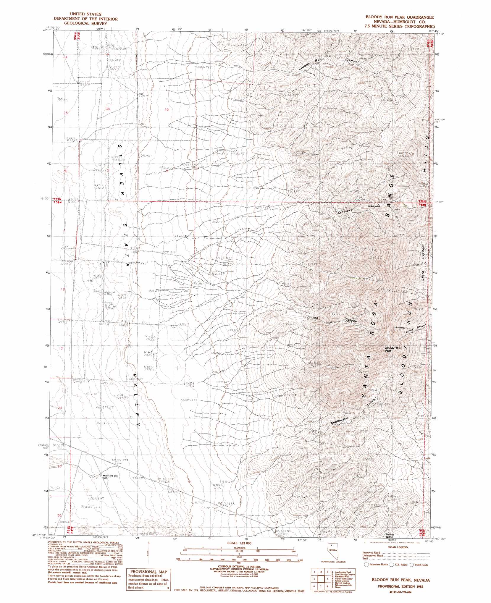
USGS Topo Quad 41117b7 - 1:24,000 scale
| Topo Map Name: | Bloody Run Peak |
| USGS Topo Quad ID: | 41117b7 |
| Print Size: | ca. 21 1/4" wide x 27" high |
| Southeast Coordinates: | 41.125° N latitude / 117.75° W longitude |
| Map Center Coordinates: | 41.1875° N latitude / 117.8125° W longitude |
| U.S. State: | NV |
| Filename: | o41117b7.jpg |
| Download Map JPG Image: | Bloody Run Peak topo map 1:24,000 scale |
| Map Type: | Topographic |
| Topo Series: | 7.5´ |
| Map Scale: | 1:24,000 |
| Source of Map Images: | United States Geological Survey (USGS) |
| Alternate Map Versions: |
Bloody Run Peak NV 1982 Download PDF Buy paper map Bloody Run Peak NV 2011 Download PDF Buy paper map Bloody Run Peak NV 2015 Download PDF Buy paper map |
1:24,000 Topo Quads surrounding Bloody Run Peak
Sod House |
Gallagher Flat |
Andorno Ranch |
Five Fingers |
Paradise Valley |
Jackson Well |
Awakening Peak |
Mud Spring Canyon |
Paradise Well |
Willow Point |
Sombrero Peak |
Silver State Draw |
Bloody Run Peak |
China Garden |
Gumboot Lake |
Mormon Dan Butte |
Barrett Springs |
Winnemucca Mountain |
Weso |
Golconda Butte |
Pronto |
Rose Creek |
Winnemucca West |
Winnemucca East |
Pole Creek |
> Back to 41117a1 at 1:100,000 scale
> Back to 41116a1 at 1:250,000 scale
> Back to U.S. Topo Maps home
Bloody Run Peak topo map: Gazetteer
Bloody Run Peak: Springs
Bathtub Spring elevation 1535m 5036′Bloody Run Peak: Streams
Bloody Run Creek elevation 1360m 4461′Bloody Run Peak: Summits
Bloody Run Peak elevation 2392m 7847′Granite Peak elevation 1905m 6250′
Bloody Run Peak: Valleys
Bloody Run Canyon elevation 1469m 4819′Crossover Canyon elevation 1538m 5045′
Pinson Canyon elevation 1490m 4888′
South Water Canyon elevation 1450m 4757′
Bloody Run Peak: Wells
Miller and Lux Well elevation 1274m 4179′Bloody Run Peak digital topo map on disk
Buy this Bloody Run Peak topo map showing relief, roads, GPS coordinates and other geographical features, as a high-resolution digital map file on DVD: