Willow Point Topo Map Nevada
To zoom in, hover over the map of Willow Point
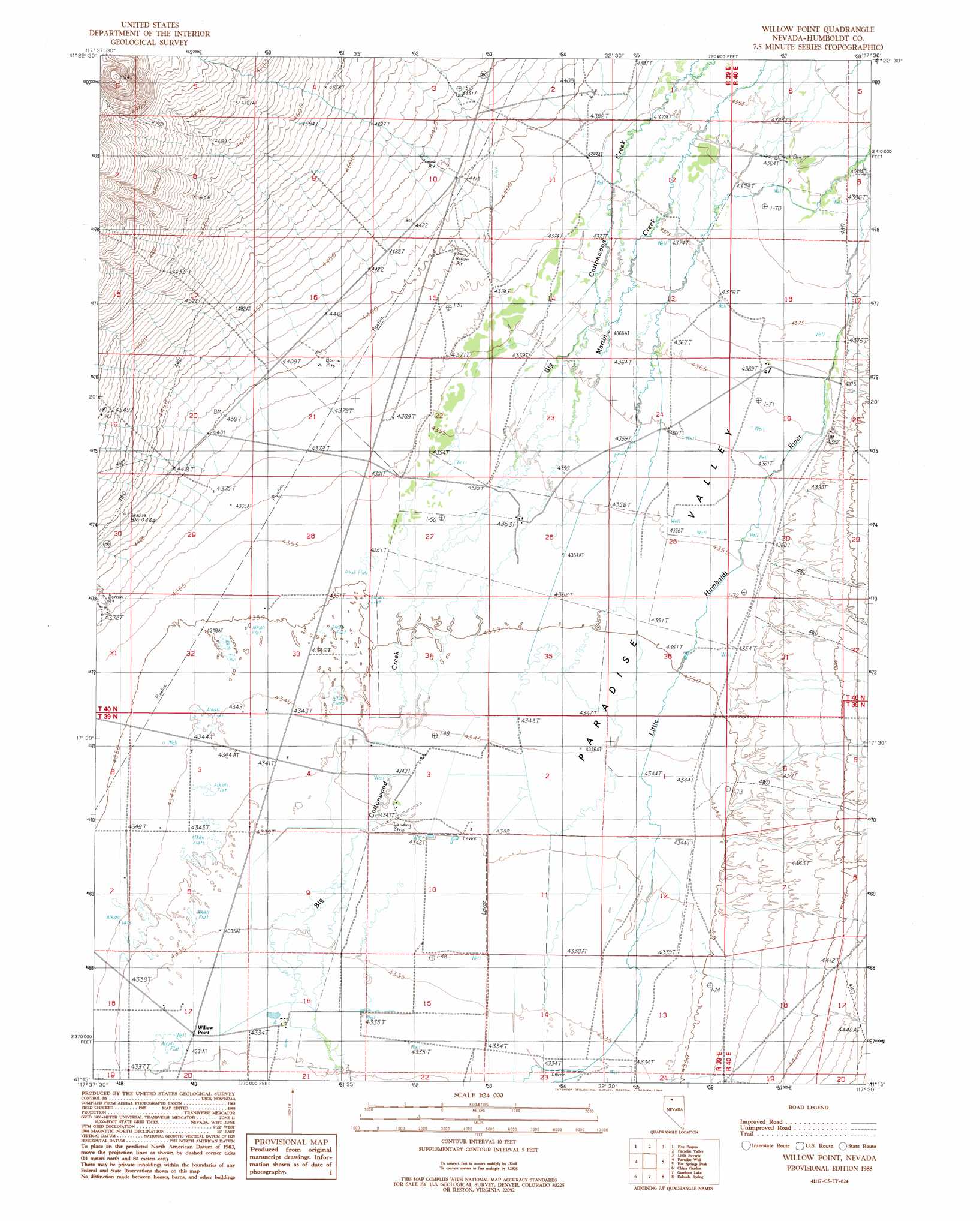
USGS Topo Quad 41117c5 - 1:24,000 scale
| Topo Map Name: | Willow Point |
| USGS Topo Quad ID: | 41117c5 |
| Print Size: | ca. 21 1/4" wide x 27" high |
| Southeast Coordinates: | 41.25° N latitude / 117.5° W longitude |
| Map Center Coordinates: | 41.3125° N latitude / 117.5625° W longitude |
| U.S. State: | NV |
| Filename: | o41117c5.jpg |
| Download Map JPG Image: | Willow Point topo map 1:24,000 scale |
| Map Type: | Topographic |
| Topo Series: | 7.5´ |
| Map Scale: | 1:24,000 |
| Source of Map Images: | United States Geological Survey (USGS) |
| Alternate Map Versions: |
Willow Point NV 1988, updated 1989 Download PDF Buy paper map Willow Point NV 2011 Download PDF Buy paper map Willow Point NV 2015 Download PDF Buy paper map |
1:24,000 Topo Quads surrounding Willow Point
Orovada |
Santa Rosa Peak |
Mullinix Creek |
Spring City |
Hardscrabble |
Andorno Ranch |
Five Fingers |
Paradise Valley |
Little Poverty |
Fairbanks Canyon |
Mud Spring Canyon |
Paradise Well |
Willow Point |
Hot Springs Peak |
Eden Valley |
Bloody Run Peak |
China Garden |
Gumboot Lake |
Delvada Spring |
Adam Peak |
Winnemucca Mountain |
Weso |
Golconda Butte |
Anderson Gardens |
Red House Flat West |
> Back to 41117a1 at 1:100,000 scale
> Back to 41116a1 at 1:250,000 scale
> Back to U.S. Topo Maps home
Willow Point topo map: Gazetteer
Willow Point: Canals
Lyng Ditch elevation 1337m 4386′Willow Point: Populated Places
Willow Point (historical) elevation 1321m 4333′Willow Point: Post Offices
Willow Point Post Office (historical) elevation 1321m 4333′Willow Point: Streams
Wash O'Neal Creek elevation 1355m 4445′Woodman Creek elevation 1330m 4363′
Willow Point digital topo map on disk
Buy this Willow Point topo map showing relief, roads, GPS coordinates and other geographical features, as a high-resolution digital map file on DVD: