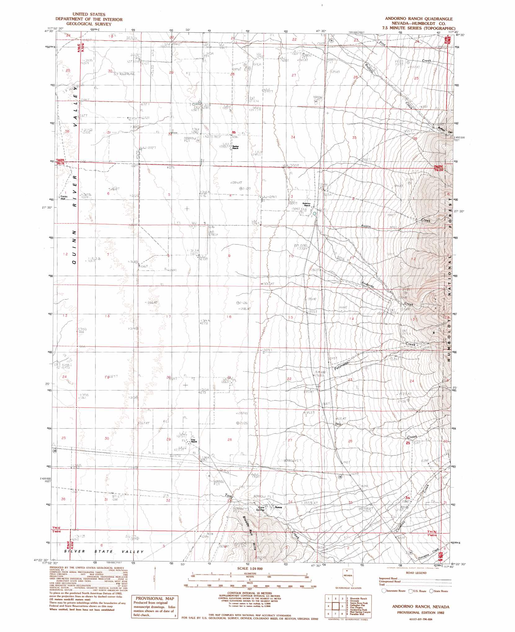
Andorno Ranch Topo Map Nevada
To zoom in, hover over the map of Andorno Ranch
USGS Topo Quad 41117d7 - 1:24,000 scale
| Topo Map Name: | Andorno Ranch |
| USGS Topo Quad ID: | 41117d7 |
| Print Size: | ca. 21 1/4" wide x 27" high |
| Southeast Coordinates: | 41.375° N latitude / 117.75° W longitude |
| Map Center Coordinates: | 41.4375° N latitude / 117.8125° W longitude |
| U.S. State: | NV |
| Filename: | o41117d7.jpg |
| Download Map JPG Image: | Andorno Ranch topo map 1:24,000 scale |
| Map Type: | Topographic |
| Topo Series: | 7.5´ |
| Map Scale: | 1:24,000 |
| Source of Map Images: | United States Geological Survey (USGS) |
| Alternate Map Versions: |
Andorno Ranch NV 1982, updated 1982 Download PDF Buy paper map Andorno Ranch NV 2011 Download PDF Buy paper map Andorno Ranch NV 2015 Download PDF Buy paper map |
| FStopo: | US Forest Service topo Andorno Ranch is available: Download FStopo PDF Download FStopo TIF |
1:24,000 Topo Quads surrounding Andorno Ranch
Thacker Pass |
Sentinel Rock |
Willow Creek Ranch |
White Rock Canyon |
Hinkey Summit |
Moonshine Canyon |
Riverside Ranch |
Orovada |
Santa Rosa Peak |
Mullinix Creek |
Sod House |
Gallagher Flat |
Andorno Ranch |
Five Fingers |
Paradise Valley |
Jackson Well |
Awakening Peak |
Mud Spring Canyon |
Paradise Well |
Willow Point |
Sombrero Peak |
Silver State Draw |
Bloody Run Peak |
China Garden |
Gumboot Lake |
> Back to 41117a1 at 1:100,000 scale
> Back to 41116a1 at 1:250,000 scale
> Back to U.S. Topo Maps home
Andorno Ranch topo map: Gazetteer
Andorno Ranch: Mines
Cane Springs Mine elevation 1322m 4337′Andorno Ranch: Populated Places
Amos (historical) elevation 1324m 4343′Andorno Ranch: Post Offices
Amos Post Office (historical) elevation 1324m 4343′Andorno Ranch: Springs
Cane Springs elevation 1326m 4350′Andorno Ranch: Streams
Andorno Creek elevation 1326m 4350′Austin Creek elevation 1358m 4455′
Chimney Creek elevation 1369m 4491′
Dry Creek elevation 1296m 4251′
Peterman Creek elevation 1285m 4215′
Tony Creek elevation 1286m 4219′
Andorno Ranch: Valleys
Buffalo Canyon elevation 1469m 4819′Andorno Ranch: Wells
Franks Well elevation 1265m 4150′Andorno Ranch digital topo map on disk
Buy this Andorno Ranch topo map showing relief, roads, GPS coordinates and other geographical features, as a high-resolution digital map file on DVD: