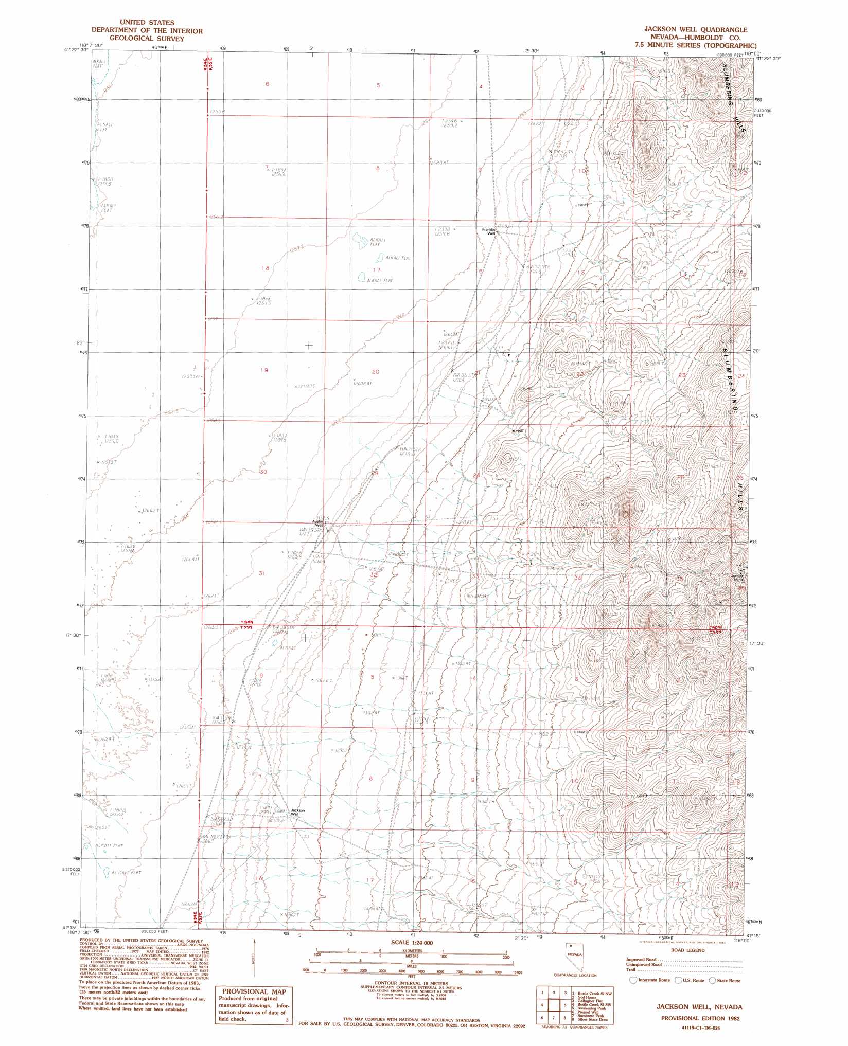
Jackson Well Topo Map Nevada
To zoom in, hover over the map of Jackson Well
USGS Topo Quad 41118c1 - 1:24,000 scale
| Topo Map Name: | Jackson Well |
| USGS Topo Quad ID: | 41118c1 |
| Print Size: | ca. 21 1/4" wide x 27" high |
| Southeast Coordinates: | 41.25° N latitude / 118° W longitude |
| Map Center Coordinates: | 41.3125° N latitude / 118.0625° W longitude |
| U.S. State: | NV |
| Filename: | o41118c1.jpg |
| Download Map JPG Image: | Jackson Well topo map 1:24,000 scale |
| Map Type: | Topographic |
| Topo Series: | 7.5´ |
| Map Scale: | 1:24,000 |
| Source of Map Images: | United States Geological Survey (USGS) |
| Alternate Map Versions: |
Jackson Well NV 1982, updated 1982 Download PDF Buy paper map Jackson Well NV 2011 Download PDF Buy paper map Jackson Well NV 2015 Download PDF Buy paper map |
1:24,000 Topo Quads surrounding Jackson Well
Mustang Spring |
Coyote Hills |
Moonshine Canyon |
Riverside Ranch |
Orovada |
Bottle Hill |
Bottle Creek Slough Nw |
Sod House |
Gallagher Flat |
Andorno Ranch |
Bottle Creek Ranch |
Bottle Creek Slough Sw |
Jackson Well |
Awakening Peak |
Mud Spring Canyon |
Dry Hills |
Presnel Well |
Sombrero Peak |
Silver State Draw |
Bloody Run Peak |
Donna Schee Peak |
Lay Waterhole |
Mormon Dan Butte |
Barrett Springs |
Winnemucca Mountain |
> Back to 41118a1 at 1:100,000 scale
> Back to 41118a1 at 1:250,000 scale
> Back to U.S. Topo Maps home
Jackson Well topo map: Gazetteer
Jackson Well: Wells
Austin Well elevation 1267m 4156′Franklin Well elevation 1264m 4146′
Jackson Well elevation 1287m 4222′
Jackson Well digital topo map on disk
Buy this Jackson Well topo map showing relief, roads, GPS coordinates and other geographical features, as a high-resolution digital map file on DVD: