Kings River Ranch Topo Map Nevada
To zoom in, hover over the map of Kings River Ranch
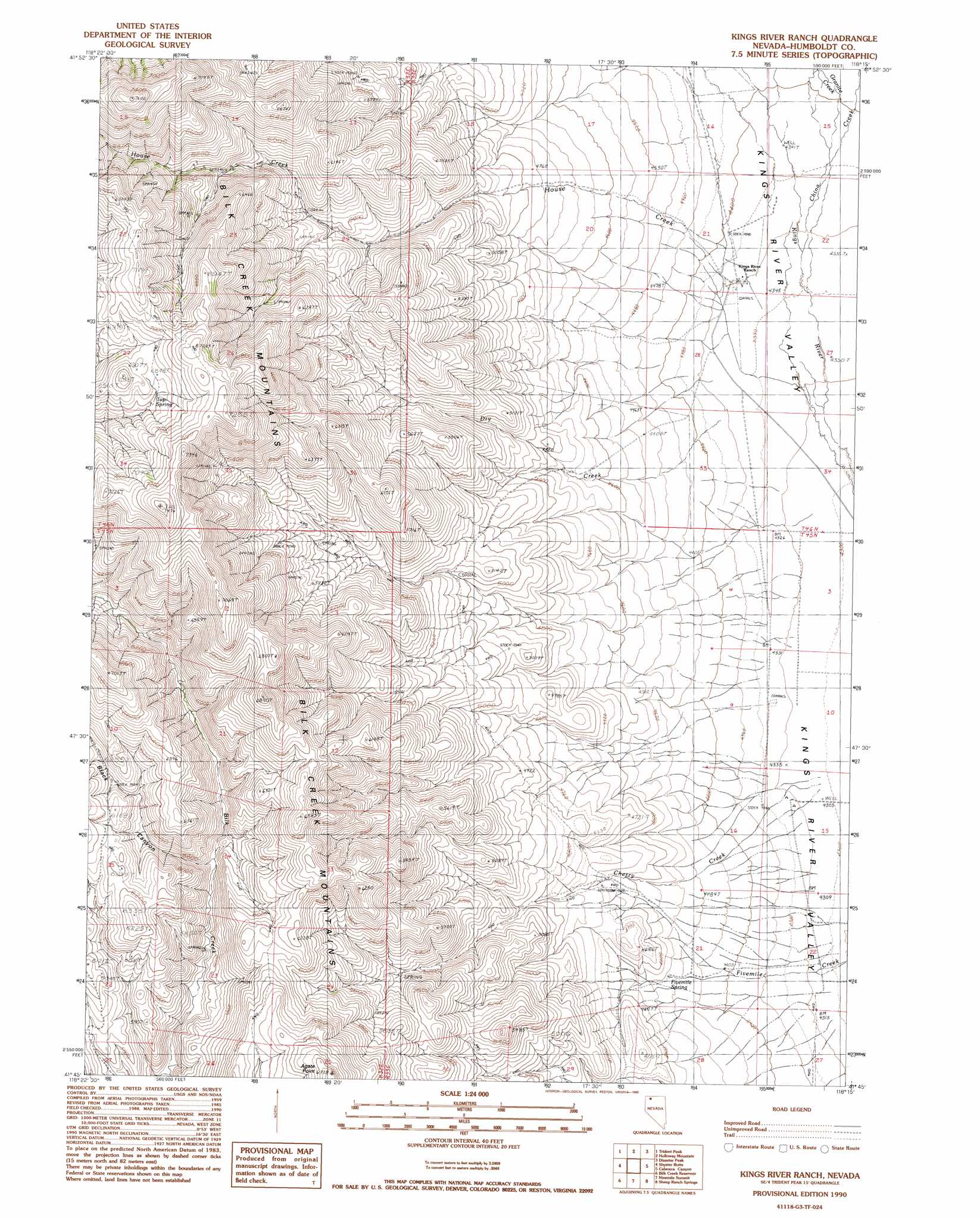
USGS Topo Quad 41118g3 - 1:24,000 scale
| Topo Map Name: | Kings River Ranch |
| USGS Topo Quad ID: | 41118g3 |
| Print Size: | ca. 21 1/4" wide x 27" high |
| Southeast Coordinates: | 41.75° N latitude / 118.25° W longitude |
| Map Center Coordinates: | 41.8125° N latitude / 118.3125° W longitude |
| U.S. State: | NV |
| Filename: | o41118g3.jpg |
| Download Map JPG Image: | Kings River Ranch topo map 1:24,000 scale |
| Map Type: | Topographic |
| Topo Series: | 7.5´ |
| Map Scale: | 1:24,000 |
| Source of Map Images: | United States Geological Survey (USGS) |
| Alternate Map Versions: |
Kings River Ranch NV 1990, updated 1990 Download PDF Buy paper map Kings River Ranch NV 2011 Download PDF Buy paper map Kings River Ranch NV 2015 Download PDF Buy paper map |
1:24,000 Topo Quads surrounding Kings River Ranch
Colony Ranch |
Windy Point |
The V |
Chicken Spring |
Payne Creek |
Wilder Creek Ranch |
Trident Peak |
Holloway Mountain |
Disaster Peak |
Washburn Basin |
Denio Summit |
Shyster Butte |
Kings River Ranch |
Calavera Canyon |
Jordan Meadow Mountain |
Howard Hot Springs |
Bilk Creek Reservoir |
Ninemile Summit |
Sheep Ranch Springs |
Thacker Pass |
Dyke Canyon |
Quinn River Crossing |
Mustang Spring |
Coyote Hills |
Moonshine Canyon |
> Back to 41118e1 at 1:100,000 scale
> Back to 41118a1 at 1:250,000 scale
> Back to U.S. Topo Maps home
Kings River Ranch topo map: Gazetteer
Kings River Ranch: Springs
Fivemile Spring elevation 1369m 4491′Top Spring elevation 2070m 6791′
Warm Spring elevation 1376m 4514′
Kings River Ranch: Streams
Cherry Creek elevation 1313m 4307′China Creek elevation 1327m 4353′
Dry Creek elevation 1326m 4350′
Granite Creek elevation 1336m 4383′
House Creek elevation 1330m 4363′
Kings River Ranch: Summits
Agate Point elevation 2047m 6715′Kings River Ranch: Valleys
Black Canyon elevation 1717m 5633′Kings River Ranch digital topo map on disk
Buy this Kings River Ranch topo map showing relief, roads, GPS coordinates and other geographical features, as a high-resolution digital map file on DVD: