Wilder Creek Ranch Topo Map Nevada
To zoom in, hover over the map of Wilder Creek Ranch
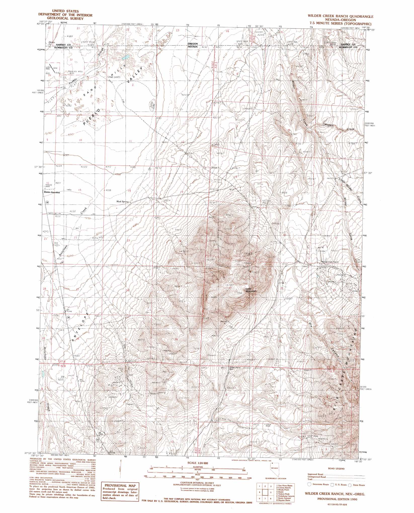
USGS Topo Quad 41118h5 - 1:24,000 scale
| Topo Map Name: | Wilder Creek Ranch |
| USGS Topo Quad ID: | 41118h5 |
| Print Size: | ca. 21 1/4" wide x 27" high |
| Southeast Coordinates: | 41.875° N latitude / 118.5° W longitude |
| Map Center Coordinates: | 41.9375° N latitude / 118.5625° W longitude |
| U.S. States: | NV, OR |
| Filename: | o41118h5.jpg |
| Download Map JPG Image: | Wilder Creek Ranch topo map 1:24,000 scale |
| Map Type: | Topographic |
| Topo Series: | 7.5´ |
| Map Scale: | 1:24,000 |
| Source of Map Images: | United States Geological Survey (USGS) |
| Alternate Map Versions: |
Wilder Creek Ranch NV 1990, updated 1990 Download PDF Buy paper map Wilder Creek Ranch NV 2011 Download PDF Buy paper map Wilder Creek Ranch NV 2015 Download PDF Buy paper map |
1:24,000 Topo Quads surrounding Wilder Creek Ranch
Rincon Flat |
Ladycomb Peak |
Tumtum Lake |
Trout Creek Canyon |
Pole Canyon |
Oregon End Table |
Van Horn Basin |
Colony Ranch |
Windy Point |
The V |
Bog Hot Springs |
Denio |
Wilder Creek Ranch |
Trident Peak |
Holloway Mountain |
Alder Creek Ranch |
Vicksburg Canyon |
Denio Summit |
Shyster Butte |
Kings River Ranch |
Knott Creek |
Duffer Peak |
Howard Hot Springs |
Bilk Creek Reservoir |
Ninemile Summit |
> Back to 41118e1 at 1:100,000 scale
> Back to 41118a1 at 1:250,000 scale
> Back to U.S. Topo Maps home
Wilder Creek Ranch topo map: Gazetteer
Wilder Creek Ranch: Flats
Spring Meadow elevation 1354m 4442′Wilder Creek Ranch: Populated Places
Denio Junction elevation 1287m 4222′Wilder Creek Ranch: Springs
Mud Spring elevation 1288m 4225′Wilder Creek Ranch: Streams
Antelope Creek elevation 1280m 4199′Little Wilder Creek elevation 1415m 4642′
Maggie Creek elevation 1384m 4540′
Wilder Creek Ranch: Summits
Lone Mountain elevation 1768m 5800′Sand Hills elevation 1275m 4183′
Wilder Creek Ranch: Valleys
Dry Canyon elevation 1446m 4744′Dry Gulch elevation 1341m 4399′
Wilder Creek Ranch: Wells
Wilder Ranch Well elevation 1482m 4862′Wilder Creek Ranch digital topo map on disk
Buy this Wilder Creek Ranch topo map showing relief, roads, GPS coordinates and other geographical features, as a high-resolution digital map file on DVD: