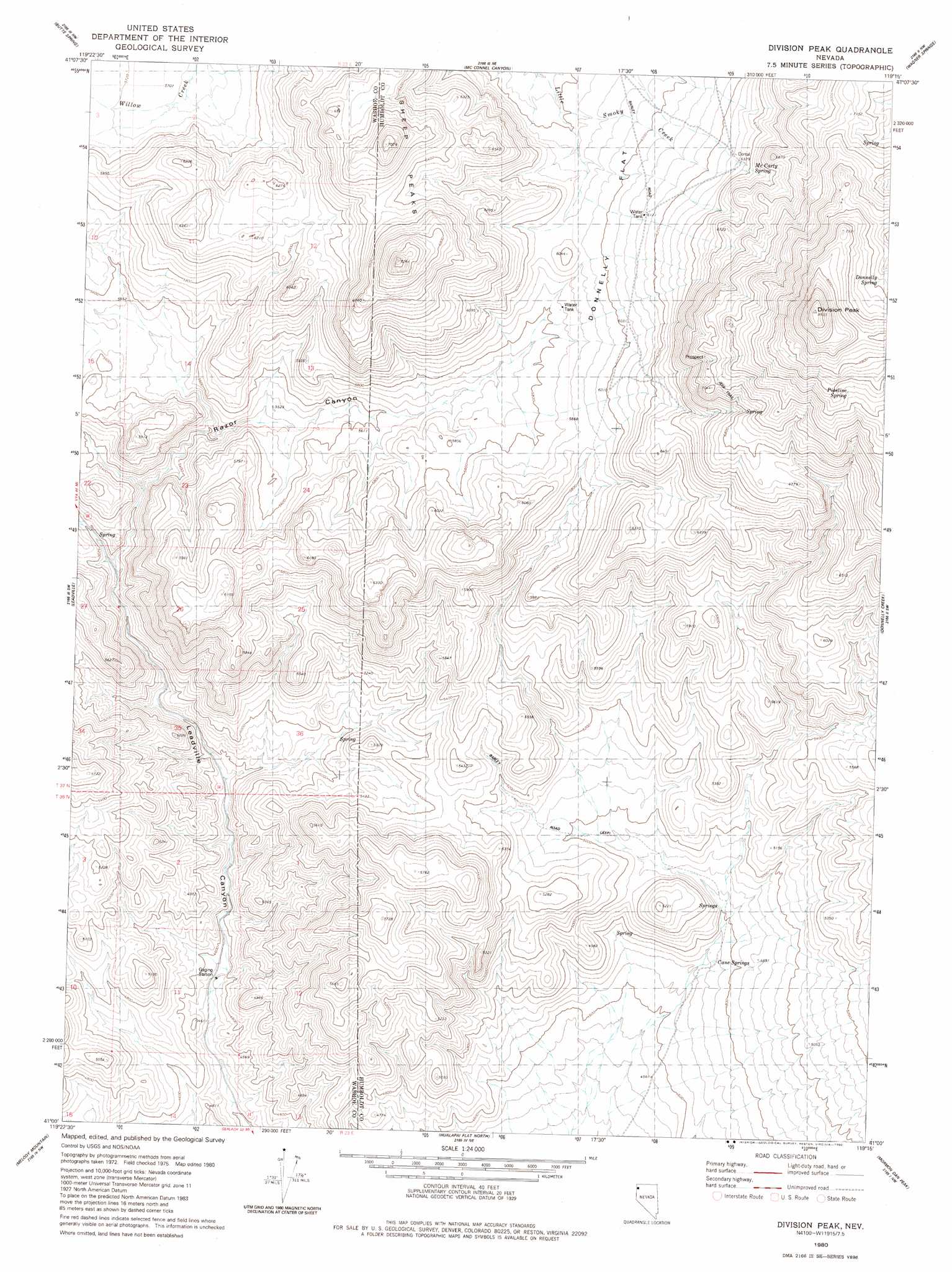
Division Peak Topo Map Nevada
To zoom in, hover over the map of Division Peak
USGS Topo Quad 41119a3 - 1:24,000 scale
| Topo Map Name: | Division Peak |
| USGS Topo Quad ID: | 41119a3 |
| Print Size: | ca. 21 1/4" wide x 27" high |
| Southeast Coordinates: | 41° N latitude / 119.25° W longitude |
| Map Center Coordinates: | 41.0625° N latitude / 119.3125° W longitude |
| U.S. State: | NV |
| Filename: | o41119a3.jpg |
| Download Map JPG Image: | Division Peak topo map 1:24,000 scale |
| Map Type: | Topographic |
| Topo Series: | 7.5´ |
| Map Scale: | 1:24,000 |
| Source of Map Images: | United States Geological Survey (USGS) |
| Alternate Map Versions: |
Division Peak NV 1980, updated 1980 Download PDF Buy paper map Division Peak NV 2011 Download PDF Buy paper map Division Peak NV 2015 Download PDF Buy paper map |
1:24,000 Topo Quads surrounding Division Peak
Hart Mountain |
Mahogany Mountain |
High Rock Lake |
Mud Meadow |
Big Mountain |
Chester Lyons Spring |
Butte Spring |
Mcconnel Canyon |
Wagner Springs |
Clapper Creek |
Fox Mountain |
Leadville |
Division Peak |
Donnelly Creek |
Double Hot Springs |
Crutcher Canyon |
Melody Mountain |
Hualapai Flat North |
Mormon Dan Peak |
Black Rock Point West |
Squaw Valley |
The Banjo |
Hualapai Flat South |
Trego |
Trego Hot Springs |
> Back to 41119a1 at 1:100,000 scale
> Back to 41118a1 at 1:250,000 scale
> Back to U.S. Topo Maps home
Division Peak topo map: Gazetteer
Division Peak: Flats
Donnelly Flat elevation 1831m 6007′Division Peak: Populated Places
Raiser City (historical) elevation 1931m 6335′Division Peak: Post Offices
Granite Creek Post Office (historical) elevation 1931m 6335′Division Peak: Ranges
Division Range elevation 2148m 7047′Division Peak: Springs
Cane Springs elevation 1444m 4737′Donnelly Spring elevation 2312m 7585′
King Spring elevation 1454m 4770′
McCarty Spring elevation 1959m 6427′
Pipeline Spring elevation 2279m 7477′
Division Peak: Summits
Division Peak elevation 2194m 7198′Donnelly Peak elevation 2597m 8520′
Ladden Cone elevation 2138m 7014′
Mount Observation elevation 1587m 5206′
Sheep Peaks elevation 2136m 7007′
Division Peak: Trails
Barley Road elevation 1658m 5439′Division Peak: Valleys
Razor Canyon elevation 1547m 5075′Division Peak digital topo map on disk
Buy this Division Peak topo map showing relief, roads, GPS coordinates and other geographical features, as a high-resolution digital map file on DVD: