Boot Lake Topo Map California
To zoom in, hover over the map of Boot Lake
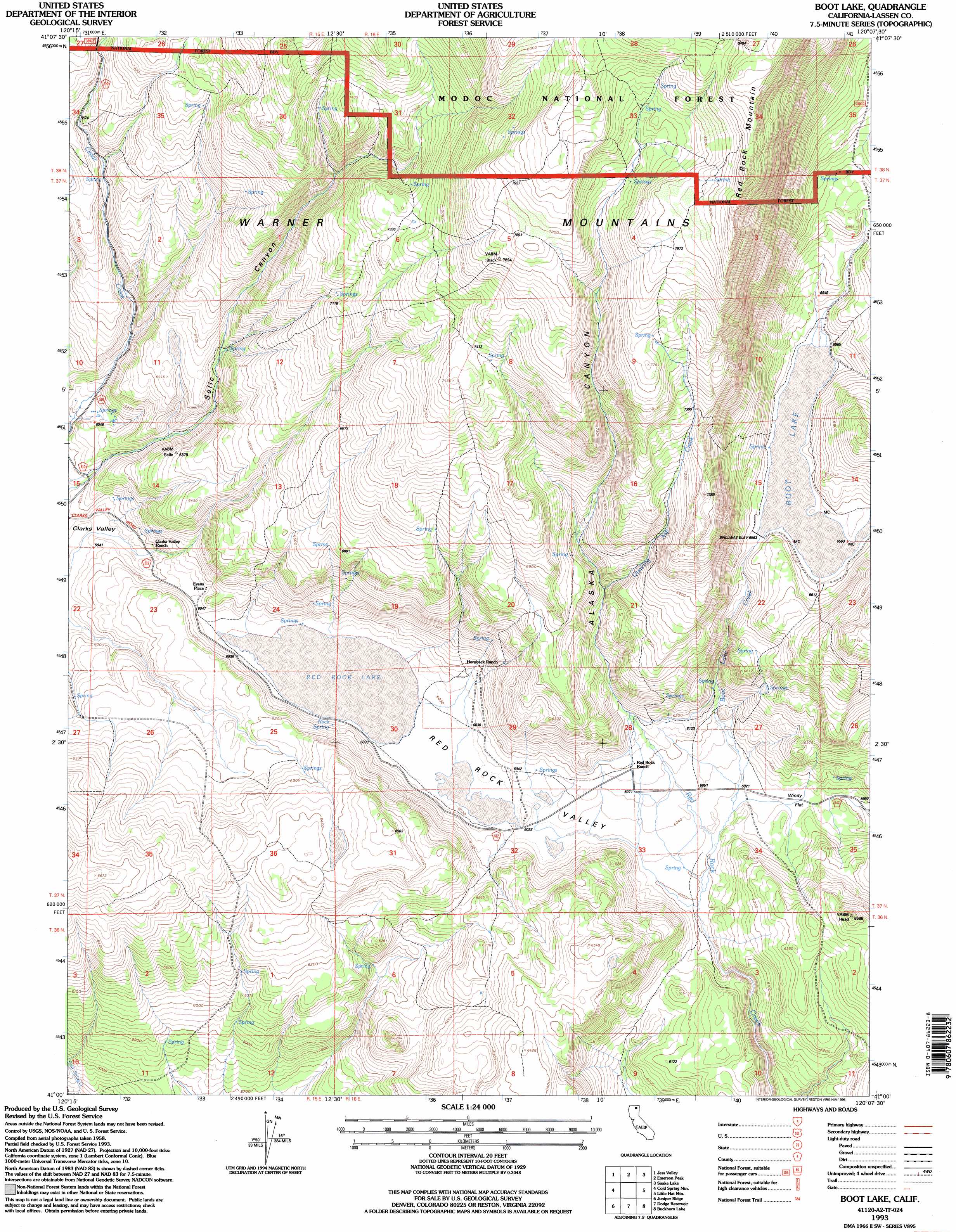
USGS Topo Quad 41120a2 - 1:24,000 scale
| Topo Map Name: | Boot Lake |
| USGS Topo Quad ID: | 41120a2 |
| Print Size: | ca. 21 1/4" wide x 27" high |
| Southeast Coordinates: | 41° N latitude / 120.125° W longitude |
| Map Center Coordinates: | 41.0625° N latitude / 120.1875° W longitude |
| U.S. State: | CA |
| Filename: | o41120a2.jpg |
| Download Map JPG Image: | Boot Lake topo map 1:24,000 scale |
| Map Type: | Topographic |
| Topo Series: | 7.5´ |
| Map Scale: | 1:24,000 |
| Source of Map Images: | United States Geological Survey (USGS) |
| Alternate Map Versions: |
Boot Lake CA 1962, updated 1964 Download PDF Buy paper map Boot Lake CA 1962, updated 1964 Download PDF Buy paper map Boot Lake CA 1962, updated 1974 Download PDF Buy paper map Boot Lake CA 1962, updated 1974 Download PDF Buy paper map Boot Lake CA 1962, updated 1983 Download PDF Buy paper map Boot Lake CA 1962, updated 1983 Download PDF Buy paper map Boot Lake CA 1993, updated 1996 Download PDF Buy paper map Boot Lake CA 1993, updated 1997 Download PDF Buy paper map Boot Lake CA 2012 Download PDF Buy paper map Boot Lake CA 2015 Download PDF Buy paper map |
| FStopo: | US Forest Service topo Boot Lake is available: Download FStopo PDF Download FStopo TIF |
1:24,000 Topo Quads surrounding Boot Lake
Little Juniper Reservoir |
Soup Creek |
Eagle Peak |
Eagleville |
Hays Canyon |
Tule Mountain |
Jess Valley |
Emerson Peak |
Snake Lake |
Pegleg Canyon |
Madeline |
Cold Spring Mountain |
Boot Lake |
Little Hat Mountain |
Duck Lake |
Mcdonald Peak |
Juniper Ridge |
Dodge Reservoir |
Buckhorn Lake |
Burnt Lake |
Termo |
Ravendale |
Observation Peak |
Buckhorn Canyon |
Hole In The Ground |
> Back to 41120a1 at 1:100,000 scale
> Back to 41120a1 at 1:250,000 scale
> Back to U.S. Topo Maps home
Boot Lake topo map: Gazetteer
Boot Lake: Flats
Windy Flat elevation 1840m 6036′Boot Lake: Lakes
Red Rock Lake elevation 1839m 6033′Boot Lake: Populated Places
Evans Place elevation 1848m 6062′Boot Lake: Reservoirs
Boot Lake elevation 2003m 6571′Boot Lake: Springs
Rock Spring elevation 1847m 6059′Boot Lake: Streams
Boot Lake Creek elevation 1830m 6003′Quaking Creek elevation 1985m 6512′
Boot Lake: Valleys
Alaska Canyon elevation 1870m 6135′Red Rock Valley elevation 1842m 6043′
Selic Canyon elevation 1824m 5984′
Boot Lake digital topo map on disk
Buy this Boot Lake topo map showing relief, roads, GPS coordinates and other geographical features, as a high-resolution digital map file on DVD: