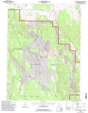
Letterbox Hill Topo Map California
To zoom in, hover over the map of Letterbox Hill
USGS Topo Quad 41120a8 - 1:24,000 scale
| Topo Map Name: | Letterbox Hill |
| USGS Topo Quad ID: | 41120a8 |
| Print Size: | ca. 21 1/4" wide x 27" high |
| Southeast Coordinates: | 41° N latitude / 120.875° W longitude |
| Map Center Coordinates: | 41.0625° N latitude / 120.9375° W longitude |
| U.S. State: | CA |
| Filename: | o41120a8.jpg |
| Download Map JPG Image: | Letterbox Hill topo map 1:24,000 scale |
| Map Type: | Topographic |
| Topo Series: | 7.5´ |
| Map Scale: | 1:24,000 |
| Source of Map Images: | United States Geological Survey (USGS) |
| Alternate Map Versions: |
Letterbox Hill CA 1990, updated 1990 Download PDF Buy paper map Letterbox Hill CA 1993, updated 1996 Download PDF Buy paper map Letterbox Hill CA 2012 Download PDF Buy paper map Letterbox Hill CA 2015 Download PDF Buy paper map |
| FStopo: | US Forest Service topo Letterbox Hill is available: Download FStopo PDF Download FStopo TIF |
1:24,000 Topo Quads surrounding Letterbox Hill
> Back to 41120a1 at 1:100,000 scale
> Back to 41120a1 at 1:250,000 scale
> Back to U.S. Topo Maps home
Letterbox Hill topo map: Gazetteer
Letterbox Hill: Crossings
Stonebreaker Crossing elevation 1549m 5082′Letterbox Hill: Flats
Myer Flat elevation 1534m 5032′Packwood Flat elevation 1609m 5278′
Whit Flat elevation 1575m 5167′
Windmill Flat elevation 1717m 5633′
Letterbox Hill: Lakes
Snider Lake elevation 1781m 5843′Twin Lakes elevation 1773m 5816′
Letterbox Hill: Parks
Hayden Hill-Silva Flat State Game Refuge elevation 1674m 5492′Letterbox Hill: Reservoirs
Cary Reservoir elevation 1472m 4829′McClelland Reservoir elevation 1643m 5390′
Packwood Reservoir elevation 1607m 5272′
Whit Flat Reservoir elevation 1570m 5150′
Letterbox Hill: Springs
Deer Spring elevation 1572m 5157′Myer Spring elevation 1549m 5082′
Letterbox Hill: Summits
Letterbox Hill elevation 1755m 5757′Little Gold Hill elevation 1364m 4475′
Lonkey Hill elevation 1528m 5013′
Manzanita Hill elevation 1804m 5918′
Letterbox Hill: Valleys
Letterbox Canyon elevation 1521m 4990′Preston Canyon elevation 1399m 4589′
Letterbox Hill digital topo map on disk
Buy this Letterbox Hill topo map showing relief, roads, GPS coordinates and other geographical features, as a high-resolution digital map file on DVD:


