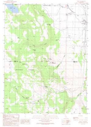
Likely Topo Map California
To zoom in, hover over the map of Likely
USGS Topo Quad 41120b5 - 1:24,000 scale
| Topo Map Name: | Likely |
| USGS Topo Quad ID: | 41120b5 |
| Print Size: | ca. 21 1/4" wide x 27" high |
| Southeast Coordinates: | 41.125° N latitude / 120.5° W longitude |
| Map Center Coordinates: | 41.1875° N latitude / 120.5625° W longitude |
| U.S. State: | CA |
| Filename: | o41120b5.jpg |
| Download Map JPG Image: | Likely topo map 1:24,000 scale |
| Map Type: | Topographic |
| Topo Series: | 7.5´ |
| Map Scale: | 1:24,000 |
| Source of Map Images: | United States Geological Survey (USGS) |
| Alternate Map Versions: |
Likely CA 1990, updated 1990 Download PDF Buy paper map Likely CA 1993, updated 1996 Download PDF Buy paper map Likely CA 2012 Download PDF Buy paper map Likely CA 2015 Download PDF Buy paper map |
| FStopo: | US Forest Service topo Likely is available: Download FStopo PDF Download FStopo TIF |
1:24,000 Topo Quads surrounding Likely
> Back to 41120a1 at 1:100,000 scale
> Back to 41120a1 at 1:250,000 scale
> Back to U.S. Topo Maps home
Likely topo map: Gazetteer
Likely: Airports
Likely Airport elevation 1343m 4406′Likely: Flats
Sears Flat elevation 1687m 5534′Likely: Lakes
Delta Lake elevation 1577m 5173′Likely: Populated Places
D Flourney elevation 1341m 4399′K Flourney elevation 1346m 4416′
Likely elevation 1356m 4448′
R Flourney elevation 1360m 4461′
Vestil elevation 1353m 4438′
Likely: Post Offices
Likely Post Office elevation 1357m 4452′Likely: Springs
Box Springs elevation 1657m 5436′Cottonwood Springs elevation 1640m 5380′
Dago Spring elevation 1922m 6305′
Johnny Ois Spring elevation 1392m 4566′
Mud Spring elevation 1717m 5633′
Rock Springs elevation 1652m 5419′
Sears Flat Spring elevation 1677m 5501′
Smokey Charley Spring elevation 1371m 4498′
Water Canyon Spring elevation 1834m 6017′
Likely: Streams
Dry Creek elevation 1340m 4396′Likely: Summits
Bald Mountain elevation 1797m 5895′Likely Mountain elevation 2249m 7378′
Little Bald Mountain elevation 1795m 5889′
Likely: Valleys
Montgomery Canyon elevation 1366m 4481′Stones Canyon elevation 1390m 4560′
Water Canyon elevation 1686m 5531′
Likely digital topo map on disk
Buy this Likely topo map showing relief, roads, GPS coordinates and other geographical features, as a high-resolution digital map file on DVD:


